File:Dnieper River (MODIS 2018-09-24).jpg
Jump to navigation
Jump to search

Size of this preview: 723 × 600 pixels. Other resolutions: 289 × 240 pixels | 579 × 480 pixels | 926 × 768 pixels | 1,234 × 1,024 pixels | 2,469 × 2,048 pixels | 4,644 × 3,853 pixels.
Original file (4,644 × 3,853 pixels, file size: 2.3 MB, MIME type: image/jpeg)
Captions
Captions
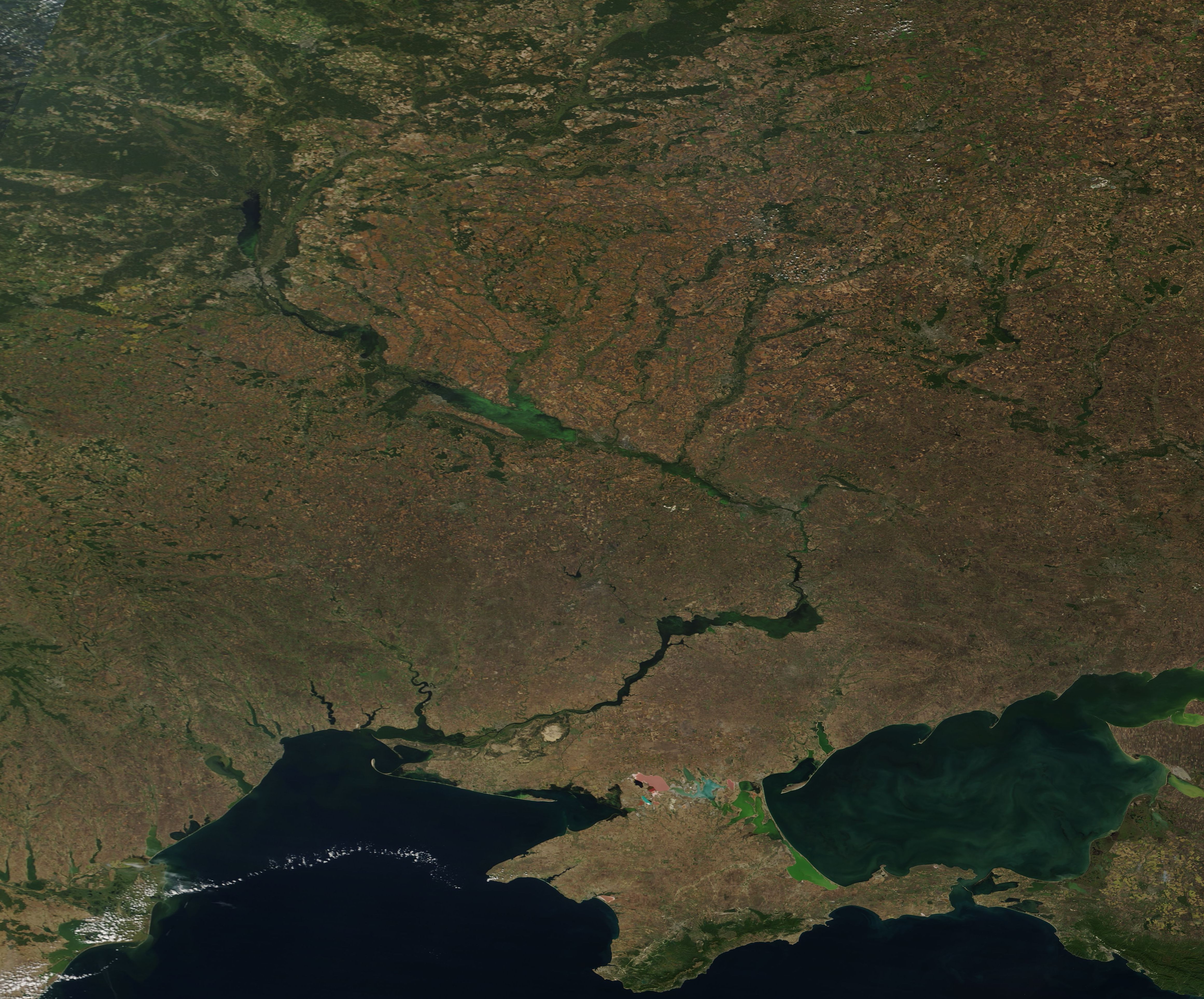
On September 19, 2018, the Moderate Resolution Imaging Spectroradiometer (MODIS) aboard NASA’s Terra satellite acquired a true-color image of the middle and lower Dnieper River as it twists through the late summer landscape of Ukraine.
Summary
[edit].jpg&action=edit§ion=1)
| Description |
English: The Dnieper River is the fourth-longest river in Europe, rising from a small peat bog in the Valdai Hills west of Moscow, Russia and flowing about 1,400 miles (2,200 km) through Russia, Belarus, and Ukraine to reach the Black Sea. On September 19, 2018, the Moderate Resolution Imaging Spectroradiometer (MODIS) aboard NASA’s Terra satellite acquired a true-color image of the middle and lower Dnieper River as it twists through the late summer landscape of Ukraine.
Kiev, the largest city and capital of Ukraine, is built on the banks of the Dnieper, roughly where the river reaches its western-most extent in Ukraine. Kiev can be seen as an area of gray pixels in the northwest section of this image just south of a green (forested) area and reaching the western bank of the Dnieper. The curving river meanders through Kiev and, once south, it widens to about 1 mile (1.6 km). Further downstream it passes through a rocky plateau and the quiet river drops through a series of rapids. This has been harnessed to provide hydroelectric power. Further south the Dnieper enters the Black Sea lowland area which consists of black-soil steppe. The grassy steppe vegetation has been nearly all put into agriculture, with remnants existing primarily in nature reserves. The waters of the Dnieper are frequently used for irrigation in the lowlands, before the river flows into the Black Sea. |
||
| Date | Taken on 19 September 2018 | ||
| Source |
|
||
| Author | MODIS Land Rapid Response Team, NASA GSFC |
| This media is a product of the Terra mission Credit and attribution belongs to the mission team, if not already specified in the "author" row |
Licensing
[edit].jpg&action=edit§ion=2)
| This file is in the public domain in the United States because it was solely created by NASA. NASA copyright policy states that "NASA material is not protected by copyright unless noted". (See Template:PD-USGov, NASA copyright policy page or JPL Image Use Policy.) | ||
 |
Warnings:
|
File history
Click on a date/time to view the file as it appeared at that time.
| Date/Time | Thumbnail | Dimensions | User | Comment | |
|---|---|---|---|---|---|
| current | 01:29, 17 February 2024 | | 4,644 × 3,853 (2.3 MB) | OptimusPrimeBot (talk | contribs) | #Spacemedia - Upload of http://modis.gsfc.nasa.gov/gallery/images/image09242018_250m.jpg via Commons:Spacemedia |
You cannot overwrite this file.
File usage on Commons
There are no pages that use this file.
.jpg&oldid=852527965)