File:Djouce trig point.jpg
From Wikimedia Commons, the free media repository
Jump to navigation
Jump to search
![File:Djouce trig point.jpg](https://upload.wikimedia.org/wikipedia/commons/thumb/2/23/Djouce_trig_point.jpg/800px-Djouce_trig_point.jpg?20190708104851)
Size of this preview: 800 × 377 pixels. Other resolutions: 320 × 151 pixels | 640 × 301 pixels | 1,024 × 482 pixels | 1,280 × 603 pixels | 4,166 × 1,962 pixels.
Original file (4,166 × 1,962 pixels, file size: 2.96 MB, MIME type: image/jpeg)
File information
Structured data
Captions
Captions
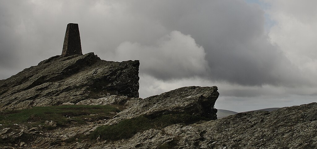
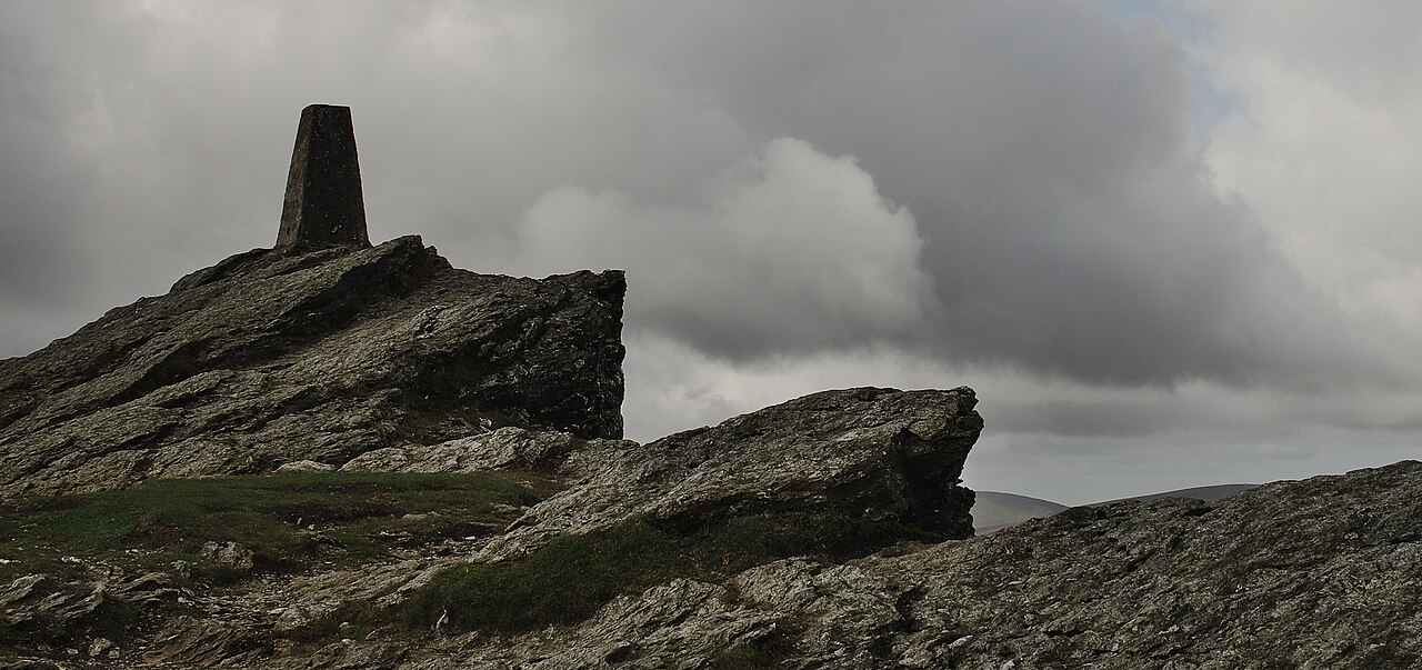
Summit and trig point on Djouce, Ireland
Summary
[edit]DescriptionDjouce trig point.jpg |
English: Djouce has the feeling of a "proper" mountain - rocky at the summit as opposed to the hill bog so common in Wicklow (I'm looking at you, Lugnaquilla). |
Date | |
Source | https://www.flickr.com/photos/robhurson/14962539522/ |
Author | Rob Hurson |
Camera location | 53° 07′ 51.28″ N, 6° 14′ 22.98″ W ![]() ![]() | View this and other nearby images on: OpenStreetMap | ![]() |
---|
Licensing
[edit]![w:en:Creative Commons](https://upload.wikimedia.org/wikipedia/commons/thumb/7/79/CC_some_rights_reserved.svg/90px-CC_some_rights_reserved.svg.png)
![attribution](https://upload.wikimedia.org/wikipedia/commons/thumb/1/11/Cc-by_new_white.svg/24px-Cc-by_new_white.svg.png)
![share alike](https://upload.wikimedia.org/wikipedia/commons/thumb/d/df/Cc-sa_white.svg/24px-Cc-sa_white.svg.png)
This file is licensed under the Creative Commons Attribution-Share Alike 2.0 Generic license.
- You are free:
- to share – to copy, distribute and transmit the work
- to remix – to adapt the work
- Under the following conditions:
- attribution – You must give appropriate credit, provide a link to the license, and indicate if changes were made. You may do so in any reasonable manner, but not in any way that suggests the licensor endorses you or your use.
- share alike – If you remix, transform, or build upon the material, you must distribute your contributions under the same or compatible license as the original.
![]() |
This image was originally posted to Flickr by Rob Hurson at https://flickr.com/photos/65378423@N08/14962539522 (archive). It was reviewed on 8 July 2019 by FlickreviewR 2 and was confirmed to be licensed under the terms of the cc-by-sa-2.0. |
8 July 2019
File history
Click on a date/time to view the file as it appeared at that time.
Date/Time | Thumbnail | Dimensions | User | Comment | |
---|---|---|---|---|---|
current | 10:48, 8 July 2019 | ![]() | 4,166 × 1,962 (2.96 MB) | Britishfinance (talk | contribs) | User created page with UploadWizard |
You cannot overwrite this file.
File usage on Commons
There are no pages that use this file.
Metadata
This file contains additional information such as Exif metadata which may have been added by the digital camera, scanner, or software program used to create or digitize it. If the file has been modified from its original state, some details such as the timestamp may not fully reflect those of the original file. The timestamp is only as accurate as the clock in the camera, and it may be completely wrong.
Camera manufacturer | PENTAX |
---|---|
Camera model | PENTAX K-30 |
Author | Rob.Hurson@Gmail.com |
Copyright holder | Rob.Hurson@Gmail.com |
Exposure time | 1/250 sec (0.004) |
F-number | f/13 |
ISO speed rating | 100 |
Date and time of data generation | 11:27, 17 August 2014 |
Lens focal length | 30 mm |
Latitude | 53° 7′ 51.28″ N |
Longitude | 6° 14′ 22.99″ W |
Altitude | 726.8 meters above sea level |
Orientation | Normal |
Horizontal resolution | 300 dpi |
Vertical resolution | 300 dpi |
Software used | SILKYPIX Developer Studio Pro 6 |
File change date and time | 23:20, 17 August 2014 |
Y and C positioning | Co-sited |
Exposure Program | Aperture priority |
Exif version | 2.3 |
Date and time of digitizing | 11:27, 17 August 2014 |
Meaning of each component |
|
APEX exposure bias | 0 |
Metering mode | Center weighted average |
Flash | Flash did not fire, compulsory flash suppression |
Supported Flashpix version | 1 |
Color space | sRGB |
Sensing method | One-chip color area sensor |
Custom image processing | Custom process |
Exposure mode | Auto bracket |
Focal length in 35 mm film | 45 mm |
Scene capture type | Standard |
Subject distance range | Distant view |
GPS time (atomic clock) | 10:27 |
Satellites used for measurement | 07 |
Receiver status | Measurement in progress |
Measurement mode | 3-dimensional measurement |
Speed unit | Kilometers per hour |
Speed of GPS receiver | 0.84 |
Reference for direction of movement | True direction |
Direction of movement | 192.4 |
Reference for direction of image | True direction |
Direction of image | 274.64 |
Geodetic survey data used | WGS-84 |
GPS date | 17 August 2014 |
GPS tag version | 2.3.0.0 |