File:Divided Yemen-ko.svg
Jump to navigation
Jump to search

Size of this PNG preview of this SVG file: 800 × 483 pixels. Other resolutions: 320 × 193 pixels | 640 × 386 pixels | 1,024 × 618 pixels | 1,280 × 772 pixels | 2,560 × 1,544 pixels | 1,210 × 730 pixels.
Original file (SVG file, nominally 1,210 × 730 pixels, file size: 44 KB)
Captions
Captions
Add a one-line explanation of what this file represents
| Description |
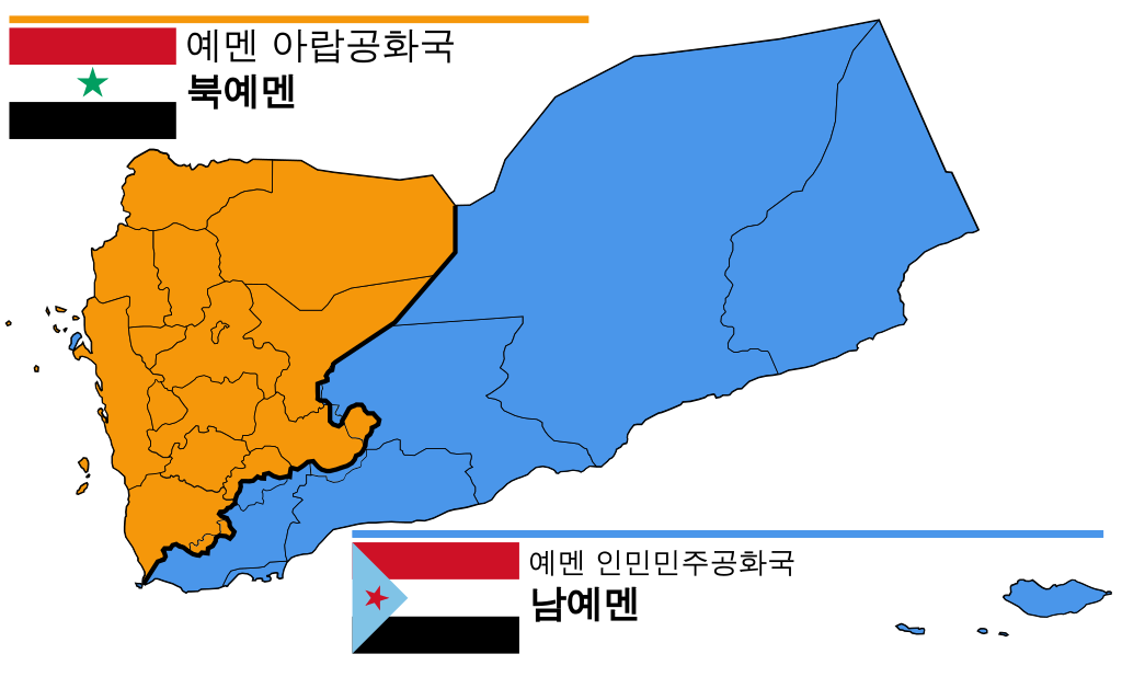
English: Map of North and South Yemen prior to unification. Español: Yemen previo a la unificación, en 1990. Français : Le Yémen avant l'unification. Português: Iêmen do Norte (em laranja) e Iêmen do Sul (em azul) antes de 1990. |
| Date | (translation), 2011-10-20 (upload to Commons) |
| Source | translated from Divided Yemen.svg |
| Author |
|
| Permission (Reusing this file) |
This file is licensed under the Creative Commons Attribution-Share Alike 3.0 Unported license.
|
| Other versions |
|


.svg)


|
This SVG file contains embedded text that can be translated into your language, using any capable SVG editor, text editor or the SVG Translate tool. For more information see: About translating SVG files. |
Original upload log
[edit]
This image is a derivative work of the following images:
- File:Divided Yemen.svg licensed with Cc-by-sa-3.0,
- 2012-10-20T19:35:21Z Mnmazur 1210x730 (48100 bytes) Correction: Perim to PDR Yemen (thanks, Thabet202!)
- 2011-10-20T21:25:42Z Mnmazur 1210x730 (47916 bytes) == {{int:filedesc}} == {{Information |Description={{en|1=Map of North and South Yemen prior to unification.}} |Source=*[[:File:Map_of_North_and_South_Yemen.png|]] *[[:File:Flag_of_North_Yemen.svg|]] *[[:File:Flag_of_South_Yem
Translated using SVG Translate
File history
Click on a date/time to view the file as it appeared at that time.
| Date/Time | Thumbnail | Dimensions | User | Comment | |
|---|---|---|---|---|---|
| current | 17:49, 26 September 2020 | | 1,210 × 730 (44 KB) | AlMahra67 (talk | contribs) | Check English version comments |
| 13:50, 11 June 2016 |  | 1,210 × 730 (48 KB) | Flappiefh (talk | contribs) | Removed Dhale Governorate because it didn't exist at that time (created after 1990 unification). | |
| 08:11, 20 September 2014 |  | 1,210 × 730 (47 KB) | 고려 (talk | contribs) | Upload SVG translation using svgtranslate |
You cannot overwrite this file.
File usage on Commons
The following 11 pages use this file:
File usage on other wikis
The following other wikis use this file:
- Usage on fr.wikipedia.org