File:Dive sites of Whittle Rock on multibeam map.jpg
Jump to navigation
Jump to search

Size of this preview: 783 × 600 pixels. Other resolutions: 314 × 240 pixels | 627 × 480 pixels | 1,003 × 768 pixels | 1,280 × 980 pixels | 1,683 × 1,289 pixels.
Original file (1,683 × 1,289 pixels, file size: 520 KB, MIME type: image/jpeg)
Captions
Captions
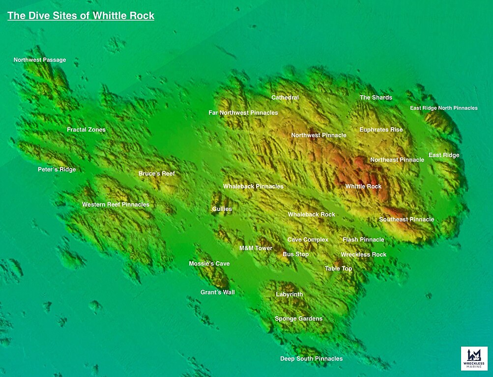
Dive sites of Whittle Rock, False Bay
Summary
[edit]
| Description |
English: Multibeam sonar map Whittle Rock showing dive sites |
| Date | |
| Source | Own work |
| Author | Wreckless Marine |
Licensing
[edit]
I, the copyright holder of this work, hereby publish it under the following license:
This file is licensed under the Creative Commons Attribution-Share Alike 4.0 International license.
- You are free:
- to share – to copy, distribute and transmit the work
- to remix – to adapt the work
- Under the following conditions:
- attribution – You must give appropriate credit, provide a link to the license, and indicate if changes were made. You may do so in any reasonable manner, but not in any way that suggests the licensor endorses you or your use.
- share alike – If you remix, transform, or build upon the material, you must distribute your contributions under the same or compatible license as the original.
File history
Click on a date/time to view the file as it appeared at that time.
| Date/Time | Thumbnail | Dimensions | User | Comment | |
|---|---|---|---|---|---|
| current | 16:21, 21 October 2022 | | 1,683 × 1,289 (520 KB) | Wreckless Marine (talk | contribs) | Corrections |
| 18:09, 20 October 2022 |  | 1,683 × 1,289 (511 KB) | Wreckless Marine (talk | contribs) | Uploaded own work with UploadWizard |
You cannot overwrite this file.
File usage on Commons
The following page uses this file: