File:Ditch on Lakenheath Fen - geograph.org.uk - 801544.jpg
Jump to navigation
Jump to search
No higher resolution available.
Ditch_on_Lakenheath_Fen_-_geograph.org.uk_-_801544.jpg (640 × 426 pixels, file size: 85 KB, MIME type: image/jpeg)
Captions
Captions
Add a one-line explanation of what this file represents
Summary
[edit]
| Description |
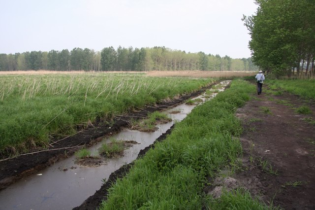
English: Ditch on Lakenheath Fen When the RSPB took over this area it was arable farmland, with ditches for draining it. This ditch, with the lumps of earth in the middle has been profiled with wildlife as a priority as the area has been returned to wet fenland so drainage is not a priority. |
| Date | |
| Source | From geograph.org.uk |
| Author | Hugh Venables |
| Attribution (required by the license) | Hugh Venables / Ditch on Lakenheath Fen / |
| Camera location | | View this and other nearby images on: OpenStreetMap |
|---|
_heading:337.00&language=en)
| Object location | | View this and other nearby images on: OpenStreetMap |
|---|
_heading:337.00&language=en)
Licensing
[edit]

|
This image was taken from the Geograph project collection. See this photograph's page on the Geograph website for the photographer's contact details. The copyright on this image is owned by Hugh Venables and is licensed for reuse under the Creative Commons Attribution-ShareAlike 2.0 license.
|
This file is licensed under the Creative Commons Attribution-Share Alike 2.0 Generic license.
Attribution: Hugh Venables
- You are free:
- to share – to copy, distribute and transmit the work
- to remix – to adapt the work
- Under the following conditions:
- attribution – You must give appropriate credit, provide a link to the license, and indicate if changes were made. You may do so in any reasonable manner, but not in any way that suggests the licensor endorses you or your use.
- share alike – If you remix, transform, or build upon the material, you must distribute your contributions under the same or compatible license as the original.
File history
Click on a date/time to view the file as it appeared at that time.
| Date/Time | Thumbnail | Dimensions | User | Comment | |
|---|---|---|---|---|---|
| current | 08:05, 20 February 2011 | | 640 × 426 (85 KB) | GeographBot (talk | contribs) | == {{int:filedesc}} == {{Information |description={{en|1=Ditch on Lakenheath Fen When the RSPB took over this area it was arable farmland, with ditches for draining it. This ditch, with the lumps of earth in the middle has been profiled with wildlife as a |
You cannot overwrite this file.
File usage on Commons
There are no pages that use this file.