File:Districts in Perak.svg

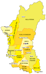
Original file (SVG file, nominally 1,359 × 2,176 pixels, file size: 643 KB)
Captions
Captions
Summary
[edit]
| Description |
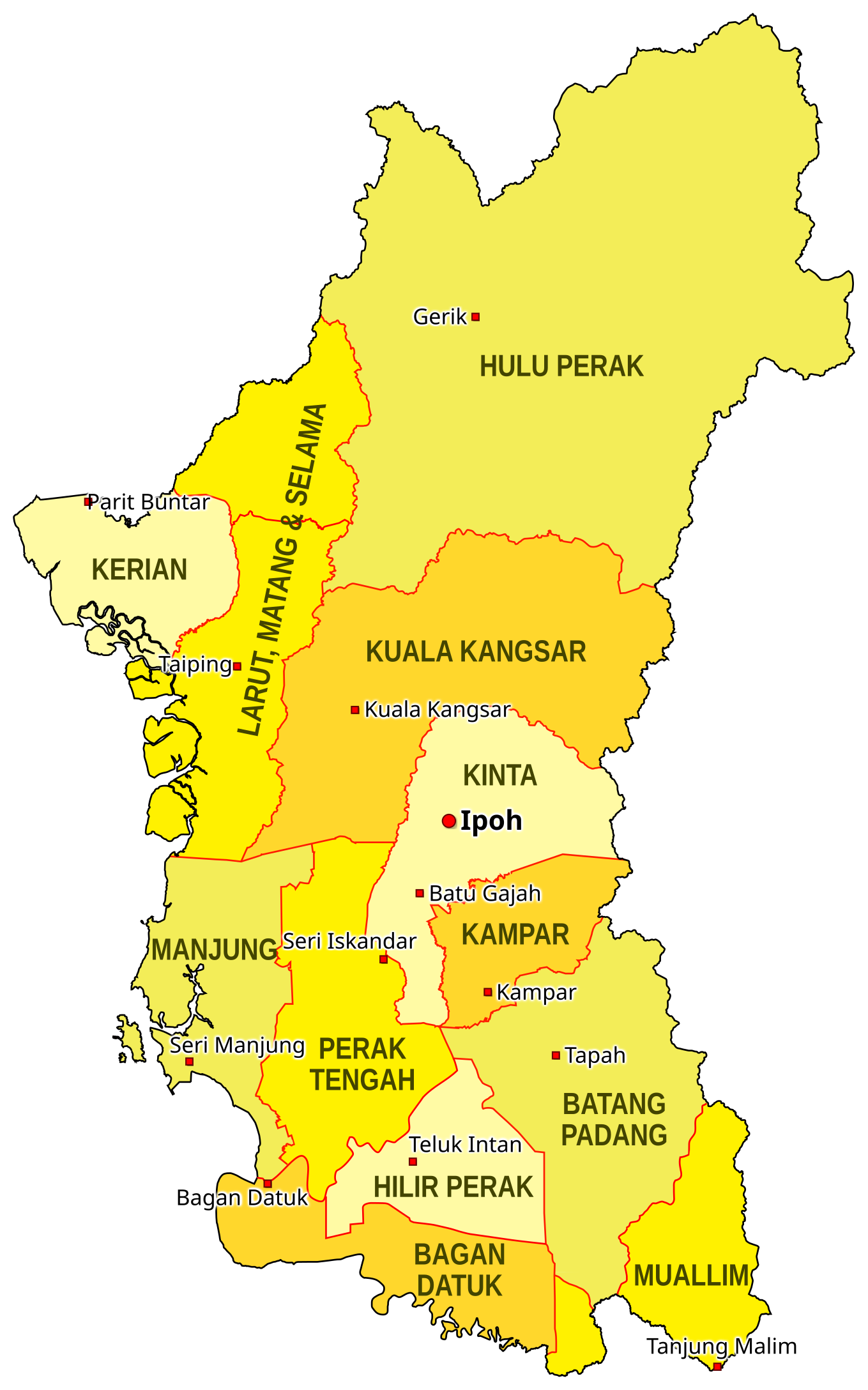
EN: This is the map of the districts of the Malaysian state of Perak as of 2018. The district borders are based on the map on the Unique Parcel Identifier site, and the location of cities are approximated based on OpenStreetMap. The borders of the districts Muallim and Bagan Datuk (declared in 2016) are based on the map on the South Perak Region website. This map is meant to only be for illustrative purposes. This map is not an authority on state district borders and should not be used for navigation. MS: Ini adalah peta daerah-daerah di negeri Perak di Malaysia pada tahun 2018. Sempadan-sempadan daerah didasarkan peta daripada laman Unique Parcel Identifier, dan kedudukan bandar-bandar dianggarkan berdasarkan peta OpenStreetMap. Sempadan daerah Muallim dan Bagan Datuk (diisytihar 2016) didasarkan peta di laman Wilayah Perak Selatan. Peta ini hanya bertujuan untuk tujuan ilustratif sahaja. Ia bukannya penentu kedudukan tepat sempadan-sempadan daerah dan tidak sepatutnya digunakan untuk navigasi. |
| Date | |
| Source | Own work |
| Author | SyahirSQRT2 (talk) |
Licensing
[edit]

|
Permission is granted to copy, distribute and/or modify this document under the terms of the GNU Free Documentation License, Version 1.2 or any later version published by the Free Software Foundation; with no Invariant Sections, no Front-Cover Texts, and no Back-Cover Texts. A copy of the license is included in the section entitled GNU Free Documentation License. |
- You are free:
- to share – to copy, distribute and transmit the work
- to remix – to adapt the work
- Under the following conditions:
- attribution – You must give appropriate credit, provide a link to the license, and indicate if changes were made. You may do so in any reasonable manner, but not in any way that suggests the licensor endorses you or your use.
- share alike – If you remix, transform, or build upon the material, you must distribute your contributions under the same or compatible license as the original.
File history
Click on a date/time to view the file as it appeared at that time.
| Date/Time | Thumbnail | Dimensions | User | Comment | |
|---|---|---|---|---|---|
| current | 13:32, 22 January 2018 | | 1,359 × 2,176 (643 KB) | SyahirSQRT2 (talk | contribs) | Even brighter colors. Sorry, Commons. |
| 12:28, 22 January 2018 |  | 1,359 × 2,176 (643 KB) | SyahirSQRT2 (talk | contribs) | Tried faffing around with the colors a bit to make it brighter. Don't know if it does anything. Graphic design: I can try, but that's about it. | |
| 19:43, 12 January 2018 |  | 1,359 × 2,176 (643 KB) | SyahirSQRT2 (talk | contribs) | Added Bagan Datuk district (that's been long overdue!) | |
| 09:20, 13 January 2016 |  | 1,274 × 2,040 (700 KB) | SyahirSQRT2 (talk | contribs) | Fixed error on the "Larut, Matang & Selama" label. | |
| 09:07, 13 January 2016 |  | 1,274 × 2,040 (700 KB) | SyahirSQRT2 (talk | contribs) | {{Information |Description= '''EN''': This is the map of the districts of the Malaysian state of Perak as of 2016, when Muallim was proclaimed a separate district on January 11. Labelled on the map with squar... |
You cannot overwrite this file.
File usage on Commons
The following page uses this file:
File usage on other wikis
The following other wikis use this file:
- Usage on en.wikipedia.org
- Usage on simple.wikipedia.org
- Usage on ur.wikipedia.org
- Usage on vi.wikipedia.org
- Usage on www.wikidata.org
- Usage on zh-min-nan.wikipedia.org
- Usage on zh.wikipedia.org