File:Districts Vojvodina Lat.png
Jump to navigation
Jump to search

Size of this preview: 717 × 600 pixels. Other resolutions: 287 × 240 pixels | 574 × 480 pixels | 966 × 808 pixels.
Original file (966 × 808 pixels, file size: 60 KB, MIME type: image/png)
Captions
Captions
Add a one-line explanation of what this file represents
| Description |
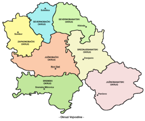
English: map of the districts of Vojvodina (Serbian language Latin script version) Serbian Cyrillic: мапа округа Војводине (латинична верзија на српском језику) References
|
||
| Source | Own work | ||
| Author | PANONIAN | ||
| Permission (Reusing this file) |
|
File history
Click on a date/time to view the file as it appeared at that time.
| Date/Time | Thumbnail | Dimensions | User | Comment | |
|---|---|---|---|---|---|
| current | 18:45, 22 September 2009 | | 966 × 808 (60 KB) | PANONIAN (talk | contribs) | {{Information |Description={{en|1=map of the districts of Vojvodina (Serbian language Latin script version)<br> '''Serbian Cyrillic''': мапа округа Војводине (латинична верзија на српском језику)<br> '''Se |
You cannot overwrite this file.
File usage on Commons
There are no pages that use this file.
File usage on other wikis
The following other wikis use this file:
- Usage on bs.wikipedia.org
- Usage on de.wikipedia.org
- Usage on sh.wikipedia.org