File:Distribution of Nomi kofungun.jpg
Jump to navigation
Jump to search
Size of this preview: 800 × 448 pixels. Other resolutions: 320 × 179 pixels | 640 × 359 pixels | 1,024 × 574 pixels | 1,280 × 718 pixels | 2,722 × 1,526 pixels.
Original file (2,722 × 1,526 pixels, file size: 2.97 MB, MIME type: image/jpeg)
Captions
Captions
Add a one-line explanation of what this file represents
Summary
[edit]
| Description |
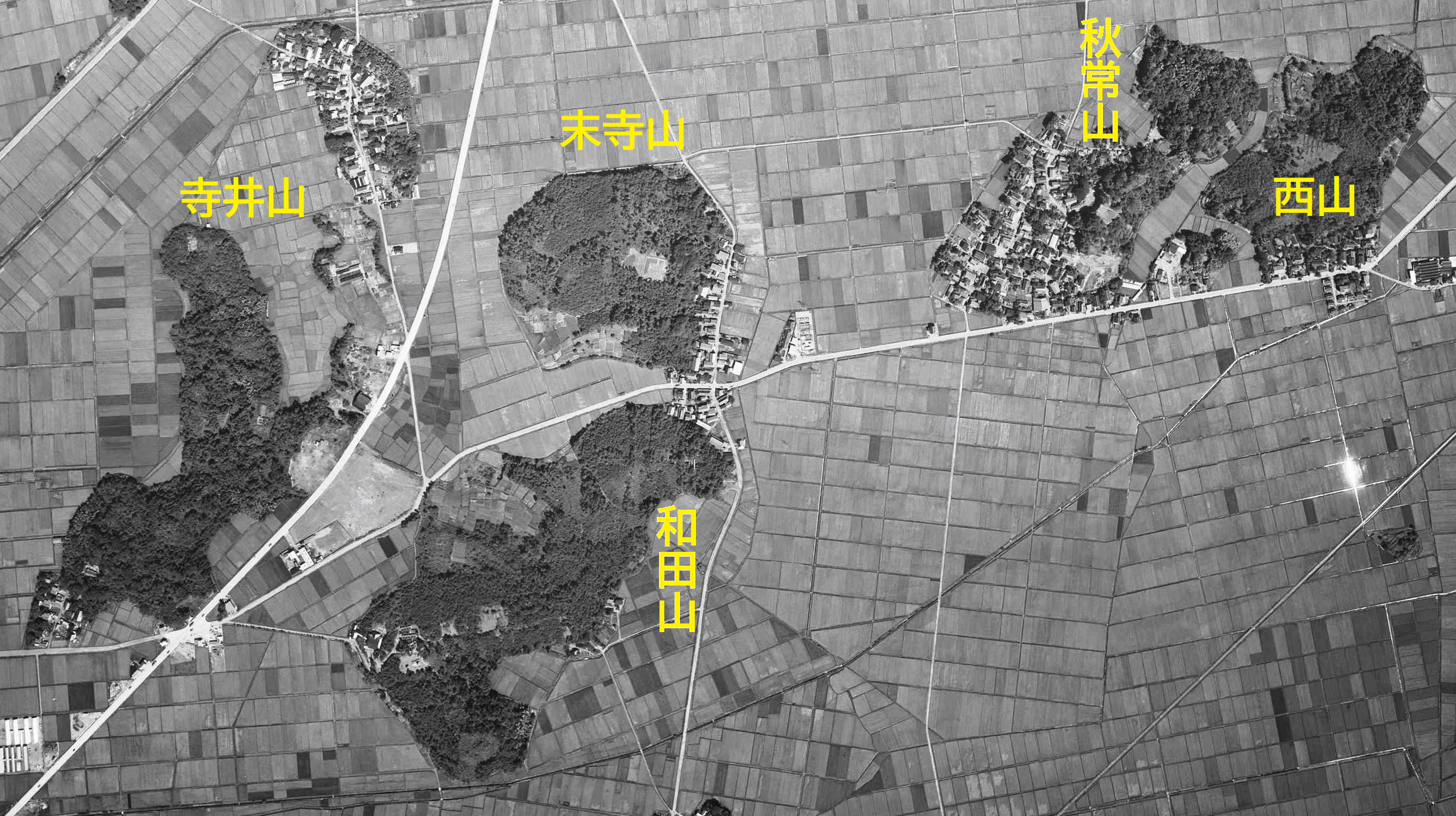
日本語:能美古墳群を構成する各古墳群が所在する山々
国土交通省撮影の空中写真MCB632-C4-7を使用。 |
| Date | |
| Source | 国土地理院地図・空中写真閲覧サービス |
| Author | 国土交通省国土地理院 |
| Camera location | | View this and other nearby images on: OpenStreetMap |
|---|
Licensing
[edit]

|
The copyright holder of this file, the Ministry of Land, Infrastructure, Transport and Tourism of Japan, allows anyone to use it for any purpose, provided that the copyright holder is properly attributed. Redistribution, derivative work, commercial use, and all other use is permitted. |
Attribution:
Copyright © National Land Image Information (Color Aerial Photographs), Ministry of Land, Infrastructure, Transport and Tourism
|
 |
This image is copyrighted by the Ministry of Land, Infrastructure, Transport and Tourism of Japan. For terms of use, see the stipulation to use of National Land Information (in Japanese) and message from MLIT (in Japanese and English). When you display this image on an article, include the following phrase in the description: "Made based on National Land Image Information (Color Aerial Photographs), Ministry of Land, Infrastructure, Transport and Tourism".
|
File history
Click on a date/time to view the file as it appeared at that time.
| Date/Time | Thumbnail | Dimensions | User | Comment | |
|---|---|---|---|---|---|
| current | 10:29, 8 January 2022 | | 2,722 × 1,526 (2.97 MB) | 名古屋太郎 (talk | contribs) | ベース画像変更 |
| 15:01, 17 August 2012 |  | 1,916 × 1,152 (1.92 MB) | 名古屋太郎 (talk | contribs) | {{Information |Description ={{ja|1=能美古墳群を構成する各古墳群が所在する山々}} |Source =国土情報ウェブマッピングシステム 空中写真ccb-75-22_c20_8およびccb-75-22_c19a_9を使用 |Author =... |
You cannot overwrite this file.
File usage on Commons
The following page uses this file:
File usage on other wikis
The following other wikis use this file:
- Usage on en.wikipedia.org
- Usage on ja.wikipedia.org