File:Distribution of ARS.png
Jump to navigation
Jump to search

Size of this preview: 800 × 565 pixels. Other resolutions: 320 × 226 pixels | 640 × 452 pixels | 1,024 × 724 pixels | 1,280 × 905 pixels | 2,560 × 1,809 pixels | 3,508 × 2,479 pixels.
Original file (3,508 × 2,479 pixels, file size: 6.74 MB, MIME type: image/png)
Captions
Captions
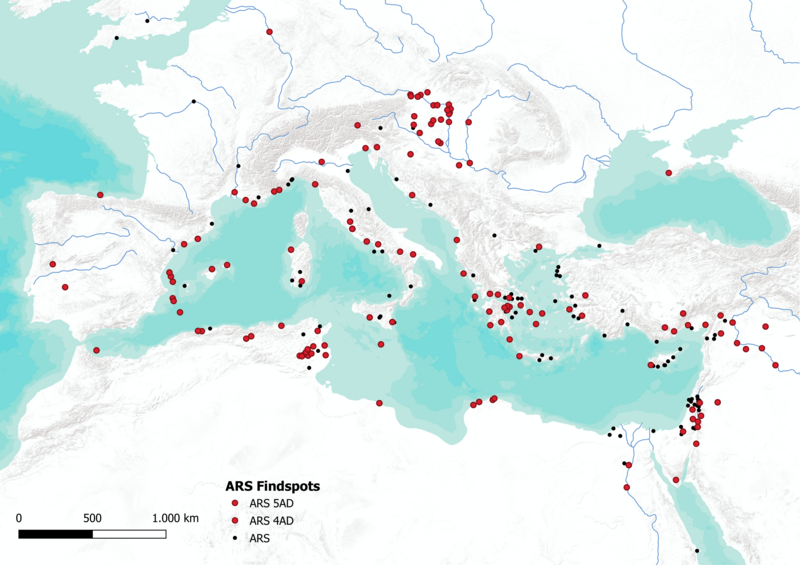
Distribution of ARS
Summary
[edit]
| Description |
English: scale 1:20000000, EPSG:3859, bounding-box: -1227354.449, 2644882.041, 4712645.557, 6844882.045, created with QGIS, rivers by geojson.xyz and Natural Earth Data (Public Domain), base map ESRI.WorldTerrain by USGS, Esri, TANA, DeLorme, and NPS. The ARS data is based on Lizanne Mollema’s bachelor thesis 2018 at Leiden University [Lizanne Mollema, CC BY] and has been transformed into GeoJSON and WGS84. Note: "ARS" means "African Red Slip Ware" here |
| Date | |
| Source | Own work |
| Author | Florian Thiery |
Licensing
[edit]
I, the copyright holder of this work, hereby publish it under the following license:
This file is licensed under the Creative Commons Attribution 4.0 International license.
- You are free:
- to share – to copy, distribute and transmit the work
- to remix – to adapt the work
- Under the following conditions:
- attribution – You must give appropriate credit, provide a link to the license, and indicate if changes were made. You may do so in any reasonable manner, but not in any way that suggests the licensor endorses you or your use.
File history
Click on a date/time to view the file as it appeared at that time.
| Date/Time | Thumbnail | Dimensions | User | Comment | |
|---|---|---|---|---|---|
| current | 07:23, 10 March 2023 | | 3,508 × 2,479 (6.74 MB) | Fthierygeo (talk | contribs) | Uploaded own work with UploadWizard |
You cannot overwrite this file.
File usage on Commons
There are no pages that use this file.