File:Distance from Amidon.png
Jump to navigation
Jump to search

Size of this preview: 800 × 536 pixels. Other resolutions: 320 × 214 pixels | 640 × 429 pixels | 936 × 627 pixels.
Original file (936 × 627 pixels, file size: 84 KB, MIME type: image/png)
Captions
Captions
Add a one-line explanation of what this file represents
Summary
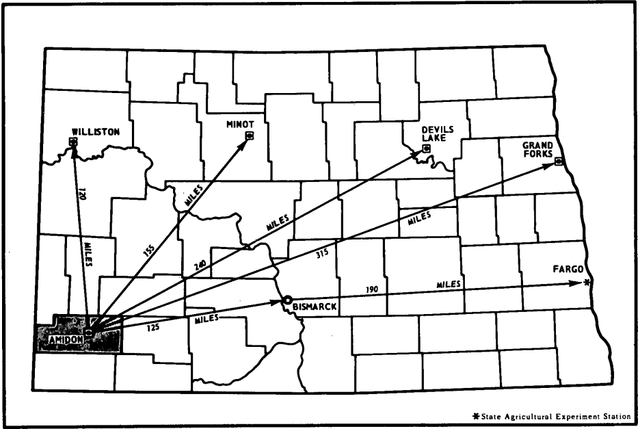
[edit]| Description | Distance between Amidon, ND and other cities | |||
| Date | ||||
| Source | Soil Survey of Slope County, North Dakota page 8 (on paper, this is page iv) | |||
| Author | USDA Soil Conservation Service | |||
| Permission (Reusing this file) |
|

File history
Click on a date/time to view the file as it appeared at that time.
| Date/Time | Thumbnail | Dimensions | User | Comment | |
|---|---|---|---|---|---|
| current | 22:08, 14 April 2020 | | 936 × 627 (84 KB) | Epiphyllumlover (talk | contribs) | {{Information |description=Distance between Amidon, ND and other cities |date=November 1978 |source=[https://www.nrcs.usda.gov/Internet/FSE_MANUSCRIPTS/north_dakota/slopeND1978/slopeND1978.pdf Soil Survey of Slope County, North Dakota] page 8 (on paper, this is page iv) |author=USDA Soil Conservation Service |permission={{PD-USGov-USDA}} |other versions= }} Category:Amidon, North Dakota |
You cannot overwrite this file.
File usage on Commons
There are no pages that use this file.