File:Directional well under city.png
Jump to navigation
Jump to search
Size of this preview: 800 × 385 pixels. Other resolutions: 320 × 154 pixels | 640 × 308 pixels | 1,024 × 492 pixels | 1,280 × 615 pixels | 3,441 × 1,654 pixels.
Original file (3,441 × 1,654 pixels, file size: 1.35 MB, MIME type: image/png)
Captions
Captions
Add a one-line explanation of what this file represents

|
File:Directional well under city.svg is a vector version of this file. It should be used in place of this PNG file when not inferior.
File:Directional well under city.png → File:Directional well under city.svg
For more information, see Help:SVG. |
 |
Summary
[edit]
| Description |
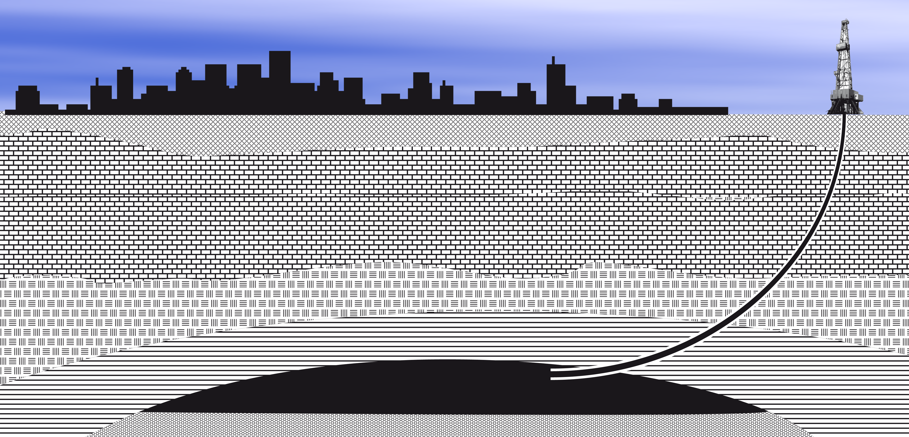
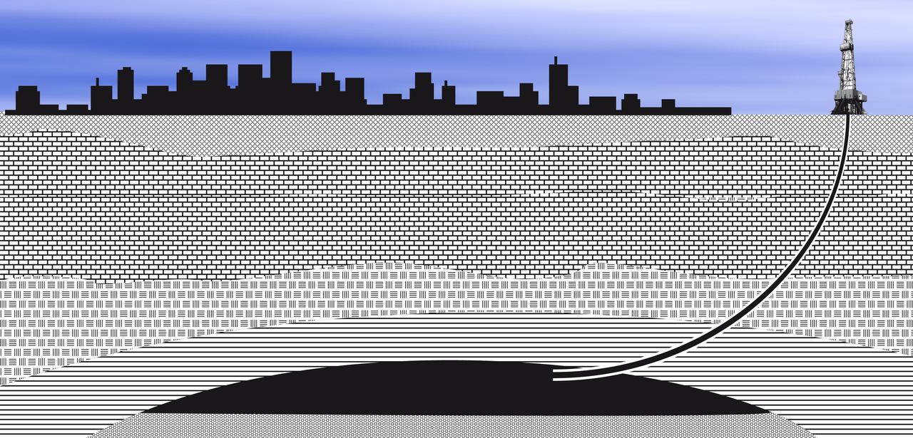
Deutsch: Richtbohrung unter eine Stadt - Schematische Darstellung
English: Directional well under city - diagram
Polski: Otwór kierunkowy pod miastem - schemat |
| Date | |
| Source | Own work |
| Author | SebaeL |
Licensing
[edit]
I, the copyright holder of this work, hereby publish it under the following licenses:

|
Permission is granted to copy, distribute and/or modify this document under the terms of the GNU Free Documentation License, Version 1.2 or any later version published by the Free Software Foundation; with no Invariant Sections, no Front-Cover Texts, and no Back-Cover Texts. A copy of the license is included in the section entitled GNU Free Documentation License. |
This file is licensed under the Creative Commons Attribution-Share Alike 4.0 International, 3.0 Unported, 2.5 Generic, 2.0 Generic and 1.0 Generic license.
- You are free:
- to share – to copy, distribute and transmit the work
- to remix – to adapt the work
- Under the following conditions:
- attribution – You must give appropriate credit, provide a link to the license, and indicate if changes were made. You may do so in any reasonable manner, but not in any way that suggests the licensor endorses you or your use.
- share alike – If you remix, transform, or build upon the material, you must distribute your contributions under the same or compatible license as the original.
You may select the license of your choice.
File history
Click on a date/time to view the file as it appeared at that time.
| Date/Time | Thumbnail | Dimensions | User | Comment | |
|---|---|---|---|---|---|
| current | 21:18, 13 November 2009 | | 3,441 × 1,654 (1.35 MB) | SebaeL (talk | contribs) | Reverted to version as of 21:03, 13 November 2009 |
| 21:18, 13 November 2009 |  | 3,441 × 1,654 (440 KB) | SebaeL (talk | contribs) | Reverted to version as of 21:36, 19 June 2009 | |
| 21:03, 13 November 2009 |  | 3,441 × 1,654 (1.35 MB) | SebaeL (talk | contribs) | Kosmetyczne | |
| 21:36, 19 June 2009 |  | 3,441 × 1,654 (440 KB) | SebaeL (talk | contribs) | {{Information |Description={{en|1=Directional well under city - diagram}} {{pl|1=Otwór kierunkowy pod miastem - schemat}} |Source=Praca własna osoby przesyłającej (own work by uploader) |Author=SebaeL |Date=2009-06-19 |Permission= |oth |
You cannot overwrite this file.
File usage on Commons
The following page uses this file:
File usage on other wikis
The following other wikis use this file:
- Usage on ar.wikipedia.org
- Usage on de.wikipedia.org
- Usage on en.wikiversity.org
- Usage on fr.wikipedia.org