File:Dione map 2010 PIA12814.jpg
Original file (6,203 × 3,521 pixels, file size: 5.91 MB, MIME type: image/jpeg)
Captions
Captions
Summary
[edit]
| Description |
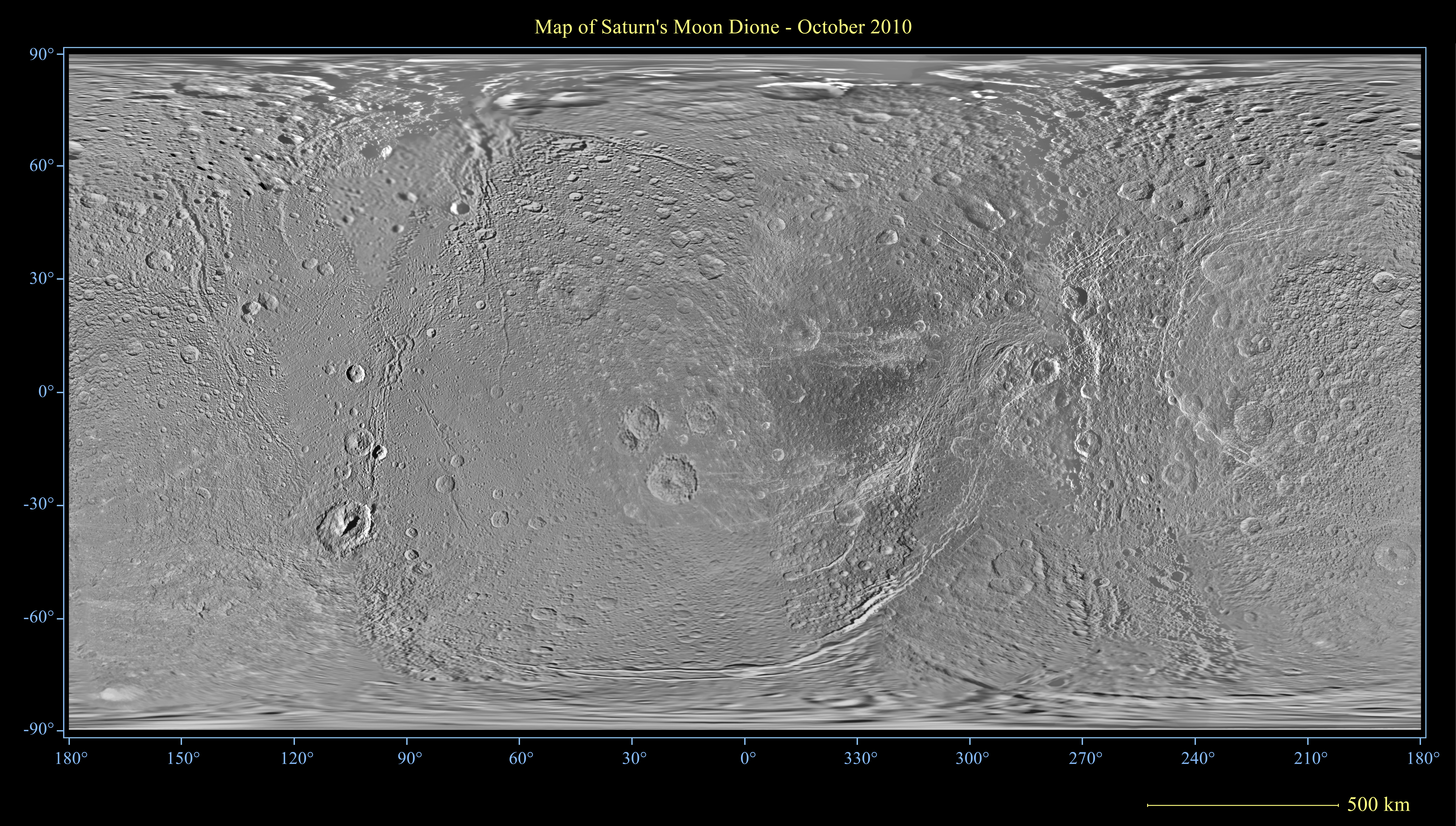
English: This global map of Saturn's moon Dione was created using images taken during flybys by NASA's Cassini spacecraft. Images from NASA's Voyager mission fill the gaps in Cassini's coverage.
An extensive system of bright ice cliffs created by tectonic fractures adorns the moon's trailing hemisphere, which is centered on 270 degrees west. The map is a simple cylindrical (equidistant) projection and has a scale of 153 meters (500 feet) per pixel at the equator. The resolution of the map is 64 pixels per degree. The mean radius of Dione used for projection of this map is 563 kilometers (350 miles). This map is an update to the version released in February 2010 (see PIA12577). The title of that older version ("Map of Dione - February 2010") denotes the month the map was released, not when the data in the map were collected. The title of this new version reflects when the most recent data used in the map were captured. The newest data were used to improve coverage across the whole north polar region. Moving south from the north polar region, coverage is improved all the way down to about 45 degrees south latitude in the area between the leading hemisphere and the anti-Saturn side of the moon from about 95 degrees west longitude to 135 degrees west longitude. Even farther south, new coverage on the trailing hemisphere reaches to about 65 degrees south latitude from about 220 degrees west longitude to 360 degrees west longitude. Like other recent Dione global maps, this map has been shifted west by 0.6 degrees of longitude, compared to the 2006 version of the map (PIA08341), in order to conform to the International Astronomical Union longitude system convention for Dione. The Cassini Solstice Mission is a joint United States and European endeavor. The Jet Propulsion Laboratory, a division of the California Institute of Technology in Pasadena, manages the mission for NASA's Science Mission Directorate, Washington, D.C. The Cassini orbiter was designed, developed and assembled at JPL. The imaging team consists of scientists from the US, England, France, and Germany. The imaging operations center and team lead (Dr. C. Porco) are based at the Space Science Institute in Boulder, Colo. |
| Date | |
| Source | http://www.ciclops.org/view.php?id=6711&js=1 |
| Author | NASA / Jet Propulsion Lab / Space Science Institute |
Licensing
[edit]
| This file is in the public domain in the United States because it was solely created by NASA. NASA copyright policy states that "NASA material is not protected by copyright unless noted". (See Template:PD-USGov, NASA copyright policy page or JPL Image Use Policy.) | ||
 |
Warnings:
|
File history
Click on a date/time to view the file as it appeared at that time.
| Date/Time | Thumbnail | Dimensions | User | Comment | |
|---|---|---|---|---|---|
| current | 01:37, 6 November 2012 | | 6,203 × 3,521 (5.91 MB) | WolfmanSF (talk | contribs) | User created page with UploadWizard |
You cannot overwrite this file.
File usage on Commons
There are no pages that use this file.