File:Die Alpen um Tierfehd.JPG
Jump to navigation
Jump to search
Size of this preview: 800 × 600 pixels. Other resolutions: 320 × 240 pixels | 640 × 480 pixels | 1,024 × 768 pixels | 1,280 × 960 pixels | 2,560 × 1,920 pixels | 3,072 × 2,304 pixels.
Original file (3,072 × 2,304 pixels, file size: 4.77 MB, MIME type: image/jpeg)
Captions
Captions
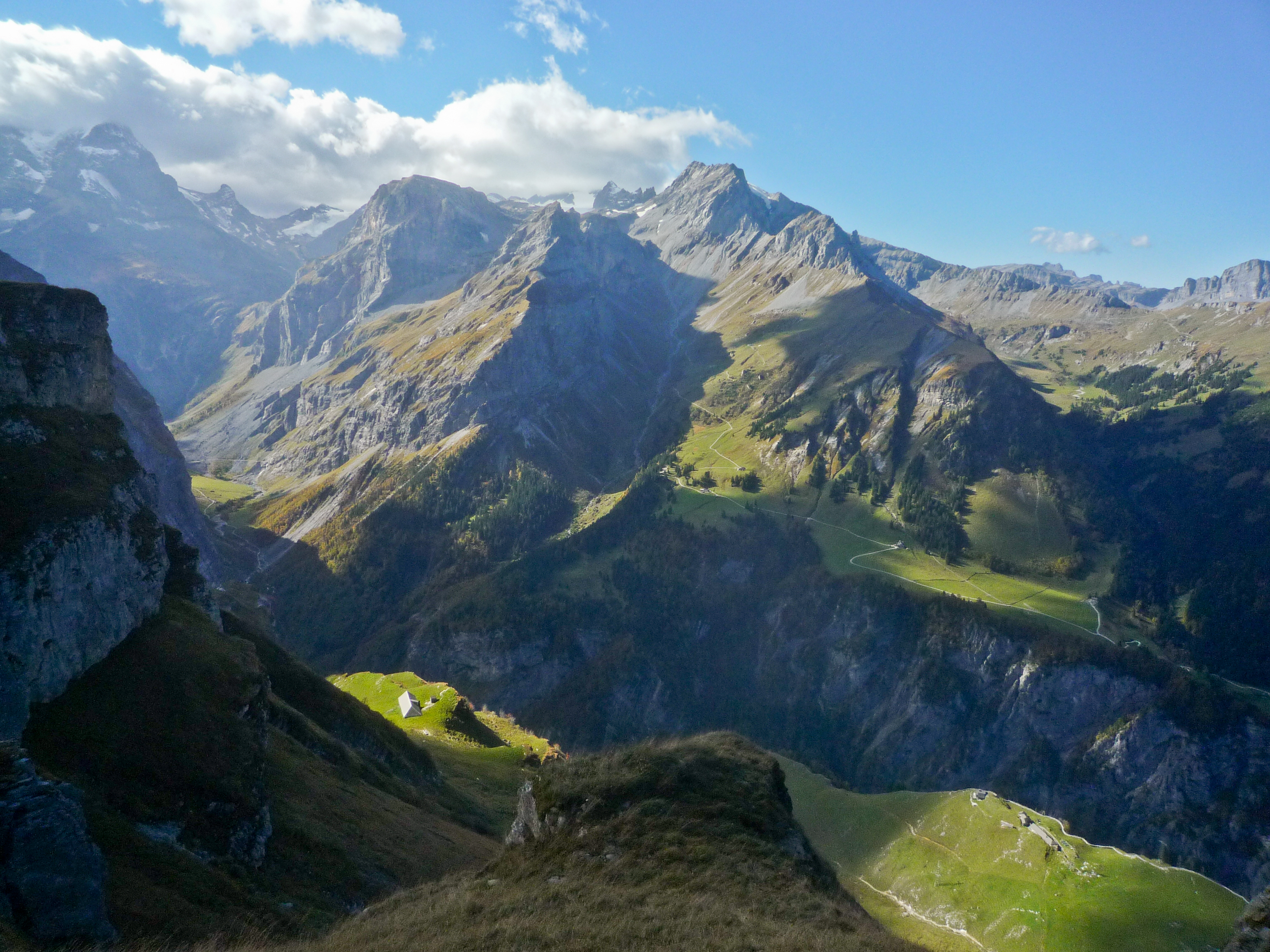
Five grazing areas behind Linthal
Summary
[edit]
| Description |
Deutsch: Fünf Alpen um Tierfehd in der Sonne; links im hinteren Talverlauf Vorder Sand 1280 Meter, im Vordergrund links Mättli 1830 Meter und rechts Baumgarten 1590 Meter; auf der gegenüberliegenden Talseite links Altstafel 1528 Meter und Chäsboden 1328 Meter. Tierfehd selber liegt unsichtbar im Taleinschnitt auf 805 Metern über Meer
English: Five grazing areas ("alps") behind Linthal (Glarus) each in individual sunshine-spots - note that the closer alps seem to be lower but are actually higher as they are closer to the point of the photographer - well above them |
| Date | |
| Source | Own work |
| Author | Caumasee |
Licensing
[edit]
I, the copyright holder of this work, hereby publish it under the following license:
This file is licensed under the Creative Commons Attribution-Share Alike 4.0 International license.
- You are free:
- to share – to copy, distribute and transmit the work
- to remix – to adapt the work
- Under the following conditions:
- attribution – You must give appropriate credit, provide a link to the license, and indicate if changes were made. You may do so in any reasonable manner, but not in any way that suggests the licensor endorses you or your use.
- share alike – If you remix, transform, or build upon the material, you must distribute your contributions under the same or compatible license as the original.
| Annotations | This image is annotated: View the annotations at Commons |
File history
Click on a date/time to view the file as it appeared at that time.
| Date/Time | Thumbnail | Dimensions | User | Comment | |
|---|---|---|---|---|---|
| current | 05:32, 18 January 2020 | | 3,072 × 2,304 (4.77 MB) | Fährtenleser (talk | contribs) | Bildverbesserung: Helligkeit, Kontrast, Fülllicht, Schwarz, Klarheit und Dynamik |
| 08:00, 24 April 2016 |  | 3,072 × 2,304 (2.77 MB) | Caumasee (talk | contribs) | User created page with UploadWizard |
You cannot overwrite this file.
File usage on Commons
There are no pages that use this file.
File usage on other wikis
The following other wikis use this file:
- Usage on de.wikipedia.org
- Usage on en.wikipedia.org
- Usage on frp.wikipedia.org
- Usage on fr.wikipedia.org
- Usage on kbd.wiktionary.org
- Usage on ru.wikipedia.org