File:Dicks Peak summit vista.jpg
Jump to navigation
Jump to search

Size of this preview: 800 × 452 pixels. Other resolutions: 320 × 181 pixels | 640 × 362 pixels | 1,024 × 579 pixels | 1,280 × 724 pixels | 3,212 × 1,816 pixels.
Original file (3,212 × 1,816 pixels, file size: 1.68 MB, MIME type: image/jpeg)
Captions
Captions
Add a one-line explanation of what this file represents
Summary
[edit]
| Description |
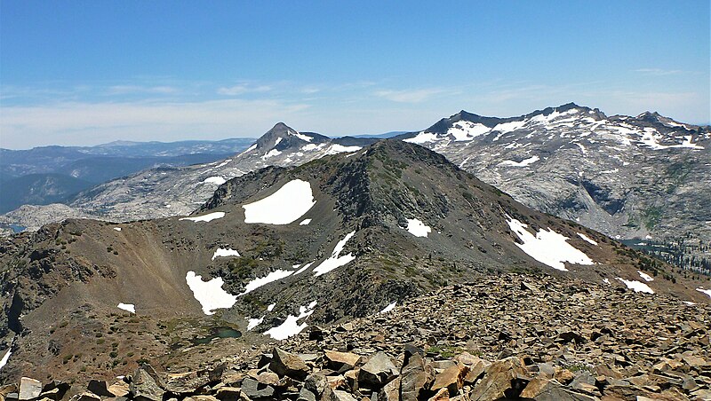
English: View from Dicks Peak, looking south at Jacks Peak, Pyramid Peak, and Mount Price. |
| Date | |
| Source | https://www.flickr.com/photos/rickmccharles/7869376054/ |
| Author | Rick McCharles |
| Camera location | | View this and other nearby images on: OpenStreetMap |
|---|
Licensing
[edit]
This file is licensed under the Creative Commons Attribution 2.0 Generic license.
- You are free:
- to share – to copy, distribute and transmit the work
- to remix – to adapt the work
- Under the following conditions:
- attribution – You must give appropriate credit, provide a link to the license, and indicate if changes were made. You may do so in any reasonable manner, but not in any way that suggests the licensor endorses you or your use.
| This image was originally posted to Flickr by Rick McCharles at https://flickr.com/photos/71035721@N00/7869376054. It was reviewed on 4 June 2022 by FlickreviewR 2 and was confirmed to be licensed under the terms of the cc-by-2.0. |
| Annotations | This image is annotated: View the annotations at Commons |
File history
Click on a date/time to view the file as it appeared at that time.
| Date/Time | Thumbnail | Dimensions | User | Comment | |
|---|---|---|---|---|---|
| current | 23:41, 4 June 2022 | | 3,212 × 1,816 (1.68 MB) | Ron Clausen (talk | contribs) | crop, exposure |
| 02:03, 4 June 2022 |  | 4,000 × 3,000 (3.83 MB) | Ron Clausen (talk | contribs) | Uploaded a work by Rick McCharles from https://www.flickr.com/photos/rickmccharles/7869376054/ with UploadWizard |
You cannot overwrite this file.
File usage on Commons
There are no pages that use this file.
File usage on other wikis
The following other wikis use this file:
- Usage on en.wikipedia.org