File:Diamonitirion 2011.jpg
From Wikimedia Commons, the free media repository
Jump to navigation
Jump to search
Size of this preview: 450 × 600 pixels. Other resolutions: 180 × 240 pixels | 360 × 480 pixels | 576 × 768 pixels | 768 × 1,024 pixels | 2,136 × 2,848 pixels.
Original file (2,136 × 2,848 pixels, file size: 1.29 MB, MIME type: image/jpeg)
File information
Structured data
Captions
Summary
[edit]DescriptionDiamonitirion 2011.jpg |
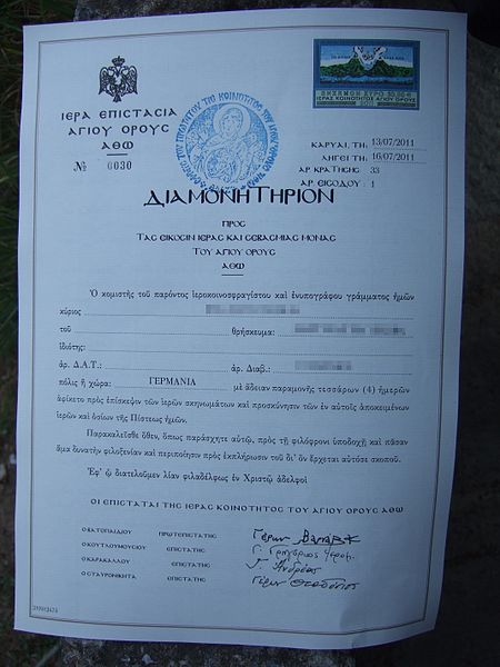
Deutsch: Diamonitirion (Erlaubnis, den Athos zu besuchen) 2011 English: Diamonētērion (permit to visit Mount Athos) from 2011 Ελληνικά: Διαμονητηριον 2011 Русский: Диамонитирион 2011 |
Date | |
Source | Own work |
Author | Administration of Mount Athos |
(source name=dscf_F30-2_010181_Besuchserlaubnis_Athos_bearb.jpg)
Camera location | 40° 19′ 38.87″ N, 23° 58′ 49.04″ E | View this and other nearby images on: OpenStreetMap | 40.327465; 23.980290 |
---|
Licensing
[edit]Public domainPublic domainfalsefalse |
This work is ineligible for copyright and therefore in the public domain because it consists entirely of information that is common property and contains no original authorship. |
Public domainPublic domainfalsefalse |
This image is in the public domain according to Greek copyright law (Paragraph 5 of Article II, Law 2121 of 1993) because it shows or is part of an official text expressive of the authority of the State, notably a legislative, administrative or judicial text. |
File history
Click on a date/time to view the file as it appeared at that time.
Date/Time | Thumbnail | Dimensions | User | Comment | |
---|---|---|---|---|---|
current | 08:34, 6 September 2014 | 2,136 × 2,848 (1.29 MB) | Malenki (talk | contribs) | User created page with UploadWizard |
You cannot overwrite this file.
File usage on Commons
There are no pages that use this file.
Metadata
This file contains additional information such as Exif metadata which may have been added by the digital camera, scanner, or software program used to create or digitize it. If the file has been modified from its original state, some details such as the timestamp may not fully reflect those of the original file. The timestamp is only as accurate as the clock in the camera, and it may be completely wrong.
Camera manufacturer | FUJIFILM |
---|---|
Camera model | FinePix F30 |
Exposure time | 1/340 sec (0.0029411764705882) |
F-number | f/2.8 |
ISO speed rating | 100 |
Date and time of data generation | 07:40, 13 July 2011 |
Lens focal length | 8 mm |
Latitude | 40° 19′ 38.87″ N |
Longitude | 23° 58′ 49.04″ E |
Altitude | 6 meters above sea level |
Orientation | Normal |
Horizontal resolution | 72 dpi |
Vertical resolution | 72 dpi |
Software used | GIMP 2.6.11 |
File change date and time | 15:22, 17 October 2011 |
Y and C positioning | Co-sited |
Exposure Program | Normal program |
Exif version | 2.2 |
Date and time of digitizing | 07:40, 13 July 2011 |
Meaning of each component |
|
Image compression mode | 2 |
APEX shutter speed | 8.4 |
APEX aperture | 3 |
APEX brightness | 6.55 |
APEX exposure bias | −0.33 |
Maximum land aperture | 3 APEX (f/2.83) |
Metering mode | Pattern |
Light source | Unknown |
Flash | Flash did not fire, compulsory flash suppression |
Supported Flashpix version | 1 |
Color space | sRGB |
Focal plane X resolution | 3,703 |
Focal plane Y resolution | 3,703 |
Focal plane resolution unit | 3 |
Sensing method | One-chip color area sensor |
File source | Digital still camera |
Scene type | A directly photographed image |
Custom image processing | Normal process |
Exposure mode | Auto exposure |
White balance | Auto white balance |
Scene capture type | Standard |
Sharpness | Normal |
Subject distance range | Unknown |
Geodetic survey data used | WGS-84 |
GPS tag version | 0.0.0.2 |