File:Delta plain of the Medjerda River, Tunisia.jpg

Original file (3,507 × 2,480 pixels, file size: 7.82 MB, MIME type: image/jpeg)
Captions
Captions
Summary
[edit]
| Description |
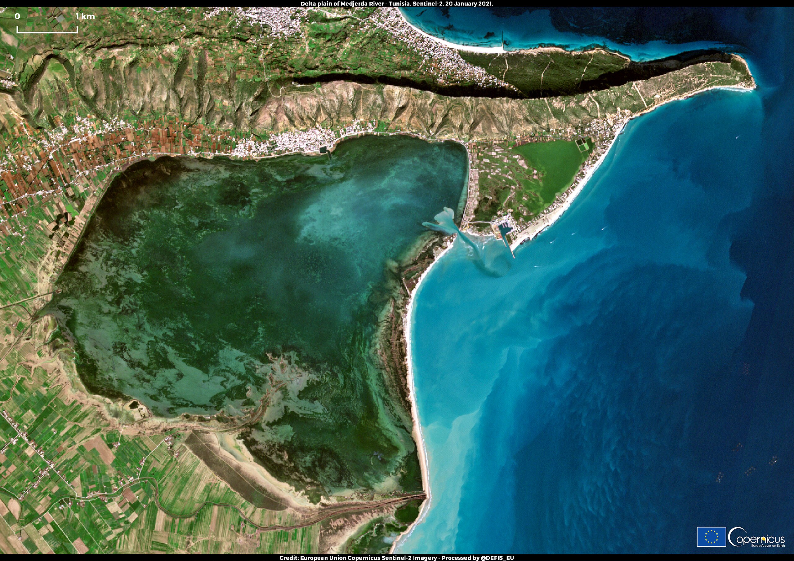
English: As a consequence of climate change and the ongoing rise of the global sea level, the arid coasts of North Africa are experiencing pronounced shoreline retreats and coastal flooding. Along the 4,633 km coastline that extends from the Gulf of Tunis to the Nile Delta, deltaic and sandy beaches exhibit some particularly interesting dynamics due to anthropogenic and climate change-related factors that increase their vulnerability to coastal hazards. According to a study recently published in the Scientific Reports journal, 47% of North African coasts have a high or very high vulnerability as a result of anthropogenic drivers such as damming and the rapid urban growth of the past decades, and not (only) global warming. The densely populated river deltas in Tunisia and Egypt are particularly vulnerable to coastal hazards, the environmental consequences of which affect crop yields and result in increased migrations from the affected regions. This image, acquired by one of the two Copernicus Sentinel-2 satellites on 20 January 2021, shows the northern side of the Medjerda River delta plain in Tunisia, which is one of the regions analysed in the newly published study. To better observe the shoreline retreat and the deterioration of the river’s coasts, the study authors used Sentinel-2 images captured in 2019 and compared them to aerial photographs and Landsat-5 imagery of the same region, taken in the 1970s. The Copernicus Sentinel-2 mission, which is composed of two twin satellites, Sentinel-2A and Sentinel-2B, allows users to monitor and study coastal zones and wetlands globally, with a maximal spatial resolution of 10 metres and an average revisit time of five days at the equator. |
| Date | Taken on 20 January 2021 |
| Source | Delta plain of the Medjerda River, Tunisia |
| Author | European Union, Copernicus Sentinel-2 imagery |
Licensing
[edit]

|
This image contains data from a satellite in the Copernicus Programme, such as Sentinel-1, Sentinel-2 or Sentinel-3. Attribution is required when using this image.
Attribution: Contains modified Copernicus Sentinel data 2021
The use of Copernicus Sentinel Data is regulated under EU law (Commission Delegated Regulation (EU) No 1159/2013 and Regulation (EU) No 377/2014). Relevant excerpts:
Free access shall be given to GMES dedicated data [...] made available through GMES dissemination platforms [...].
Access to GMES dedicated data [...] shall be given for the purpose of the following use in so far as it is lawful:
GMES dedicated data [...] may be used worldwide without limitations in time.
GMES dedicated data and GMES service information are provided to users without any express or implied warranty, including as regards quality and suitability for any purpose. |
File history
Click on a date/time to view the file as it appeared at that time.
| Date/Time | Thumbnail | Dimensions | User | Comment | |
|---|---|---|---|---|---|
| current | 08:16, 27 August 2023 | | 3,507 × 2,480 (7.82 MB) | OptimusPrimeBot (talk | contribs) | #Spacemedia - Upload of https://www.copernicus.eu/system/files/2021-02/image_day/MedjerdaDelta.jpeg via Commons:Spacemedia |
You cannot overwrite this file.
File usage on Commons
There are no pages that use this file.