File:Deforestation in Mexico.jpg
Original file (3,508 × 2,555 pixels, file size: 3.35 MB, MIME type: image/jpeg)
Captions
Captions
Summary
[edit]
| Description |
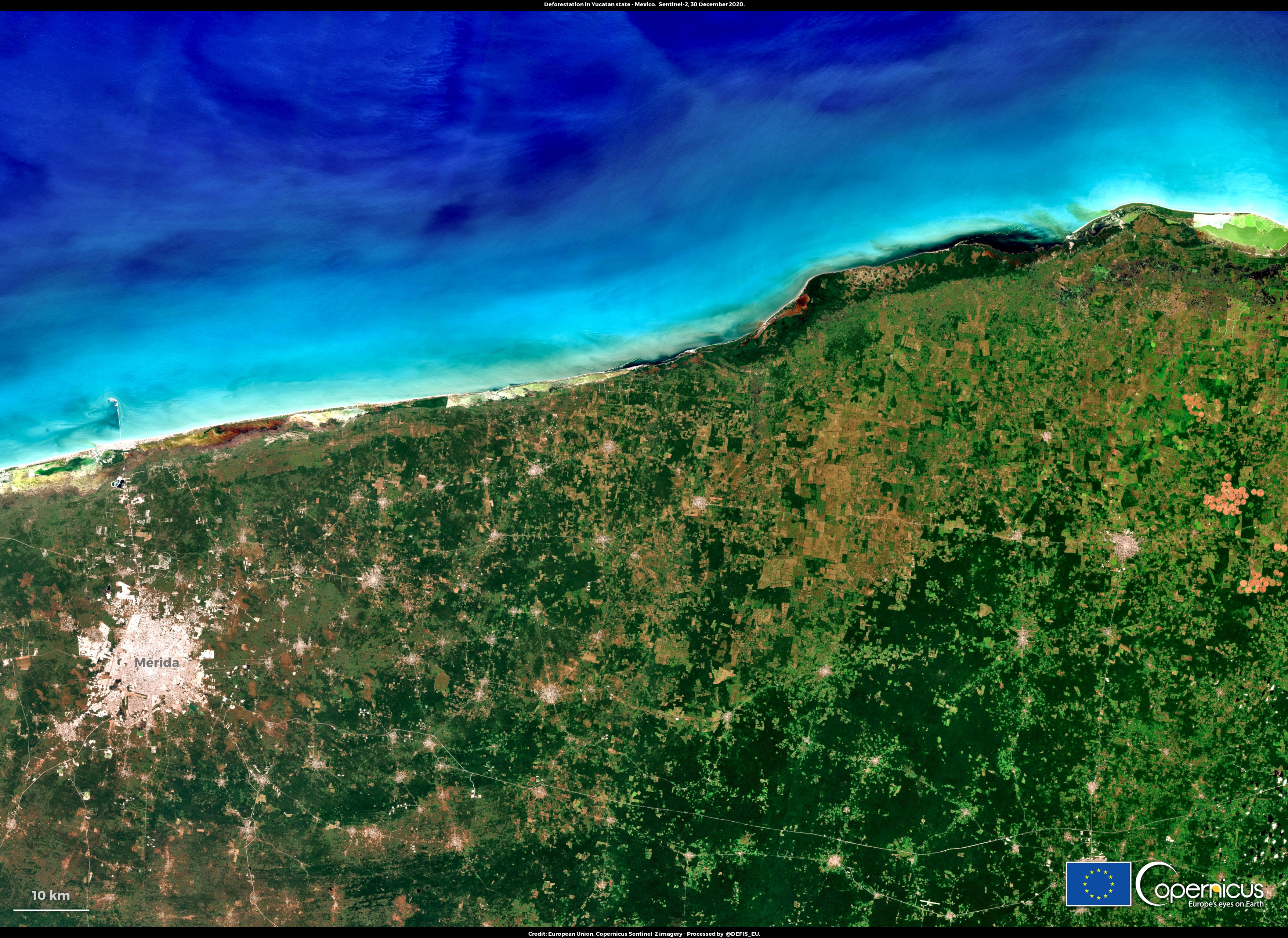
English: Forests are essential to our lives. After oceans, forests are the largest storehouses of carbon. They are critical in the fight against the climate crisis. A new study by the World Wildlife Fund, has identified 24 "deforestation fronts": they are hot spots where global deforestation has been clustered, causing 43 million hectares of forests loss between 2004 and 2017 (i.e. nearly the size of California or twice the size of UK). This image, acquired by one of the Copernicus Sentinel-2 satellites on 30 December 2020, shows the northern part of the “Maya Forest front”, in the northern part of the State of Yucatán, in Mexico, one of the fronts identified by WWF. The high revisit frequency of the Copernicus Sentinel-2 satellites supports the attempts to mitigate deforestation by providing greater opportunities to acquire cloud-free optical data. |
| Date | Taken on 30 December 2020 |
| Source | Deforestation in Mexico |
| Author | European Union , Copernicus Sentinel-2 imagery |
Licensing
[edit]

|
This image contains data from a satellite in the Copernicus Programme, such as Sentinel-1, Sentinel-2 or Sentinel-3. Attribution is required when using this image.
Attribution: Contains modified Copernicus Sentinel data 2020
The use of Copernicus Sentinel Data is regulated under EU law (Commission Delegated Regulation (EU) No 1159/2013 and Regulation (EU) No 377/2014). Relevant excerpts:
Free access shall be given to GMES dedicated data [...] made available through GMES dissemination platforms [...].
Access to GMES dedicated data [...] shall be given for the purpose of the following use in so far as it is lawful:
GMES dedicated data [...] may be used worldwide without limitations in time.
GMES dedicated data and GMES service information are provided to users without any express or implied warranty, including as regards quality and suitability for any purpose. |
File history
Click on a date/time to view the file as it appeared at that time.
| Date/Time | Thumbnail | Dimensions | User | Comment | |
|---|---|---|---|---|---|
| current | 12:49, 26 August 2023 | | 3,508 × 2,555 (3.35 MB) | OptimusPrimeBot (talk | contribs) | #Spacemedia - Upload of https://www.copernicus.eu/system/files/2021-01/image_day/DeforestationMexico.jpg via Commons:Spacemedia |
You cannot overwrite this file.
File usage on Commons
There are no pages that use this file.