File:Deep Cut Road bridge over canal.jpg
Jump to navigation
Jump to search
Size of this preview: 800 × 600 pixels. Other resolutions: 320 × 240 pixels | 640 × 480 pixels | 1,024 × 768 pixels | 1,280 × 960 pixels | 2,560 × 1,920 pixels | 2,816 × 2,112 pixels.
Original file (2,816 × 2,112 pixels, file size: 2.23 MB, MIME type: image/jpeg)
Captions
Captions
Add a one-line explanation of what this file represents
| Camera location | | View this and other nearby images on: OpenStreetMap |
|---|
| Description |
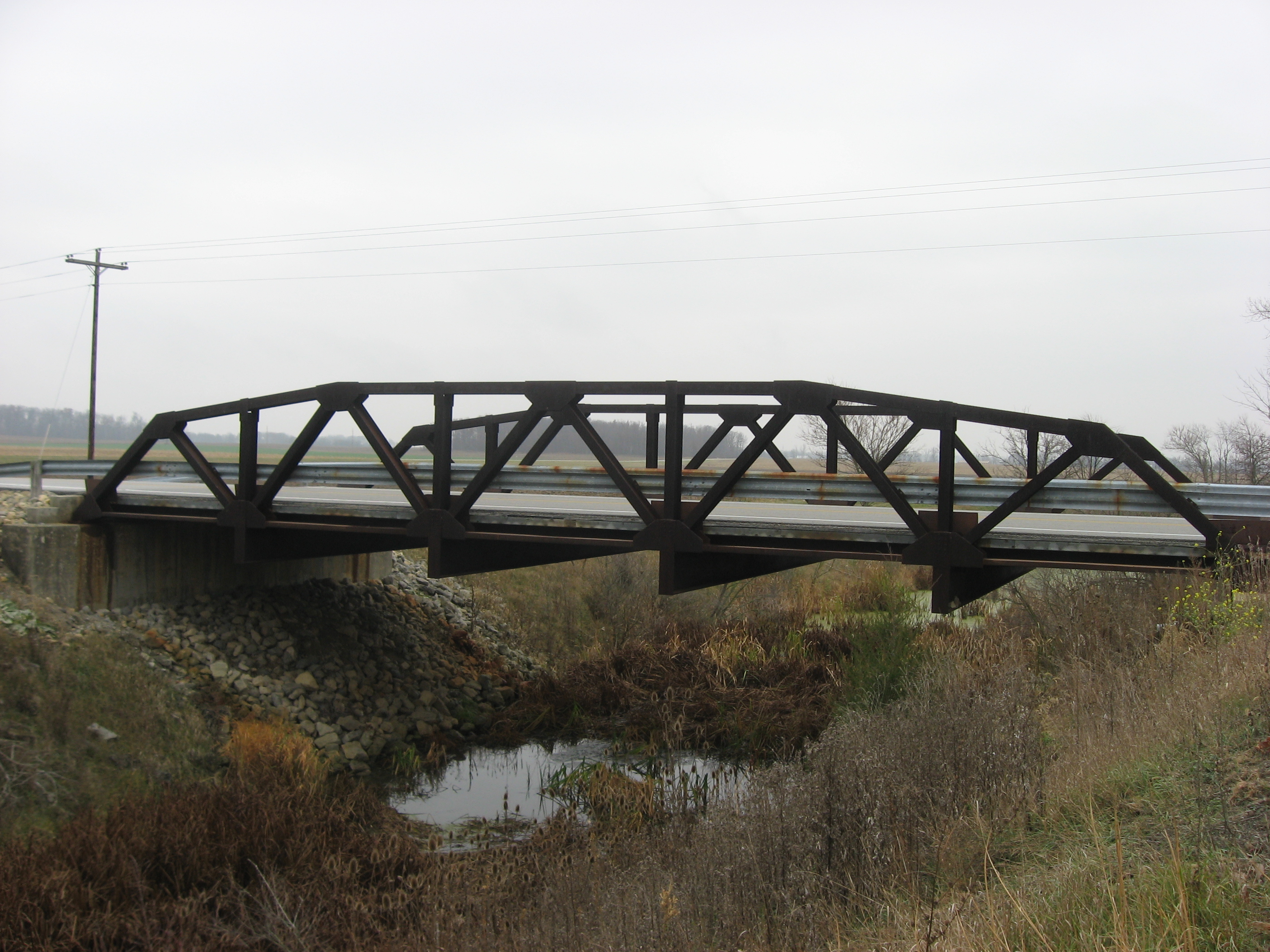
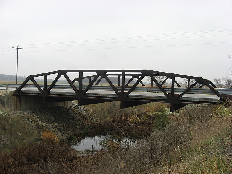
English: Northern side of the Warren pony truss bridge that carries Deep Cut Road over the Miami and Erie Canal in Salem Township, Auglaize County, Ohio, United States. Deep Cut Road is officially the southern boundary of the Miami and Erie Canal Deep Cut, a segment of the canal that was dug much deeper than any other part; it is today recognized as a National Historic Landmark. |
||
| Date | Taken on 24 November 2009 | ||
| Source | Own work | ||
| Author | Nyttend | ||
| Permission (Reusing this file) |
|
File history
Click on a date/time to view the file as it appeared at that time.
| Date/Time | Thumbnail | Dimensions | User | Comment | |
|---|---|---|---|---|---|
| current | 05:11, 25 November 2009 | | 2,816 × 2,112 (2.23 MB) | Nyttend (talk | contribs) | {{Location|40|40|55.2|N|84|21|57.6|W}} {{Information |Description={{en|Northern side of the bridge that carries Deep Cut Road over the {{w|Miami and Erie Canal}} in {{w|Salem Township, Auglaize County, Ohio|Salem Township}}, {{w|Auglaize County, Ohio|Augl |
You cannot overwrite this file.
File usage on Commons
There are no pages that use this file.
File usage on other wikis
The following other wikis use this file:
- Usage on en.wikipedia.org