File:Debarked trees and EF4 damage to a home southwest of Rolling Fork, Mississippi.jpg
Jump to navigation
Jump to search

Size of this preview: 800 × 600 pixels. Other resolutions: 320 × 240 pixels | 640 × 480 pixels | 1,024 × 768 pixels | 1,280 × 960 pixels | 2,560 × 1,920 pixels | 3,264 × 2,448 pixels.
Original file (3,264 × 2,448 pixels, file size: 3.18 MB, MIME type: image/jpeg)
Captions
Captions
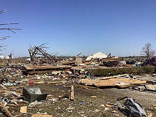
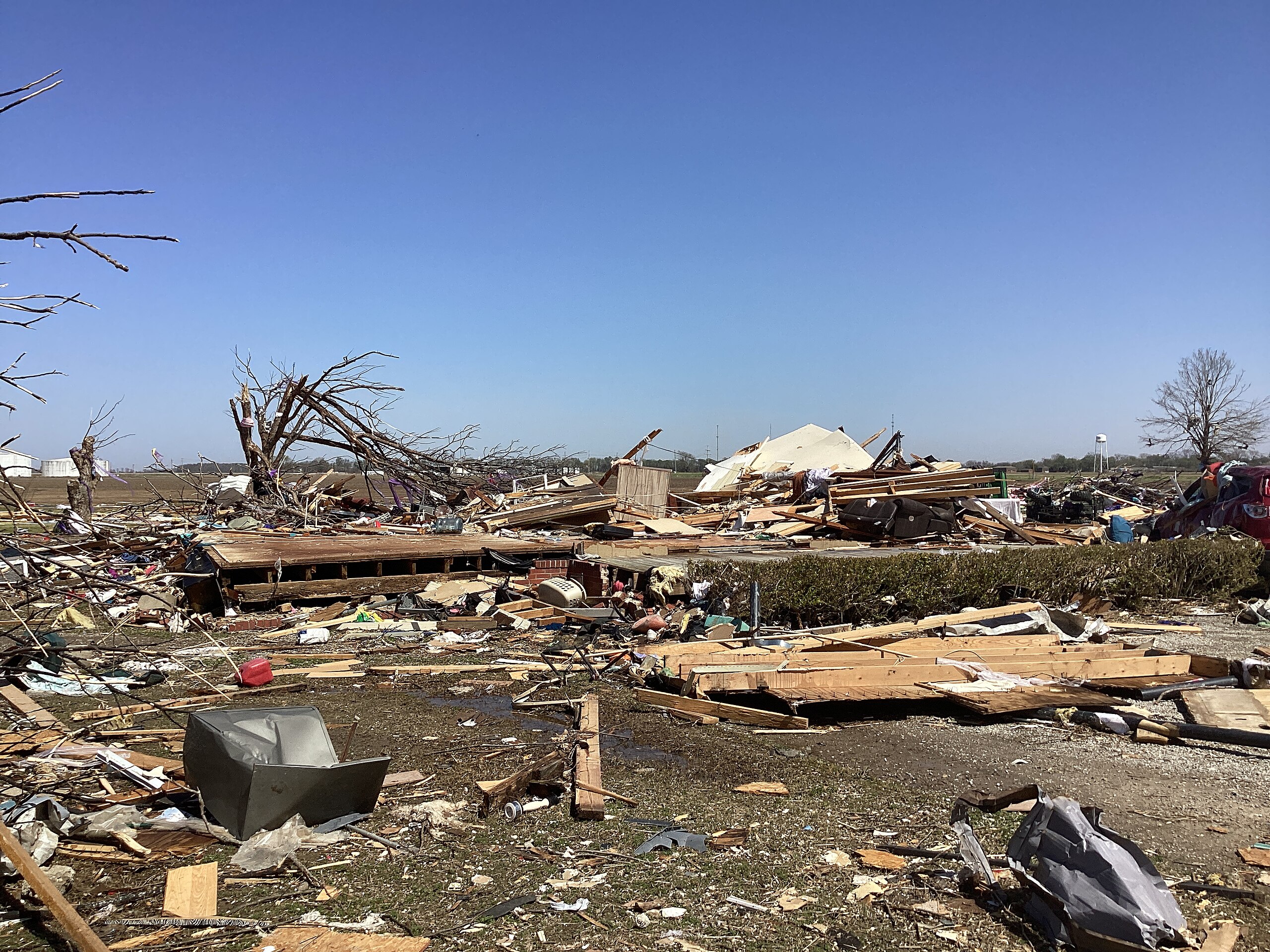
Debarked trees and EF4 damage to a home southwest of Rolling Fork, Mississippi.
Summary
[edit]
| Description |
English: Debarked trees and EF4 damage to a home southwest of Rolling Fork, Mississippi. |
| Date | |
| Source | https://apps.dat.noaa.gov/StormDamage/DamageViewer/ |
| Author | National Oceanic and Atmospheric Administration |
| Camera location | | View this and other nearby images on: OpenStreetMap |
|---|
Licensing
[edit]
This file is in the public domain in the United States because it was solely created by employees of the National Weather Service or National Severe Storms Laboratory using the Damage Assessment Toolkit (DAT), an interactive map and database.
|
File history
Click on a date/time to view the file as it appeared at that time.
| Date/Time | Thumbnail | Dimensions | User | Comment | |
|---|---|---|---|---|---|
| current | 21:15, 15 July 2023 | | 3,264 × 2,448 (3.18 MB) | Nicholas Krasznavolgyi (talk | contribs) | Uploaded a work by National Oceanic and Atmospheric Administration from https://apps.dat.noaa.gov/StormDamage/DamageViewer/ with UploadWizard |
You cannot overwrite this file.
File usage on Commons
There are no pages that use this file.
File usage on other wikis
The following other wikis use this file:
- Usage on en.wikipedia.org