File:Dawson Springs KY EF3 damage.jpg
Jump to navigation
Jump to search

Size of this preview: 800 × 600 pixels. Other resolutions: 320 × 240 pixels | 640 × 480 pixels | 1,024 × 768 pixels | 1,280 × 960 pixels | 2,560 × 1,920 pixels | 4,032 × 3,024 pixels.
Original file (4,032 × 3,024 pixels, file size: 5.55 MB, MIME type: image/jpeg)
Captions
Captions
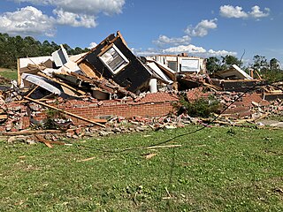
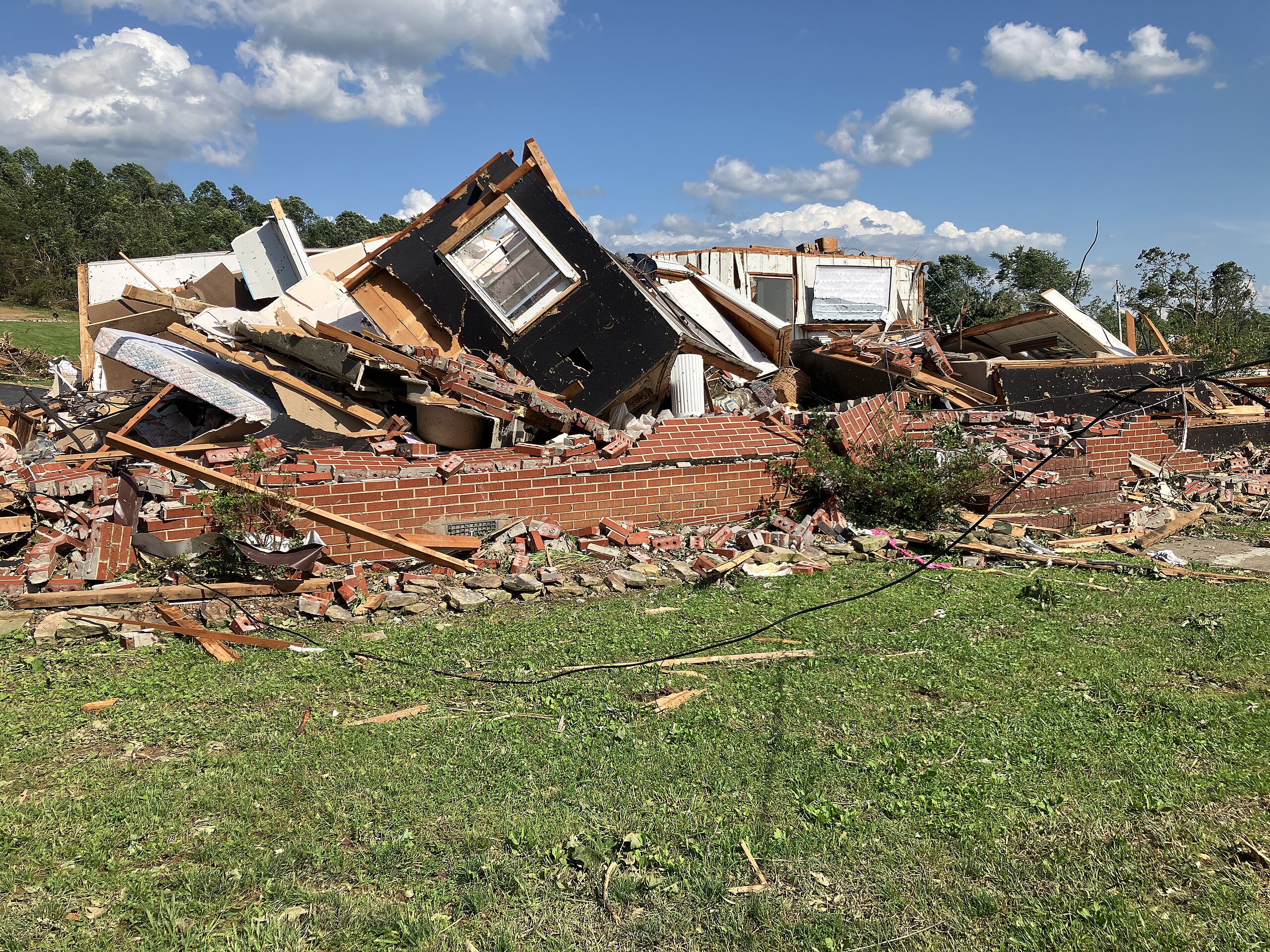
EF3 tornado damage to a home north of Dawson Springs, Kentucky from a tornado on May 26, 2024
Summary
[edit]
| Description |
English: EF3 tornado damage to a home north of Dawson Springs, Kentucky from a tornado on May 26, 2024 |
| Date | |
| Source | NOAA’s Damage Assessment Toolkit: https://apps.dat.noaa.gov/stormdamage/damageviewer/. (Exact URL) |
| Author | National Weather Service Forecast Office in Paducah, Kentucky |
| Camera location | | View this and other nearby images on: OpenStreetMap |
|---|
Licensing
[edit]
This image is in the public domain because it was stored on the web servers of the U.S. National Oceanic and Atmospheric Administration, specifically on the Damage Assessment Toolkit (DAT), an interactive map and database. Images on the Damage Assessment Toolkit are taken by the 122 National Weather Service forecast offices as well as the National Severe Storms Laboratory.
Thus, all images on the Damage Assessment Toolkit are public domain.
|
File history
Click on a date/time to view the file as it appeared at that time.
| Date/Time | Thumbnail | Dimensions | User | Comment | |
|---|---|---|---|---|---|
| current | 01:43, 29 May 2024 | | 4,032 × 3,024 (5.55 MB) | TornadoLGS (talk | contribs) | Uploaded a work by National Weather Service Forecast Office in Paducah, Kentucky from NOAA’s Damage Assessment Toolkit: https://apps.dat.noaa.gov/stormdamage/damageviewer/. ([https://services.dat.noaa.gov/arcgis/rest/services/nws_damageassessmenttoolkit/DamageViewer/FeatureServer/0/4025681/attachments/2435900 Exact URL]) with UploadWizard |
You cannot overwrite this file.
File usage on Commons
There are no pages that use this file.
File usage on other wikis
The following other wikis use this file:
- Usage on en.wikipedia.org