File:Davidovic map 1846.jpg
Jump to navigation
Jump to search
Size of this preview: 800 × 525 pixels. Other resolutions: 320 × 210 pixels | 640 × 420 pixels | 1,024 × 671 pixels | 1,280 × 839 pixels | 2,135 × 1,400 pixels.
Original file (2,135 × 1,400 pixels, file size: 1.21 MB, MIME type: image/jpeg)
Captions
Captions
Add a one-line explanation of what this file represents
Summary
[edit]
| Description |
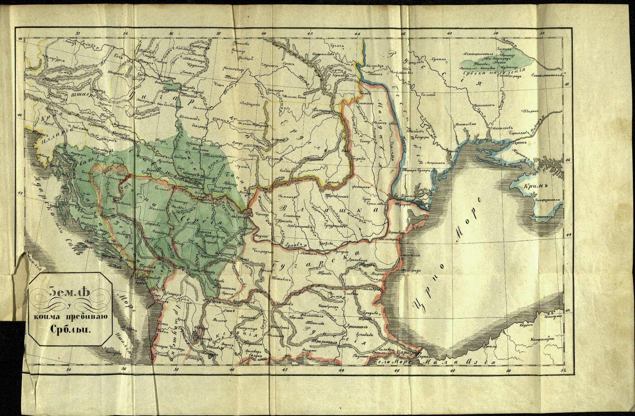
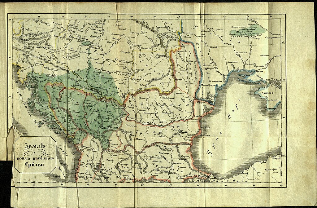
English: Second edition of the map called „Territories inhabited by Servians” from 1846. It forms a supplement to the book: „History of the Servian People, edited by Dimitrije Davidovic.” This map has originally appeared in Vienna in 1821, where it was published at the cost of the Serbian State. It was reprinted in Belgrade after the death of Davidovic in 1846 and in 1848. It shows the ethnological boundaries of the Serbian people. There are some distinctions between the different editions, regarding the map borders. A detail retrived from the third edition of the same map, shows some differences in its southeastern border. It is visible in the book "Bulgarians in Macedonia on p. 93. It was published by the Bulgarian Academy of Sciences and Arts with author Prof. Jordan Ivanov in 1915. You can see also bellow a link to the original version from 1821. The description of that southeastern border-line reads as follows in "Ethnic Mapping on the Balkans (1840–1925): a Brief Comparative Summary of Concepts and Methods of Visualization", on p. 73: "In the map of Davidović nor the Sanjak of Novipazar neither Kosovo was described as Serb. The fact that his work has been published at the expense of the Servian State and that it was translated in French means, that his work was bearing the full approval of the Servian Government of that time. Macedonia, but also the towns Niš, Leskovac, Vranja, Pirot were also situated outside the boundaries of the Serbian race". The book is issued by the Hungarian Academy of Sciences with authors G. Demeter, Zs. Bottlik and Kr. Csaplár-Degovic. |
| Date | |
| Source | ДaвидовиЋ, Димитрије - Дела Димитрија Давидовића. Књ. 1, Историја народа српског. Дигитална Библиотека Матица Српска |
| Author | Dimitrije Davidović (1789 — 1838)?/ Gligorije Vozarovic (1790 — 1848)? |
| Other versions | Davidovic map from 1821. |
Licensing
[edit]
|
The author died in 1848, so this work is in the public domain in its country of origin and other countries and areas where the copyright term is the author's life plus 100 years or fewer. This work is in the public domain in the United States because it was published (or registered with the U.S. Copyright Office) before January 1, 1929. | |
| This file has been identified as being free of known restrictions under copyright law, including all related and neighboring rights. | |
File history
Click on a date/time to view the file as it appeared at that time.
| Date/Time | Thumbnail | Dimensions | User | Comment | |
|---|---|---|---|---|---|
| current | 19:29, 14 May 2017 | | 2,135 × 1,400 (1.21 MB) | Jingiby (talk | contribs) | A third edition. Original from Matica Srbska library. |
| 05:54, 12 May 2017 |  | 1,578 × 1,212 (702 KB) | Jingiby (talk | contribs) | User created page with UploadWizard |
You cannot overwrite this file.
File usage on Commons
The following page uses this file:
- File:Davidovic map 1848.jpg (file redirect)
File usage on other wikis
The following other wikis use this file:
- Usage on bg.wikipedia.org
- Usage on en.wikipedia.org
- Usage on sq.wikipedia.org