File:Dapeng Bay National Scenic Area Administration Tourism + 鼻頭角.jpg
Jump to navigation
Jump to search
Size of this preview: 800 × 544 pixels. Other resolutions: 320 × 218 pixels | 640 × 436 pixels | 1,080 × 735 pixels.
Original file (1,080 × 735 pixels, file size: 116 KB, MIME type: image/jpeg)
Captions
Captions
Add a one-line explanation of what this file represents
Summary
[edit]
| Description |
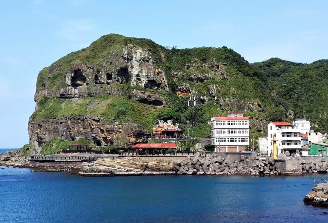
中文(臺灣):鼻頭角露出的地層,主要由桂竹林層二鬮段所組成,砂岩及頁岩中均富含有孔蟲與貝類化石。本區為岩岸地形,砂岩裡夾有頁岩層,由於頁岩受雨水侵蝕及風化的速度較快,因而形成不穩定的邊坡或是深凹的海蝕凹壁。當下部形成海蝕凹壁後,頁岩上部的砂岩遂被懸空,後因重力及風化作用,砂岩塊常沿著節理崩落,堆積而成坡腳。 |
| Date | |
| Source | Own work |
| Author | WEI, WAN-CHEN |
Licensing
[edit]
I, the copyright holder of this work, hereby publish it under the following license:
This file is licensed under the Creative Commons Attribution-Share Alike 4.0 International license.
- You are free:
- to share – to copy, distribute and transmit the work
- to remix – to adapt the work
- Under the following conditions:
- attribution – You must give appropriate credit, provide a link to the license, and indicate if changes were made. You may do so in any reasonable manner, but not in any way that suggests the licensor endorses you or your use.
- share alike – If you remix, transform, or build upon the material, you must distribute your contributions under the same or compatible license as the original.
This image was uploaded as part of Wiki Loves Earth 2023.
|
 |
File history
Click on a date/time to view the file as it appeared at that time.
| Date/Time | Thumbnail | Dimensions | User | Comment | |
|---|---|---|---|---|---|
| current | 01:33, 31 May 2023 | | 1,080 × 735 (116 KB) | WEI, WAN-CHEN (talk | contribs) | Uploaded own work with UploadWizard |
You cannot overwrite this file.
File usage on Commons
There are no pages that use this file.