File:Danube River and Sky over Bulgarian.Romanian Border SE of Bucharest.jpg
Jump to navigation
Jump to search

Size of this preview: 800 × 450 pixels. Other resolutions: 320 × 180 pixels | 640 × 360 pixels | 960 × 540 pixels.
Original file (960 × 540 pixels, file size: 64 KB, MIME type: image/jpeg)
Captions
Captions
Add a one-line explanation of what this file represents
Summary
[edit]
| Description |
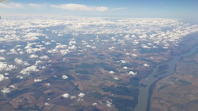
English: Danube River, ca. 60 km (40 miles) southeast of Bucharest, with Ostrov Pozharevo Protected area (islands beneath the river); view to the west-southwest. עברית: צילום של שמי ישראל בזמן ההמראה מהנתבג, Original Image Name:שמים כחולים, Location:שמי ישראל מעל נתב"ג |
| Date | between 2010 and 2012 |
| Source | sapir zaguri via the PikiWiki - Israel free image collection project |
| Author | sapir zaguri |
| Permission (Reusing this file) |
This file is licensed under the Creative Commons Attribution 2.5 Generic license. Attribution: sapir zaguri Pikiwiki Israel
|
| Object location | | View this and other nearby images on: OpenStreetMap |
|---|
| Camera location | | View this and other nearby images on: OpenStreetMap |
|---|

|
This file has been submitted through the Israeli Pikiwiki project and uploaded here automatically.
The project is cooperation between the Israel Internet Association and Wikimedia Israel in an effort to promote the concept of free content on the Web, by creating an image collection of digital-format, good quality photographs, documenting events relating to the history of Israel, or depicting places of distinction in Israel and the Middle East. The Pikiwiki Project is managed from 2021 by the "Heritage Stones" group.
Please consider notifying the project before renaming or deleting this file. Further information about the project can be found on the commons-l mailing list.
|
| Annotations | This image is annotated: View the annotations at Commons |
File history
Click on a date/time to view the file as it appeared at that time.
| Date/Time | Thumbnail | Dimensions | User | Comment | |
|---|---|---|---|---|---|
| current | 13:06, 24 December 2015 | | 960 × 540 (64 KB) | Pikiwikisrael (talk | contribs) | {{Information |Description={{en|sky, Geography of Israel}} {{he|צילום של שמי ישראל בזמן ההמראה מהנתבג, Original Image Name:שמים כחולים, Location:שמי ישראל מעל נתב"ג}} |Source=sapir zaguri vi... |
You cannot overwrite this file.
File usage on Commons
The following 2 pages use this file: