File:Danielson and Kalocsa topography ESA272905.jpg
Jump to navigation
Jump to search
Size of this preview: 800 × 414 pixels. Other resolutions: 320 × 166 pixels | 640 × 331 pixels | 1,024 × 530 pixels | 1,920 × 993 pixels.
Original file (1,920 × 993 pixels, file size: 886 KB, MIME type: image/jpeg)
Captions
Captions
Add a one-line explanation of what this file represents
Summary
[edit]| Description |
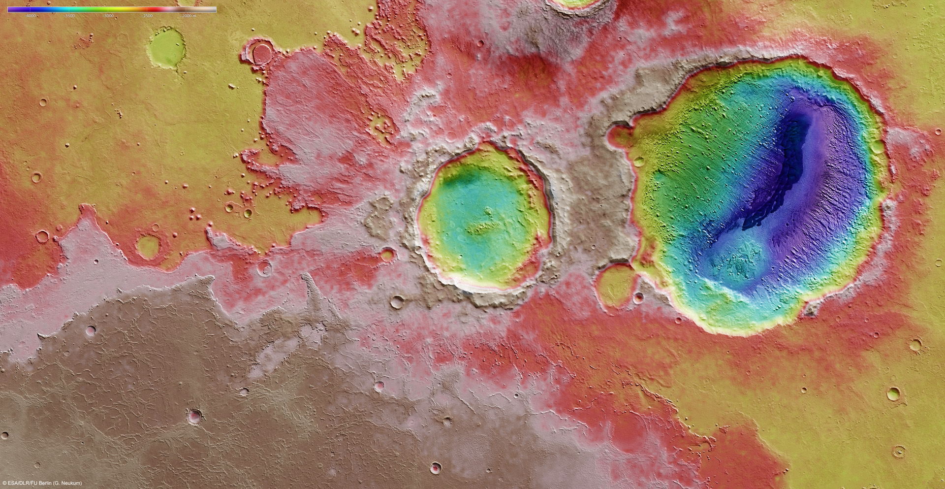
English: This colour-coded plan view is based on a digital terrain model of the region, fromwhich the topography of the landscape can be derived. Note the strong view in colour reliefof the ejecta blanket surrounding Kalocsa crater, and the marked change in depth wherethe darker dune region bisects the centre of Danielson crater. Centred at around 7°N and353°E, this image has a ground resolution of about 26 m per pixel. |
| Date | |
| Source | http://www.esa.int/spaceinimages/Images/2012/06/Danielson_and_Kalocsa_topography |
| Author | European Space Agency |
| Permission (Reusing this file) |
ESA/DLR/FU Berlin (G. Neukum),CC BY-SA 3.0 IGO |
| Other versions |
|
| Title | Danielson and Kalocsa topography |
| Mission | Mars Express |
| Activity | Space Science |

Licensing
[edit]
This file is licensed under the Creative Commons Attribution-ShareAlike 3.0 IGO license.
Attribution: ESA/DLR/FU Berlin (G. Neukum)
- You are free:
- to share – to copy, distribute and transmit the work
- to remix – to adapt the work
- Under the following conditions:
- attribution – You must give appropriate credit, provide a link to the license, and indicate if changes were made. You may do so in any reasonable manner, but not in any way that suggests the licensor endorses you or your use.
- share alike – If you remix, transform, or build upon the material, you must distribute your contributions under the same or compatible license as the original.
File history
Click on a date/time to view the file as it appeared at that time.
| Date/Time | Thumbnail | Dimensions | User | Comment | |
|---|---|---|---|---|---|
| current | 11:44, 24 May 2017 | | 1,920 × 993 (886 KB) | Fæ (talk | contribs) | European Space Agency, Id 272905, http://www.esa.int/spaceinimages/Images/2012/06/Danielson_and_Kalocsa_topography, User:Fæ/Project_list/ESA |
You cannot overwrite this file.
File usage on Commons
The following page uses this file: