File:Damine station map.jpg
Jump to navigation
Jump to search
Size of this preview: 784 × 600 pixels. Other resolutions: 314 × 240 pixels | 628 × 480 pixels | 1,004 × 768 pixels | 1,280 × 979 pixels | 1,700 × 1,300 pixels.
Original file (1,700 × 1,300 pixels, file size: 3.74 MB, MIME type: image/jpeg)
Captions
Captions
Add a one-line explanation of what this file represents
Summary
[edit]
| Description |
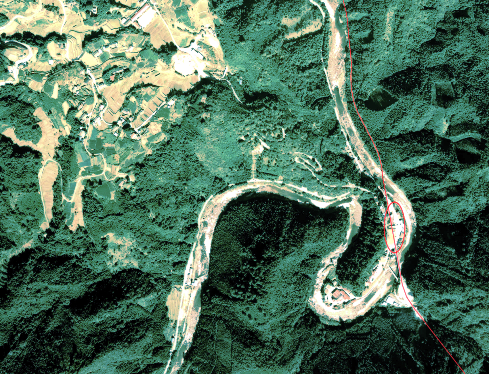
日本語: 田峯駅跡とその周囲の空中写真(1977年) |
| Date | |
| Source | http://w3land.mlit.go.jp/Air/photo400/77/ccb-77-16/c13/ccb-77-16_c13_28.jpg |
| Author | 国土交通省 |
Licensing
[edit]

|
The copyright holder of this file, the Ministry of Land, Infrastructure, Transport and Tourism of Japan, allows anyone to use it for any purpose, provided that the copyright holder is properly attributed. Redistribution, derivative work, commercial use, and all other use is permitted. |
Attribution:
Copyright © National Land Image Information (Color Aerial Photographs), Ministry of Land, Infrastructure, Transport and Tourism
|
 |
This image is copyrighted by the Ministry of Land, Infrastructure, Transport and Tourism of Japan. For terms of use, see the stipulation to use of National Land Information (in Japanese) and message from MLIT (in Japanese and English). When you display this image on an article, include the following phrase in the description: "Made based on National Land Image Information (Color Aerial Photographs), Ministry of Land, Infrastructure, Transport and Tourism".
|
File history
Click on a date/time to view the file as it appeared at that time.
| Date/Time | Thumbnail | Dimensions | User | Comment | |
|---|---|---|---|---|---|
| current | 09:32, 23 October 2017 | | 1,700 × 1,300 (3.74 MB) | Togabi (talk | contribs) | Color adjustment. |
| 16:40, 23 September 2012 |  | 1,700 × 1,300 (3.17 MB) | 継之助 (talk | contribs) | {{Information |Description ={{ja|1=田峯駅跡とその周囲の空中写真(1977年)}} |Source =http://w3land.mlit.go.jp/Air/photo400/77/ccb-77-16/c13/ccb-77-16_c13_28.jpg |Author =国土交通省 |Date =1977年 |Perm... |
You cannot overwrite this file.
File usage on Commons
The following 2 pages use this file:
File usage on other wikis
The following other wikis use this file: