File:Dalton Highway river crossing - DPLA - fc8440bffba83cf0f19b98426586711b.jpg
Jump to navigation
Jump to search

Size of this preview: 800 × 533 pixels. Other resolutions: 320 × 213 pixels | 640 × 427 pixels | 1,024 × 683 pixels | 1,280 × 853 pixels | 3,000 × 2,000 pixels.
Original file (3,000 × 2,000 pixels, file size: 1.17 MB, MIME type: image/jpeg)
Captions
Captions
Add a one-line explanation of what this file represents
Summary
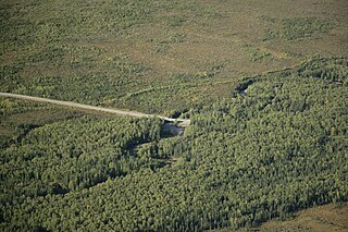
[edit]| Dalton Highway river crossing
( |
||||||||||||||||||||
|---|---|---|---|---|---|---|---|---|---|---|---|---|---|---|---|---|---|---|---|---|
| Creator | Department of the Interior. U.S. Fish and Wildlife Service. National Conservation Training Center. 10/1997-8888 | |||||||||||||||||||
| Title |
Dalton Highway river crossing |
|||||||||||||||||||
| Description |
Note: Some of the following information may have arrived from the agency cut off or incomplete. Creator: Hillebrand, Steve. Description: Aerial photo of Dalton Highway passing through trees and brush area, crossing a river bridge and entering forest area. Subjects: Human impacts; Aerial photography; Tundra; Forests; Terrestrial ecosystems; Rivers and streams; Roads. Location: Alaska. Fish and Wildlife Service Site: KANUTI NATIONAL WILDLIFE REFUGE. Publisher: U.S. Fish and Wildlife Service. |
|||||||||||||||||||
| Date | August 2006 | |||||||||||||||||||
| Collection |
|
|||||||||||||||||||
| Source/Photographer |
|
|||||||||||||||||||
| Permission (Reusing this file) |
|
|||||||||||||||||||
| Standardized rights statement |
|
|||||||||||||||||||


File history
Click on a date/time to view the file as it appeared at that time.
| Date/Time | Thumbnail | Dimensions | User | Comment | |
|---|---|---|---|---|---|
| current | 09:20, 21 November 2020 | | 3,000 × 2,000 (1.17 MB) | DPLA bot (talk | contribs) | Uploading DPLA ID fc8440bffba83cf0f19b98426586711b |
You cannot overwrite this file.
File usage on Commons
The following page uses this file: