File:Dale Abbey from the east - geograph.org.uk - 1247348.jpg
Jump to navigation
Jump to search
No higher resolution available.
Dale_Abbey_from_the_east_-_geograph.org.uk_-_1247348.jpg (640 × 426 pixels, file size: 55 KB, MIME type: image/jpeg)
Captions
Captions
Add a one-line explanation of what this file represents
Summary
[edit]
| Description |
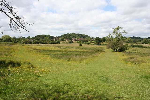
English: Dale Abbey from the east The arch of the ruined abbey is visible in this picture (if you know where to look). The footpaths across this meadow are conspicuous and slightly raised above the surrounding grassland - I suspect they are of some antiquity and wondered if they might have been monastic causeways. |
| Date | |
| Source | From geograph.org.uk |
| Author | Dave Dunford |
| Attribution (required by the license) | Dave Dunford / Dale Abbey from the east / |
| Camera location | | View this and other nearby images on: OpenStreetMap |
|---|
_heading:292.00&language=en)
| Object location | | View this and other nearby images on: OpenStreetMap |
|---|
_heading:292.00&language=en)
Licensing
[edit]

|
This image was taken from the Geograph project collection. See this photograph's page on the Geograph website for the photographer's contact details. The copyright on this image is owned by Dave Dunford and is licensed for reuse under the Creative Commons Attribution-ShareAlike 2.0 license.
|
This file is licensed under the Creative Commons Attribution-Share Alike 2.0 Generic license.
Attribution: Dave Dunford
- You are free:
- to share – to copy, distribute and transmit the work
- to remix – to adapt the work
- Under the following conditions:
- attribution – You must give appropriate credit, provide a link to the license, and indicate if changes were made. You may do so in any reasonable manner, but not in any way that suggests the licensor endorses you or your use.
- share alike – If you remix, transform, or build upon the material, you must distribute your contributions under the same or compatible license as the original.
File history
Click on a date/time to view the file as it appeared at that time.
| Date/Time | Thumbnail | Dimensions | User | Comment | |
|---|---|---|---|---|---|
| current | 16:19, 26 February 2011 | | 640 × 426 (55 KB) | GeographBot (talk | contribs) | == {{int:filedesc}} == {{Information |description={{en|1=Dale Abbey from the east The arch of the ruined abbey is visible in this picture (if you know where to look). The footpaths across this meadow are conspicuous and slightly raised above the surroundi |
You cannot overwrite this file.
File usage on Commons
There are no pages that use this file.