File:Dageraadplaats (Antwerp, Belgium) - aerial view.jpg
Jump to navigation
Jump to search
Size of this preview: 800 × 537 pixels. Other resolutions: 320 × 215 pixels | 640 × 429 pixels | 1,024 × 687 pixels | 1,280 × 859 pixels | 1,903 × 1,277 pixels.
Original file (1,903 × 1,277 pixels, file size: 2.11 MB, MIME type: image/jpeg)
Captions
Captions
Add a one-line explanation of what this file represents
Summary
[edit]_-_aerial_view.jpg&action=edit§ion=1)
| Description |
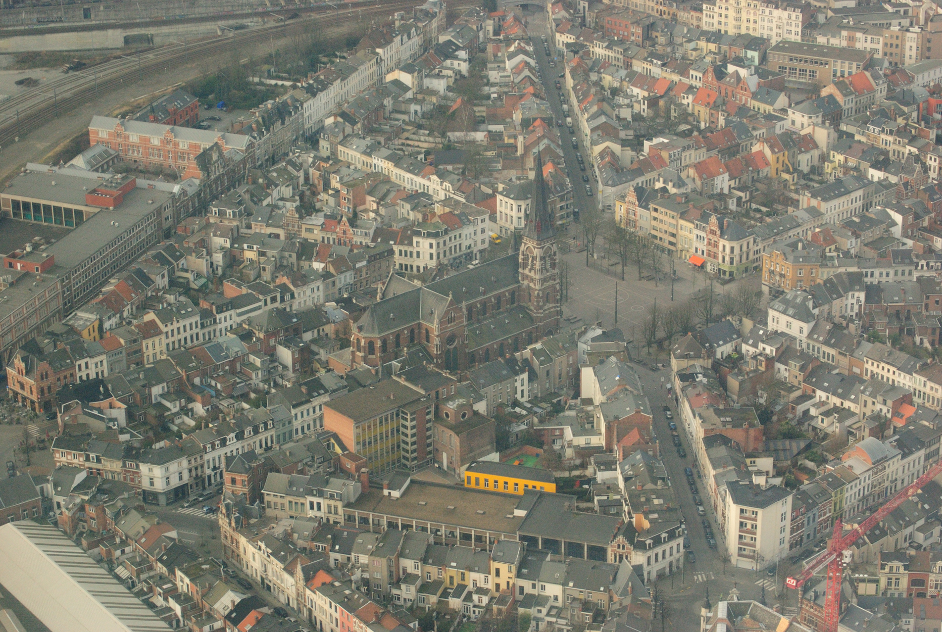
English: Aerial view, roughly from the Northeast, towards Dageraadplaats square in the Zurenborg quarter of the city of Antwerp, Belgium. In the centre is the church of Saint Norbert. The vertical street is named Arendstraat above, and Kreeftstraat below the square. Nikon D60 f=55mm f/13 at 1/250s ISO 800. Colour corrected and reduced using Nikon ViewNX 1.0.3. Reframed using Adobe Photoshop 4.0.
Nederlands: Luchtfoto, ongeveer vanuit het noordoosten, van de Dageraadplaats in de wijk Zurenborg in Antwerpen. In het midden staat de Sint-Norbertuskerk. De verticale straat heet Arendstraat boven het plein, en Kreeftstraat eronder. Nikon D60 f=55mm f/13 bij 1/250s ISO 800. Kleurcorrectie en reductie in Nikon ViewNX 1.0.3. Cadrage in Adobe Photoshop 4.0. |
| Date | CET |
| Source | Own work |
| Author | Lieven Smits |
Licensing
[edit]_-_aerial_view.jpg&action=edit§ion=2)
I, the copyright holder of this work, hereby publish it under the following licenses:

|
Permission is granted to copy, distribute and/or modify this document under the terms of the GNU Free Documentation License, Version 1.2 or any later version published by the Free Software Foundation; with no Invariant Sections, no Front-Cover Texts, and no Back-Cover Texts. A copy of the license is included in the section entitled GNU Free Documentation License. |
This file is licensed under the Creative Commons Attribution-Share Alike 3.0 Unported, 2.5 Generic, 2.0 Generic and 1.0 Generic license.
- You are free:
- to share – to copy, distribute and transmit the work
- to remix – to adapt the work
- Under the following conditions:
- attribution – You must give appropriate credit, provide a link to the license, and indicate if changes were made. You may do so in any reasonable manner, but not in any way that suggests the licensor endorses you or your use.
- share alike – If you remix, transform, or build upon the material, you must distribute your contributions under the same or compatible license as the original.
You may select the license of your choice.
File history
Click on a date/time to view the file as it appeared at that time.
| Date/Time | Thumbnail | Dimensions | User | Comment | |
|---|---|---|---|---|---|
| current | 21:44, 4 February 2009 | | 1,903 × 1,277 (2.11 MB) | Lieven Smits (talk | contribs) | {{Information |Description={{en|1=Aerial view, roughly from the Northeast, towards Dageraadplaats square in the Zurenborg quarter of the city of Antwerp, Belgium. In the centre is the church of Saint Norbert. The vertical street is named Arendstraat above |
You cannot overwrite this file.
File usage on Commons
The following page uses this file:
File usage on other wikis
The following other wikis use this file:
- Usage on nl.wikipedia.org
_-_aerial_view.jpg&oldid=882620935)