File:DSC08684 - View from Telegraph Signal Tower (36822998260).jpg
Original file (6,000 × 4,000 pixels, file size: 30.96 MB, MIME type: image/jpeg)
Captions
Captions
Summary
[edit]| Description |
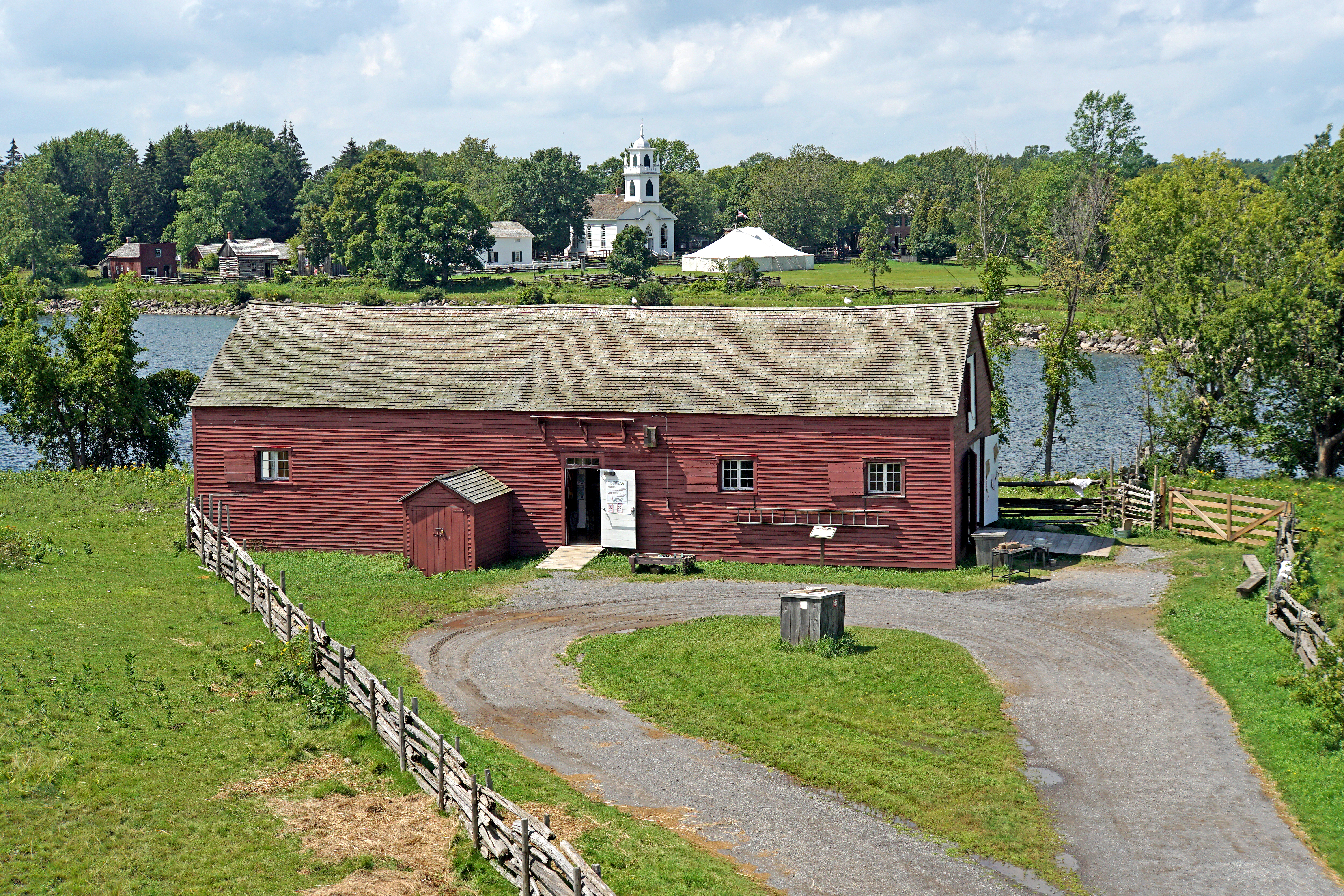
English: Looking down from the signal tower at the Family Activity Centre.
This square wooden signal tower is based on a contemporary drawing of one that stood at the eastern entrance to Kingston harbour, where Fort Henry now stands. During the War of 1812, a line of these towers, equipped with visual codes of flags, pennants and symbols mounted on a main mast, were set up to send messages between fortifications along the river to warn of enemy action. These codes, established originally for naval communications, became obsolete with the invention of the Morse code. Today, the Signal Tower tells the story of these early systems of communications. Family Activity Centre Large warehouses were a common sight all along the St. Lawrence River in the 19th century. They provided storage for good shipped up and down the river and into the Great Lakes. This building began as an early 19th century timber frame residence which was lengthened to resemble a riverfront warehouse. This home was bought from the Shove property, located on the St Lawrence riverfront about 13 kilometers west of here. On site, this building first served as the Carroll Memorial Museum on the river and displayed artifacts related to the history of the St. Lawrence River. Today, it is the Family Activity Centre. |
||||||||||||||
| Date | |||||||||||||||
| Source | DSC08684 - View from Telegraph Signal Tower | ||||||||||||||
| Author |
|
||||||||||||||
.jpg)
.jpg&action=edit§ion=1)
| Camera location | | View this and other nearby images on: OpenStreetMap |
|---|
.jpg¶ms=044.947032_N_-075.066790_E_globe:Earth_type:camera_source:Flickr_&language=en)
Licensing
[edit].jpg&action=edit§ion=2)
- You are free:
- to share – to copy, distribute and transmit the work
- to remix – to adapt the work
- Under the following conditions:
- attribution – You must give appropriate credit, provide a link to the license, and indicate if changes were made. You may do so in any reasonable manner, but not in any way that suggests the licensor endorses you or your use.
- share alike – If you remix, transform, or build upon the material, you must distribute your contributions under the same or compatible license as the original.
| This image was originally posted to Flickr by archer10 (Dennis) 127M Views at https://flickr.com/photos/22490717@N02/36822998260 (archive). It was reviewed on 2 May 2018 by FlickreviewR 2 and was confirmed to be licensed under the terms of the cc-by-sa-2.0. |
File history
Click on a date/time to view the file as it appeared at that time.
| Date/Time | Thumbnail | Dimensions | User | Comment | |
|---|---|---|---|---|---|
| current | 21:18, 2 May 2018 | | 6,000 × 4,000 (30.96 MB) | Mindmatrix (talk | contribs) | Transferred from Flickr via #flickr2commons |
You cannot overwrite this file.
File usage on Commons
There are no pages that use this file.
.jpg&oldid=904829751)