File:DS009062077DF043 44 (53779347505).jpg
Jump to navigation
Jump to search

Size of this preview: 434 × 599 pixels. Other resolutions: 174 × 240 pixels | 347 × 480 pixels | 556 × 768 pixels | 741 × 1,024 pixels | 1,483 × 2,048 pixels | 8,480 × 11,711 pixels.
Original file (8,480 × 11,711 pixels, file size: 65.51 MB, MIME type: image/jpeg)
Captions
Captions
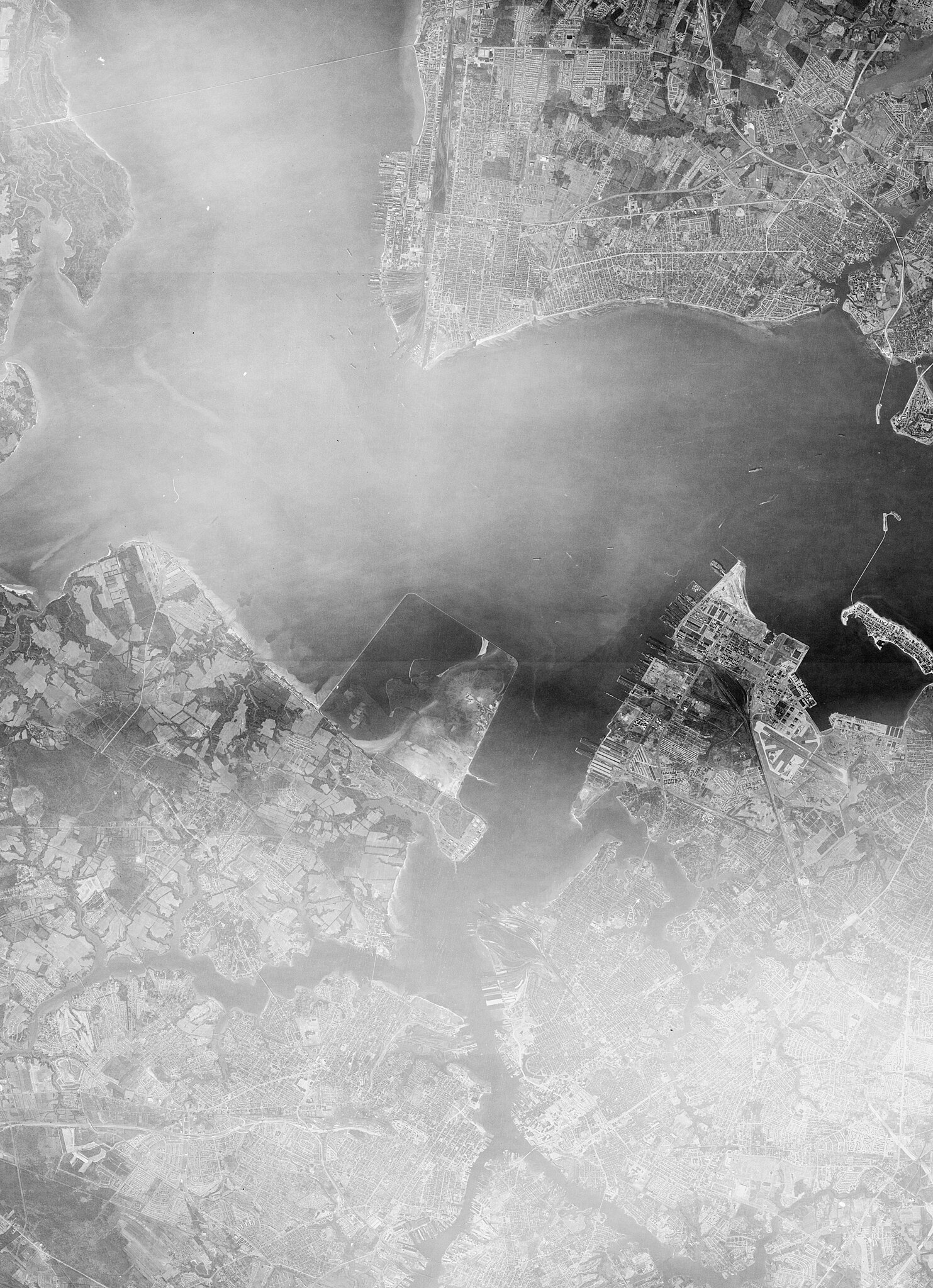
A KH-4 satellite image of Naval Station Norfolk from 1963-12-26. The image consists of two scenes which were merged, cropped and had contrasts applied to try and cut through the clouds. earthexplorer.usgs.gov/scene/metadata/full/5e839febdccb64...
Summary
[edit].jpg&action=edit§ion=1)
| Description |
English: A KH-4 satellite image of Naval Station Norfolk from 1963-12-26. The image consists of two scenes which were merged, cropped and had contrasts applied to try and cut through the clouds.
earthexplorer.usgs.gov/scene/metadata/full/5e839febdccb64... earthexplorer.usgs.gov/scene/metadata/full/5e839febdccb64... |
| Date | Taken on 26 December 1963 |
| Source | DS009062077DF043_44 |
| Author | SpaceFrom.Space |
| Flickr set | KH-4 |
| Object location | | View this and other nearby images on: OpenStreetMap |
|---|
.jpg¶ms=036.959766_N_-076.366653_E_globe:Earth_class:object_type:object__&language=en)
Licensing
[edit].jpg&action=edit§ion=2)
| This image was originally posted to Flickr by SpaceFrom.Space at https://flickr.com/photos/194849271@N04/53779347505. It was reviewed on 9 June 2024 by FlickreviewR 2 and was confirmed to be licensed under the terms of the Public Domain Mark. |
| This work originally came from a National Reconnaissance Office (NRO) website or publication and has been specifically released into the public domain in the United States. Unless specifically released, NRO information should be assumed to be classified. The NRO seal is usage-restricted. See the site policy security notice and the site policy copyright notice for more information. Please note that if a copyright is indicated on a photo, graphic, or any other material, permission to copy these materials must be obtained from the original source.[1] |

|
This image is in the public domain in the United States because it only contains materials that originally came from the United States Geological Survey, an agency of the United States Department of the Interior. For more information, see the official USGS copyright policy.
|
File history
Click on a date/time to view the file as it appeared at that time.
| Date/Time | Thumbnail | Dimensions | User | Comment | |
|---|---|---|---|---|---|
| current | 11:00, 9 June 2024 | | 8,480 × 11,711 (65.51 MB) | OptimusPrimeBot (talk | contribs) | #Spacemedia - Upload of https://live.staticflickr.com/65535/53779347505_b1d33dbf92_o.jpg via Commons:Spacemedia |
You cannot overwrite this file.
File usage on Commons
There are no pages that use this file.
.jpg&oldid=882376009)