File:DR-bergen.jpg
Jump to navigation
Jump to search
Size of this preview: 737 × 599 pixels. Other resolutions: 295 × 240 pixels | 590 × 480 pixels | 945 × 768 pixels | 1,259 × 1,024 pixels | 1,338 × 1,088 pixels.
Original file (1,338 × 1,088 pixels, file size: 515 KB, MIME type: image/jpeg)
Captions
Captions
Add a one-line explanation of what this file represents
Summary
[edit]
| Description |
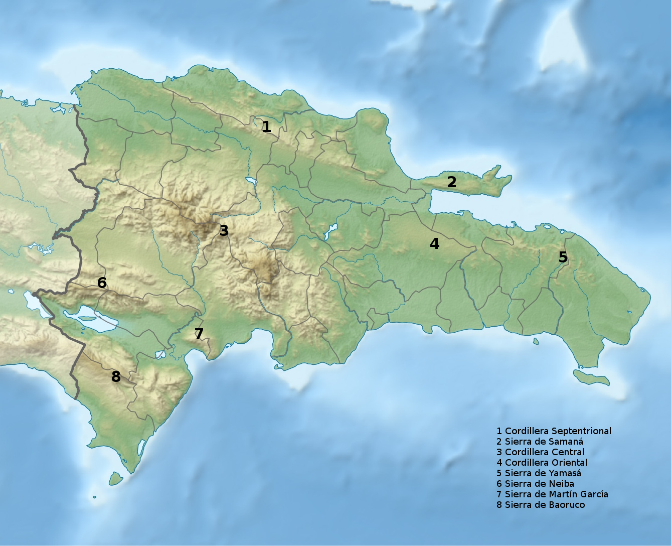
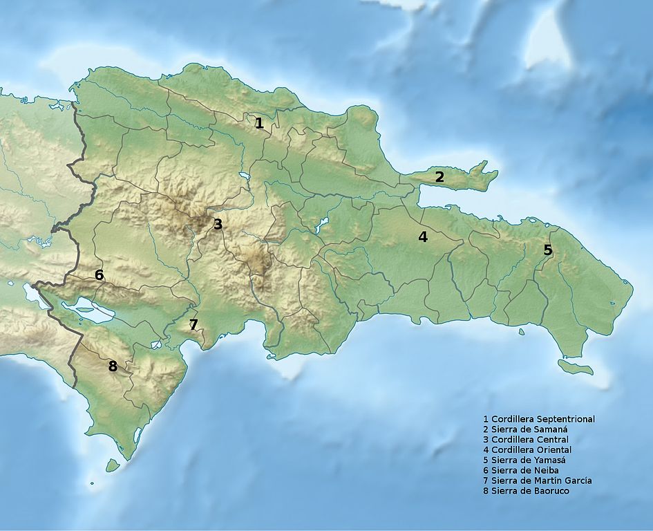
Nederlands: Kopie van File:Dominican Republic relief location map.jpg met gemerkte bergketens en index |
| Date | |
| Source | Own work |
| Author | Jos1950 |
Old version was one copy of 220px-Dominican_Republic_relief_location_map met gemerkte bergketens}}
- Cordillera Septentrional
- Cordillera Central
- Sierra de Neiba
- Sierra de Baoruco
- Sierra de Samaná
- Cordillera Oriental
Licensing
[edit]
I, the copyright holder of this work, hereby publish it under the following license:
This file is licensed under the Creative Commons Attribution-Share Alike 3.0 Unported license.
- You are free:
- to share – to copy, distribute and transmit the work
- to remix – to adapt the work
- Under the following conditions:
- attribution – You must give appropriate credit, provide a link to the license, and indicate if changes were made. You may do so in any reasonable manner, but not in any way that suggests the licensor endorses you or your use.
- share alike – If you remix, transform, or build upon the material, you must distribute your contributions under the same or compatible license as the original.
| Annotations | This image is annotated: View the annotations at Commons |
File history
Click on a date/time to view the file as it appeared at that time.
| Date/Time | Thumbnail | Dimensions | User | Comment | |
|---|---|---|---|---|---|
| current | 12:39, 4 December 2016 | | 1,338 × 1,088 (515 KB) | Jos1950 (talk | contribs) | Groter + uitgebreid + index |
| 04:00, 8 March 2014 |  | 250 × 202 (49 KB) | Jos1950 (talk | contribs) | User created page with UploadWizard |
You cannot overwrite this file.
File usage on Commons
There are no pages that use this file.
File usage on other wikis
The following other wikis use this file:
- Usage on fa.wikipedia.org
- Usage on nl.wikipedia.org
- Usage on uk.wikipedia.org