File:DEVELOPMENT SIGNS BORDER ONE OF A FEW REMAINING FARM FIELDS NEAR THE OCEAN IN FAST GROWING ORANGE COUNTY. SOME 84... - NARA - 557477.jpg
Original file (3,000 × 2,036 pixels, file size: 846 KB, MIME type: image/jpeg)
Captions
Captions
Summary
[edit]| Author |
Charles O'Rear, 1941-, Photographer (NARA record: 3403717) |
||||||||||||||||||||||||||
| Record creator | Environmental Protection Agency. (12/02/1970 - ) | ||||||||||||||||||||||||||
| Title |
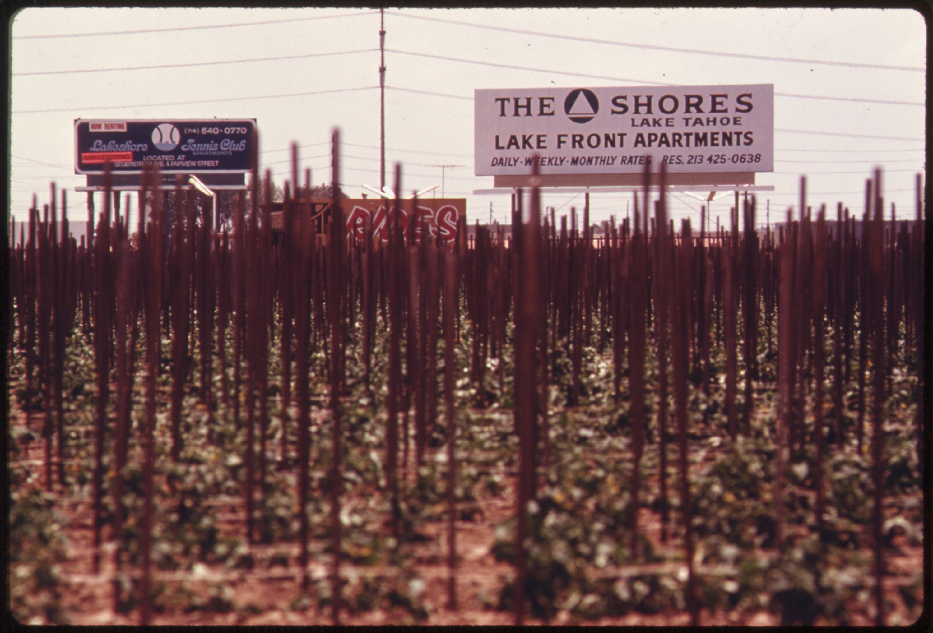
DEVELOPMENT SIGNS BORDER ONE OF A FEW REMAINING FARM FIELDS NEAR THE OCEAN IN FAST GROWING ORANGE COUNTY. SOME 84 PERCENT OF THE STATE'S RESIDENTS LIVE WITHIN 30 MILES OF THE COAST AND IT HAS RESULTED IN INCREASING LAND USE PRESSURES. SINCE NOVEMBER, 1972 REGULATORY COMMISSIONS HAVE BEEN CHARGED WITH DETERMINING DEVELOPMENT WITHIN 1,000 YARDS OF THE COAST. THE COMMISSIONS MUST SUBMIT A REPORT TO THE LEGISLATURE BY JANUARY, 1976, RECOMMENDING A PLAN FOR FUTURE COASTAL DEVELOPMENT |
||||||||||||||||||||||||||
| Depicted place |
Los Angeles (Los Angeles county, California, United States, North and Central America) inhabited place (34°03′N 118°14′W / 34.05°N 118.23°W; NARA geographical record) |
||||||||||||||||||||||||||
| Date | May 1975 | ||||||||||||||||||||||||||
| Collection |
|
||||||||||||||||||||||||||
| Record ID |
NAIL Control Number: NWDNS-412-DA-15025
|
||||||||||||||||||||||||||
| Source | U.S. National Archives and Records Administration | ||||||||||||||||||||||||||
| Other versions |
Please do not overwrite this file: any restoration work should be uploaded with a new name and linked in this page's "other versions=" parameter, so that this file represents the exact file found in the NARA catalog record to which it links. The metadata on this page was imported directly from NARA's catalog record; additional descriptive text may be added by Wikimedians to the template below with the "description=" parameter, but please do not modify the other fields.
|
||||||||||||||||||||||||||


Licensing
[edit]
This file was provided to Wikimedia Commons by the National Archives and Records Administration as part of a cooperation project. The National Archives and Records Administration provides images depicting American and global history which are public domain or licensed under a free license.
|
This image (or other media) is a work of an Environmental Protection Agency employee, taken or made as part of that person's official duties. As works of the U.S. federal government, all EPA images are in the public domain.
|
||
File history
Click on a date/time to view the file as it appeared at that time.
| Date/Time | Thumbnail | Dimensions | User | Comment | |
|---|---|---|---|---|---|
| current | 09:20, 8 October 2011 | | 3,000 × 2,036 (846 KB) | US National Archives bot (talk | contribs) | == {{int:filedesc}} == {{NARA-image-full | Title = DEVELOPMENT SIGNS BORDER ONE OF A FEW REMAINING FARM FIELDS NEAR THE OCEAN IN FAST GROWING ORANGE COUNTY. SOME 84 PERCENT OF THE STATE'S RESIDENTS LIVE WITHIN 30 MILES OF THE COAST AND |
You cannot overwrite this file.
File usage on Commons
The following 3 pages use this file:
- File:DEVELOPMENT SIGNS BORDER ONE OF A FEW REMAINING FARM FIELDS NEAR THE OCEAN IN FAST GROWING ORANGE COUNTY. SOME 84... - NARA - 557477.jpg
- File:DEVELOPMENT SIGNS BORDER ONE OF A FEW REMAINING FARM FIELDS NEAR THE OCEAN IN FAST GROWING ORANGE COUNTY. SOME 84... - NARA - 557477.tif
- File:Development signs border one of a few remaining farm fields near the ocean in fast growing Orange County, May 1975 (7158905296).jpg (file redirect)
.jpg&redirect=no)