File:DAT Damage Point for Rolling Fork Water Tower.jpg
Jump to navigation
Jump to search
Size of this preview: 800 × 451 pixels. Other resolutions: 320 × 181 pixels | 640 × 361 pixels | 1,024 × 578 pixels | 1,280 × 722 pixels | 2,388 × 1,347 pixels.
Original file (2,388 × 1,347 pixels, file size: 645 KB, MIME type: image/jpeg)
Captions
Captions
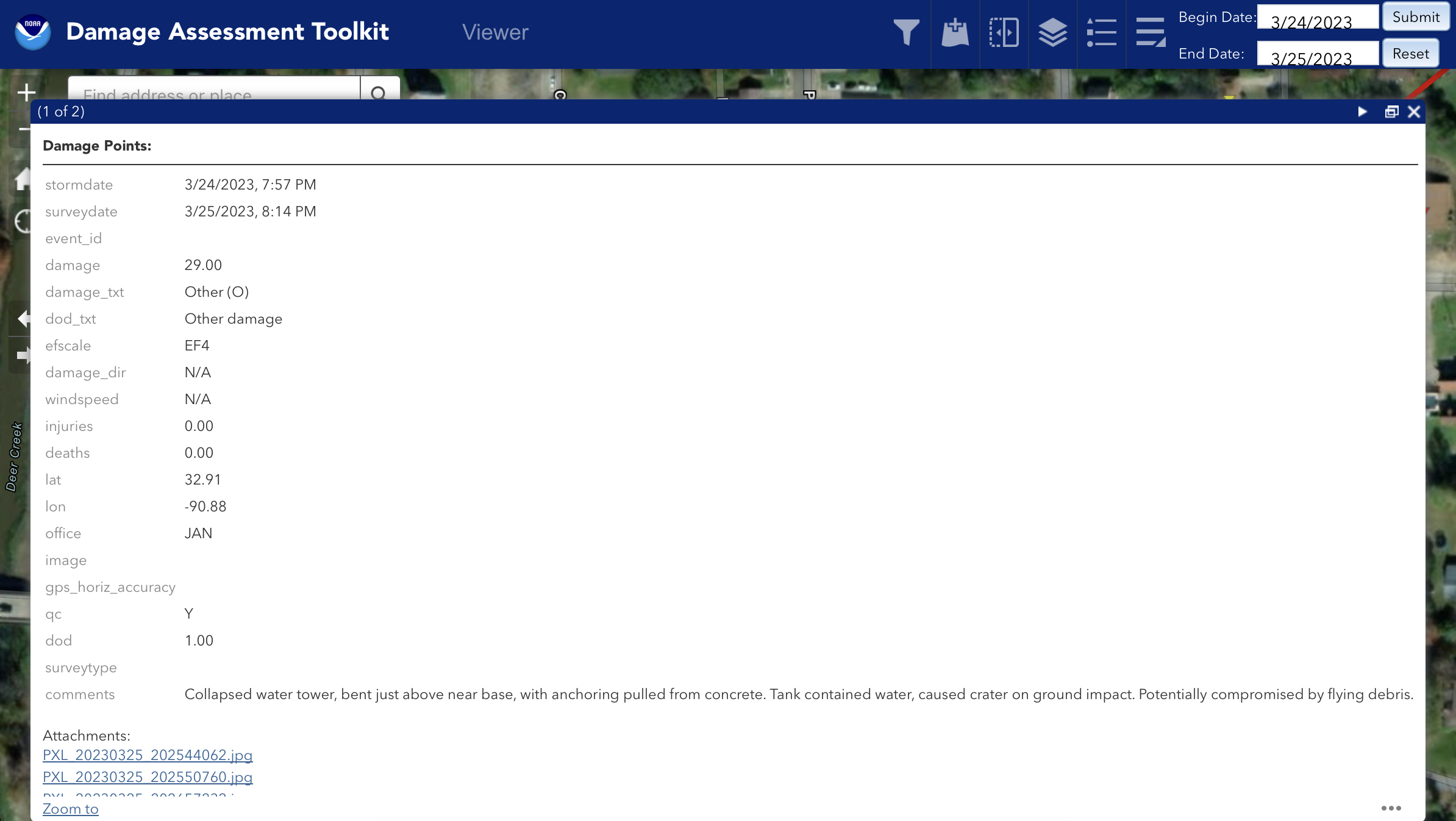
The Damage Assessment Toolkit’s damage point for the Rolling Fork, Mississippi water tower
Summary
[edit]
| Description |
English: The Damage Assessment Toolkit’s damage point for the Rolling Fork, Mississippi water tower. |
| Date | |
| Source | NOAA’s Damage Assessment Toolkit: https://apps.dat.noaa.gov/StormDamage/DamageViewer/ |
| Author | National Oceanic and Atmospheric Administration |
Licensing
[edit]
This image is in the public domain because it contains materials that originally came from the U.S. National Oceanic and Atmospheric Administration, taken or made as part of an employee's official duties.
|
File history
Click on a date/time to view the file as it appeared at that time.
| Date/Time | Thumbnail | Dimensions | User | Comment | |
|---|---|---|---|---|---|
| current | 19:27, 3 April 2023 | | 2,388 × 1,347 (645 KB) | WeatherWriter (talk | contribs) | Uploaded a work by National Oceanic and Atmospheric Administration from NOAA’s Damage Assessment Toolkit: https://apps.dat.noaa.gov/StormDamage/DamageViewer/ with UploadWizard |
You cannot overwrite this file.
File usage on Commons
There are no pages that use this file.