File:Dömestad i Norrköping, den 5 mars 2008, bild 6.jpg

Original file (3,296 × 2,472 pixels, file size: 2.23 MB, MIME type: image/jpeg)
Captions
Captions
Summary
[edit]| DescriptionDömestad i Norrköping, den 5 mars 2008, bild 6.jpg |
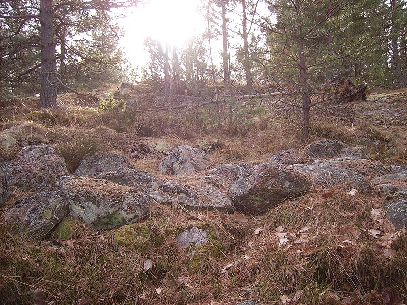
English: At Dömestad in Norrköping, it is possible to study the remains of 3000 years of human activites, from the Bronze and Iron Age living place to the modern farm. A prehistoric cairn with the RAÄ-name and -number ”Styrstad 74:1”, 15 m x 1 m, from Bronze Age, situated:
http://www.hitta.se/LargeMap.aspx?ShowSatellite=false&cx=1527120&cy=6497628&pointX=1527120&pointY=6497628&name=Styrstad 74:1&z=3
Svenska: Röse i Norrköping med beteckningen ”Styrstad 74:1”. Röset var ursprungligen ca 15 m i diameter och ca 1 m högt. Stenarna är 0,2-0,6 m stora, delvis humusblandade och övermossade samt ljungbeväxta. I Ö och NV spår av kantkedja, 0,2 m höga av 0,4-1 m långa stenar (möjligen brätte inom denna, ca 1-1,5 m breda?) 2-3 m av ytterpartierna är merendels nedrasade och nedkastade. En del nedrasade koncentrationer är stensättningsliknande. Beväxt med flera en- och rönnbuskar. 10 m Ö 10cg N om röset finns:
1) Stensättning eller röse, rest av, nu bestående av spridda, 0,3-0,6 m stora stenar inom ett område,10 m diameter samt rikligt med stenskärv och något humus. Recent härd i Ö delen. 30 m SSÖ om det stora röset är: 2) Stensättning, rund, ca 6 m diam och 0,3 m h. Lätt övertorvad fyllning av stenar, 0,3-0,8 m st .Kantkedja 0,2 m h, av 0,4-0,8 m l stenar, runt hela stensättningen förutom i Ö delen där fornlämningen gränsar mot berg i dagen. Mittblock 1,2x1 m st. Bevuxen med en enbuske. Det stora rösets belägenhet hittas: http://www.hitta.se/LargeMap.aspx?ShowSatellite=false&cx=1527120&cy=6497628&pointX=1527120&pointY=6497628&name=Styrstad 74:1&z=3 Source: http://www.kms.raa.se/cocoon/fmis-public/search.html
|
||
| Date | |||
| Source | Own work | ||
| Author | Västgöten |
Licensing
[edit]
|
Permission is granted to copy, distribute and/or modify this document under the terms of the GNU Free Documentation License, Version 1.2 or any later version published by the Free Software Foundation; with no Invariant Sections, no Front-Cover Texts, and no Back-Cover Texts. A copy of the license is included in the section entitled GNU Free Documentation License.http://www.gnu.org/copyleft/fdl.htmlGFDLGNU Free Documentation Licensetruetrue |
- You are free:
- to share – to copy, distribute and transmit the work
- to remix – to adapt the work
- Under the following conditions:
- attribution – You must give appropriate credit, provide a link to the license, and indicate if changes were made. You may do so in any reasonable manner, but not in any way that suggests the licensor endorses you or your use.
- share alike – If you remix, transform, or build upon the material, you must distribute your contributions under the same or compatible license as the original.
File history
Click on a date/time to view the file as it appeared at that time.
| Date/Time | Thumbnail | Dimensions | User | Comment | |
|---|---|---|---|---|---|
| current | 08:03, 24 March 2008 |  | 3,296 × 2,472 (2.23 MB) | Västgöten (talk | contribs) | {{Information |Description=*en: At Dömestad in Norrköping, it is possible to study the remains of 3000 years of human activites, from the Bronze and Iron Age living place to the modern farm. A prehistoric cairn with the RAÄ-name and -number ”Styrstad |
You cannot overwrite this file.
File usage on Commons
The following page uses this file:
Metadata
This file contains additional information such as Exif metadata which may have been added by the digital camera, scanner, or software program used to create or digitize it. If the file has been modified from its original state, some details such as the timestamp may not fully reflect those of the original file. The timestamp is only as accurate as the clock in the camera, and it may be completely wrong.
| Image title | DIGITAL CAMERA |
|---|---|
| Camera manufacturer | CAMERA |
| Camera model | 8MP-9U4 |
| Exposure time | 1,759/250,000 sec (0.007036) |
| F-number | f/2.8 |
| ISO speed rating | 53 |
| Date and time of data generation | 02:40, 28 November 2006 |
| Lens focal length | 5.4 mm |
| Orientation | Normal |
| Horizontal resolution | 72 dpi |
| Vertical resolution | 72 dpi |
| Software used | V1.05P1 |
| File change date and time | 02:40, 28 November 2006 |
| Y and C positioning | Co-sited |
| Exposure Program | Normal program |
| Exif version | 2.2 |
| Date and time of digitizing | 02:40, 28 November 2006 |
| APEX exposure bias | 0 |
| Maximum land aperture | 2.97 APEX (f/2.8) |
| Metering mode | Center weighted average |
| Light source | Flash |
| Flash | Flash fired, compulsory flash firing |
| Color space | sRGB |
| Custom image processing | Normal process |
| Exposure mode | Auto exposure |
| White balance | Auto white balance |
| Digital zoom ratio | 1 |
| Scene capture type | Standard |
| Contrast | Normal |
| Saturation | Normal |
| Sharpness | Normal |
| Subject distance range | Close view |