File:Départements et provinces de France.png
Jump to navigation
Jump to search
Size of this preview: 641 × 600 pixels. Other resolutions: 257 × 240 pixels | 513 × 480 pixels | 821 × 768 pixels | 1,095 × 1,024 pixels | 1,785 × 1,670 pixels.
Original file (1,785 × 1,670 pixels, file size: 310 KB, MIME type: image/png)
Captions
Captions
Add a one-line explanation of what this file represents

|
File:Départements et provinces de France.svg is a vector version of this file. It should be used in place of this PNG file when not inferior.
File:Départements et provinces de France.png → File:Départements et provinces de France.svg
For more information, see Help:SVG. |
 |
| Description |
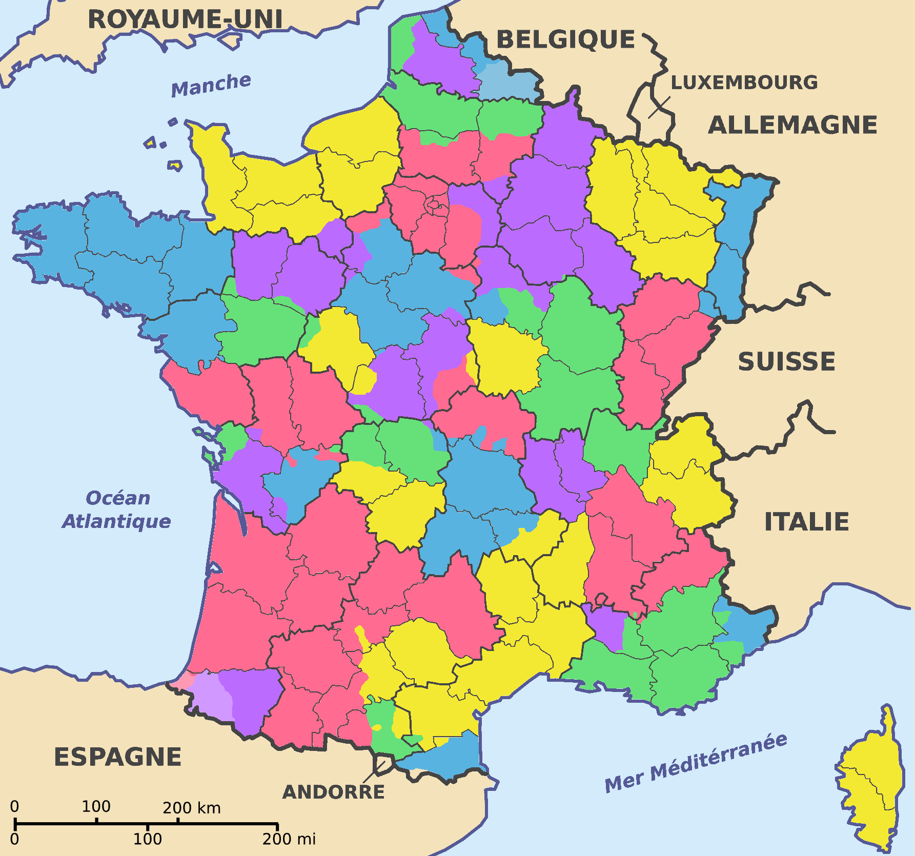
Français : Carte représentant les départements et provinces français d'après la Carte de la France en 1791 dans The Historical Atlas by William R. Shepherd (1926).
J'ai indiqué aussi le Hainaut et le Pays basque en tons clairs ; j'en ferais de même pour la Guyenne si les limites de cette dernière étaient moins floues. |
| Date | (UTC) |
| Source | |
| Author |
|
.jpg)
| I, the copyright holder of this work, release this work into the public domain. This applies worldwide. In some countries this may not be legally possible; if so: I grant anyone the right to use this work for any purpose, without any conditions, unless such conditions are required by law. |
Original upload log
[edit]
This image is a derivative work of the following images:
- File:Departements_de_France_map.svg licensed with PD-self
- 2007-08-27T19:11:36Z Superwikifan 588x550 (310662 Bytes) {{Information |Description= carte représentant les départements français |Source=self-made |Date=27.08.2007 |Author= [[User:Superwikifan|Superwikifan]] }} [[Category:Maps of France]]
- File:France_departments_1791_(1).jpg licensed with PD-old
- 2008-09-22T08:46:23Z File Upload Bot (Magnus Manske) 741x599 (225908 Bytes) {{BotMoveToCommons|fr.wikipedia}} {{Information |Description={{fr|Carte de la France en 1791 (départements et anciennes provinces - en rouge) in The Historical Atlas by William R. Shepherd, 1926 == Licence == [[:fr:Cat�
Uploaded with derivativeFX
File history
Click on a date/time to view the file as it appeared at that time.
| Date/Time | Thumbnail | Dimensions | User | Comment | |
|---|---|---|---|---|---|
| current | 15:04, 25 March 2009 | | 1,785 × 1,670 (310 KB) | QuartierLatin1968 (talk | contribs) | {{Information |Description=Carte représentant les départements et provinces français d'après la Carte de la France en 1791 dans ''The Historical Atlas'' by William R. Shepherd (1926). |Source=*File:Departements_de_France_map.svg *[[:File:France_ |
You cannot overwrite this file.
File usage on Commons
The following page uses this file:
File usage on other wikis
The following other wikis use this file:
- Usage on ar.wikipedia.org
- Usage on br.wikipedia.org
- Usage on et.wikipedia.org
- Usage on fr.wikipedia.org
- Usage on lt.wikipedia.org
- Usage on nl.wikipedia.org
- Usage on pl.wikipedia.org
- Usage on pnb.wikipedia.org
- Usage on ro.wikipedia.org
- Usage on sh.wikipedia.org
- Usage on sv.wikipedia.org
- Usage on ur.wikipedia.org
- Usage on zh.wikipedia.org