File:Départements de France Macedonian.svg
From Wikimedia Commons, the free media repository
Jump to navigation
Jump to search

Size of this PNG preview of this SVG file: 588 × 550 pixels. Other resolutions: 257 × 240 pixels | 513 × 480 pixels | 821 × 768 pixels | 1,095 × 1,024 pixels | 2,190 × 2,048 pixels.
Original file (SVG file, nominally 588 × 550 pixels, file size: 575 KB)
File information
Structured data
Captions
Captions
Add a one-line explanation of what this file represents
Summary
[edit]| DescriptionDépartements de France Macedonian.svg |
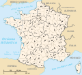
English: Regions and départements of France and their prefectures (Macedonian version). |
| Date | (UTC) |
| Source | |
| Author |
|
| Other versions |
[edit]
|
| This is a retouched picture, which means that it has been digitally altered from its original version. Modifications: Translated to Macedonian. The original can be viewed here: Départements de France English.svg:
|
I, the copyright holder of this work, hereby publish it under the following license:
| Public domainPublic domainfalsefalse |
| I, the copyright holder of this work, release this work into the public domain. This applies worldwide. In some countries this may not be legally possible; if so: I grant anyone the right to use this work for any purpose, without any conditions, unless such conditions are required by law. |
Original upload log
[edit]This image is a derivative work of the following images:
- File:Départements_de_France_English.svg licensed with PD-self
- 2007-06-19T02:25:07Z Andrew pmk 588x550 (348986 Bytes) make labels for Spain and Switzerland bigger
- 2007-06-19T02:13:23Z Andrew pmk 588x550 (348992 Bytes) move label for United Kingdom down slightly
- 2007-06-19T02:12:19Z Andrew pmk 588x550 (348986 Bytes) font -> arial to match French version
- 2007-06-19T02:07:40Z Andrew pmk 588x550 (343238 Bytes) *{{fr}} Régions et départements de France avec leurs préfectures (version anglaise). *{{en}} Regions and départements of France and their prefectures (English version). *'''Author''' : Original image [[:Image:Département
Uploaded with derivativeFX
File history
Click on a date/time to view the file as it appeared at that time.
| Date/Time | Thumbnail | Dimensions | User | Comment | |
|---|---|---|---|---|---|
| current | 23:34, 6 November 2012 |  | 588 × 550 (575 KB) | Bjankuloski06en (talk | contribs) | Improved legibility. |
| 20:40, 31 October 2010 |  | 588 × 550 (341 KB) | Bjankuloski06en (talk | contribs) | {{Information |Description={{mk|Карта на регионите и департманите во Франција со нивните префектури.} |
You cannot overwrite this file.
File usage on Commons
The following 15 pages use this file:
- File:Departamantoù Frañs.svg
- File:Departamentos e rexións de Francia.svg
- File:Dipartimenti francesi.svg
- File:Départements de France.svg
- File:Départements de France English.svg
- File:Départements de France Korean.svg
- File:Départements de France Macedonian.svg
- File:Départements de France VI.svg
- File:Départements de France hr.svg
- File:Départements et régions de France.svg
- File:Départements et régions de France eo.svg
- File:Départements et régions de France es.svg
- File:Départements et régions de France vide.svg
- File:Regiones metropolitanas de Francia.svg
- Template:Other versions/Départements et régions de France
Metadata
This file contains additional information such as Exif metadata which may have been added by the digital camera, scanner, or software program used to create or digitize it. If the file has been modified from its original state, some details such as the timestamp may not fully reflect those of the original file. The timestamp is only as accurate as the clock in the camera, and it may be completely wrong.
| Width | 587.5 |
|---|---|
| Height | 550 |
![(français) Départements (numérotés) et régions de France avant 01/01/2016 (nommées, non colorisés) [source of all the following derivatives]](https://upload.wikimedia.org/wikipedia/commons/thumb/1/1e/D%C3%A9partements_et_r%C3%A9gions_de_France.svg/120px-D%C3%A9partements_et_r%C3%A9gions_de_France.svg.png)


![(français) Départements (numérotés) et régions de France avant 01/01/2016 (non nommées, non colorisées) [rendu amélioré] (version utilisée pour rendre la carte clicable par département)](https://upload.wikimedia.org/wikipedia/commons/thumb/7/7e/D%C3%A9partements_et_r%C3%A9gions_de_France_-_Noname-2016.svg/120px-D%C3%A9partements_et_r%C3%A9gions_de_France_-_Noname-2016.svg.png)


![(français) Départements (numérotés) et régions de France avant 01/01/2016 (nommées et colorisées) [regions named/colored]](https://upload.wikimedia.org/wikipedia/commons/thumb/e/e4/D%C3%A9partements%2Br%C3%A9gions_%28France%29.svg/120px-D%C3%A9partements%2Br%C3%A9gions_%28France%29.svg.png)
![(français) Départements (numérotés) et régions de France avant 01/01/2016 (nommées et colorisées) [15% magnified, rapid JPEG format 5x faster]](https://upload.wikimedia.org/wikipedia/commons/thumb/8/81/France_departements_regions_narrow.jpg/113px-France_departements_regions_narrow.jpg)
![(français) Départements de France (numérotés, non colorisés)[numeric labels, uncolorized]](https://upload.wikimedia.org/wikipedia/commons/thumb/f/f1/D%C3%A9partements_de_France.svg/120px-D%C3%A9partements_de_France.svg.png)


![(multilingue) Départements de France (sans aucun libellé) [No labels]](https://upload.wikimedia.org/wikipedia/commons/thumb/7/76/D%C3%A9partements_et_r%C3%A9gions_de_France_vide.svg/116px-D%C3%A9partements_et_r%C3%A9gions_de_France_vide.svg.png)