File:Czyże (gmina) location map.png
Jump to navigation
Jump to search

Size of this preview: 384 × 599 pixels. Other resolutions: 154 × 240 pixels | 307 × 480 pixels | 655 × 1,022 pixels.
Original file (655 × 1,022 pixels, file size: 98 KB, MIME type: image/png)
Captions
Captions
Add a one-line explanation of what this file represents
| Description |
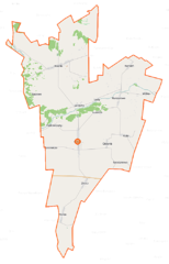
Polski: Mapa gminy Czyże, Polska
English: Map of Gmina Czyże, Poland |
|||||||||
| Date | ||||||||||
| Source | You may find a page on the OpenStreetMap wiki page for Czyże (gmina) | |||||||||
| Creator |
OpenStreetMap contributors OpenStreetMap contributors |
|||||||||
| Permission (Reusing this file) |
OpenStreetMap data is available under the Open Database License (details). Map tiles are licensed under the Creative Commons Attribution-ShareAlike 2.0 license (CC-BY-SA 2.0).
This file is licensed under the Creative Commons Attribution-Share Alike 2.0 Generic license.
|
|||||||||
| Geotemporal data | ||||||||||
| Bounding box |
|
|||||||||
| Georeferencing | If inappropriate please set warp_status = skip to hide. | |||||||||
File history
Click on a date/time to view the file as it appeared at that time.
| Date/Time | Thumbnail | Dimensions | User | Comment | |
|---|---|---|---|---|---|
| current | 09:44, 16 September 2014 | | 655 × 1,022 (98 KB) | VanWiel (talk | contribs) | |
| 10:16, 10 June 2014 |  | 655 × 1,022 (143 KB) | VanWiel (talk | contribs) | {{OpenStreetMap | name = Czyże (gmina) | location = Czyże (gmina) | description = {{pl|Mapa gminy Czyże, Polska}} {{en|Map of Gmina Czyże, Poland}} | top = 52.8919 | left = 23.3178 | right... |
You cannot overwrite this file.
File usage on Commons
The following page uses this file:
File usage on other wikis
The following other wikis use this file:
- Usage on be-tarask.wikipedia.org
- Usage on be.wikipedia.org
- Usage on fi.wikipedia.org
- Usage on lt.wikipedia.org
- Usage on pl.wikipedia.org
- Czyże (gmina)
- Czyże
- Hukowicze
- Klejniki
- Kojły
- Lady (Polska)
- Leniewo
- Łuszcze
- Maksymowszczyzna
- Podrzeczany
- Sapowo
- Szostakowo
- Zbucz
- Leszczyny (województwo podlaskie)
- Kamień (powiat hajnowski)
- Morze (powiat hajnowski)
- Osówka (powiat hajnowski)
- Rakowicze (powiat hajnowski)
- Wólka (powiat hajnowski)
- Kuraszewo (gmina Czyże)
- Wieżanka
- Podwieżanka
- Bujakowszczyzna
- Hrabniak
- Parafia Zaśnięcia Najświętszej Maryi Panny w Czyżach
- Parafia św. Antoniego Pieczerskiego w Kuraszewie
- Morze (przystanek kolejowy)
- Parafia Wniebowstąpienia Pańskiego w Klejnikach
- Cerkiew Zaśnięcia Najświętszej Maryi Panny w Czyżach
- Kaplica Świętych Braci Machabeuszy w Kuraszewie
- Cerkiew Świętych Kosmy i Damiana w Czyżach
- Kaplica św. Proroka Eliasza w Morzu
- Cerkiew św. Antoniego Pieczerskiego w Kuraszewie
- Kaplica św. Aleksego w Kojłach
- Cerkiew Wniebowstąpienia Pańskiego w Klejnikach
- Cerkiew Przemienienia Pańskiego w Klejnikach
- Moduł:Mapa/dane/Czyże (gmina)
- Kaplica św. Mikołaja Cudotwórcy w Klejnikach
- Cerkiew Świętych Męczenników Ziemi Chełmskiej i Podlaskiej w Zbuczu
- Usage on pl.wikibooks.org
- Usage on ru.wikipedia.org
- Usage on www.wikidata.org
_location_map.png&oldid=872566460)