File:Czechomoravia-geographic map-en.svg
Jump to navigation
Jump to search

Size of this PNG preview of this SVG file: 800 × 493 pixels. Other resolutions: 320 × 197 pixels | 640 × 394 pixels | 1,024 × 630 pixels | 1,280 × 788 pixels | 2,560 × 1,576 pixels | 1,949 × 1,200 pixels.
Original file (SVG file, nominally 1,949 × 1,200 pixels, file size: 14.56 MB)
Captions
Captions
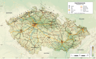
Map of Czechomoravia
Summary
[edit]
| Description |
Čeština: Zeměpisná mapa Českomoravska (Česká republika).
Deutsch: Karte von Tschechien-Mähren (Tschechische Republik).
English: Geographic map of Czechomoravia (Czech Republic).
Español: Mapa geográfico de Cheqomoravia (República Checa).
Français : Carte géographique de la Tchécomoravie (République Tchèque). |
| Date | |
| Source | File:CzechRepublic-geographic_map-cz.svg |
| Author | Edited by: Martin Tauchman, Pavel Fric |
Licensing
[edit]
This file is licensed under the Creative Commons Attribution-Share Alike 4.0 International license.
- You are free:
- to share – to copy, distribute and transmit the work
- to remix – to adapt the work
- Under the following conditions:
- attribution – You must give appropriate credit, provide a link to the license, and indicate if changes were made. You may do so in any reasonable manner, but not in any way that suggests the licensor endorses you or your use.
- share alike – If you remix, transform, or build upon the material, you must distribute your contributions under the same or compatible license as the original.
File history
Click on a date/time to view the file as it appeared at that time.
| Date/Time | Thumbnail | Dimensions | User | Comment | |
|---|---|---|---|---|---|
| current | 11:52, 4 January 2023 | | 1,949 × 1,200 (14.56 MB) | Pavel Fric (talk | contribs) | Uploaded a work by Ikonact Edited by: Martin Tauchman, Pavel Fric from File:CzechRepublic-geographic_map-cz.svg with UploadWizard |
You cannot overwrite this file.
File usage on Commons
There are no pages that use this file.