File:Cyclone Olaf 18 feb 2005 1125Z.jpg
Jump to navigation
Jump to search
No higher resolution available.
Cyclone_Olaf_18_feb_2005_1125Z.jpg (642 × 482 pixels, file size: 49 KB, MIME type: image/jpeg)
Captions
Captions
Add a one-line explanation of what this file represents
Summary
[edit]
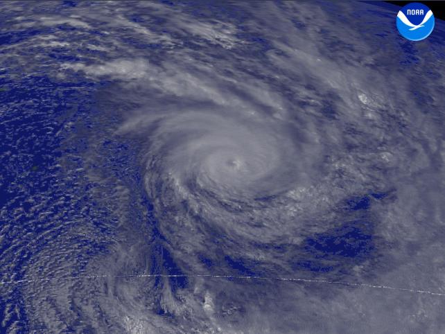
| Description | A report from The Joint Typhoon Warning Center said that Tropical Cyclone Olaf was located west of Rarotonga. This system had tracked southeastward at 20 knots. Observed by GOES-9 1 km visible imagery at 1125 UTC. | |||
| Date | ||||
| Source | http://www.nnvl.noaa.gov/cgi-bin/index.cgi?page=items&ser=108885&large=1 | |||
| Author | NOAA / Satellite and Information Service | |||
| Permission (Reusing this file) |
|
File history
Click on a date/time to view the file as it appeared at that time.
| Date/Time | Thumbnail | Dimensions | User | Comment | |
|---|---|---|---|---|---|
| current | 14:20, 8 October 2006 | | 642 × 482 (49 KB) | Good kitty (talk | contribs) | == Summary == {{Information |Description=A report from The Joint Typhoon Warning Center said that Tropical Cyclone Olaf was located west of Rarotonga. This system had tracked southeastward at 20 knots. Observed by GOES-9 1 km visible imagery at 1125 UTC. |
You cannot overwrite this file.
File usage on Commons
There are no pages that use this file.