File:CycloneLarryFlooding MODIS 20060327.jpg
Jump to navigation
Jump to search
Size of this preview: 380 × 599 pixels. Other resolutions: 152 × 240 pixels | 540 × 851 pixels.
Original file (540 × 851 pixels, file size: 141 KB, MIME type: image/jpeg)
Captions
Captions
Add a one-line explanation of what this file represents
Summary
[edit]| Description |
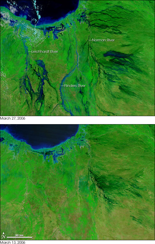
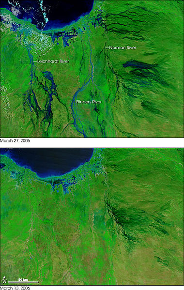
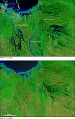
In the wake of Tropical Cyclone Larry, which plowed across Queensland the previous week, widespread flooding was affecting the region around the Gulf of Carpentaria on March 27, 2006. In this pair of false-color images, vegetation is green, naturally bare (or sparsely vegetated) ground is tan or pinkish-tan, and water is blue. Many rivers and streams that drain into the Gulf (top left) are swollen with flood water in the March 27 image, whereas on March 13, only dry riverbeds dissected the landscape. Among the rivers that experienced significant flooding were the Norman, the Flinders, and the Leichhardt Rivers. East of the Norman River and in the Leichhardt River basin, in the left side of the images, water has pooled over a large area, making the area seem like swamp land. According to an article on the Australian Broadcasting Corporation’s Website, the Leichhardt was so flooded that sharks were seen far inland of their normal location. |
|||||
| Date | ||||||
| Source | http://earthobservatory.nasa.gov/Newsroom/NewImages/images.php3?img_id=17227 | |||||
| Author | NASA images courtesy MODIS Rapid Response Team, NASA-GSFC | |||||
| Permission (Reusing this file) |
|
|||||
| Other versions | Larger, unannotated versions of both images available at source URL. |

File history
Click on a date/time to view the file as it appeared at that time.
| Date/Time | Thumbnail | Dimensions | User | Comment | |
|---|---|---|---|---|---|
| current | 20:22, 27 April 2006 | | 540 × 851 (141 KB) | Holly Cheng (talk | contribs) | {{Information | Description=Two images showing the extent of flooding caused by w:Cyclone Larry in Australia. | Source=http://earthobservatory.nasa.gov/Newsroom/NewImages/images.php3?img_id=17227 | Date=March 2006 | Author=NASA | Permission=US Governm |
You cannot overwrite this file.
File usage on Commons
There are no pages that use this file.
File usage on other wikis
The following other wikis use this file:
- Usage on de.wikipedia.org
- Usage on en.wikipedia.org
- Usage on es.wikipedia.org