File:Cumberlandplateaumap.png
Jump to navigation
Jump to search
No higher resolution available.
Cumberlandplateaumap.png (600 × 600 pixels, file size: 539 KB, MIME type: image/png)
Captions
Captions
Add a one-line explanation of what this file represents
Summary
[edit]
| Description |
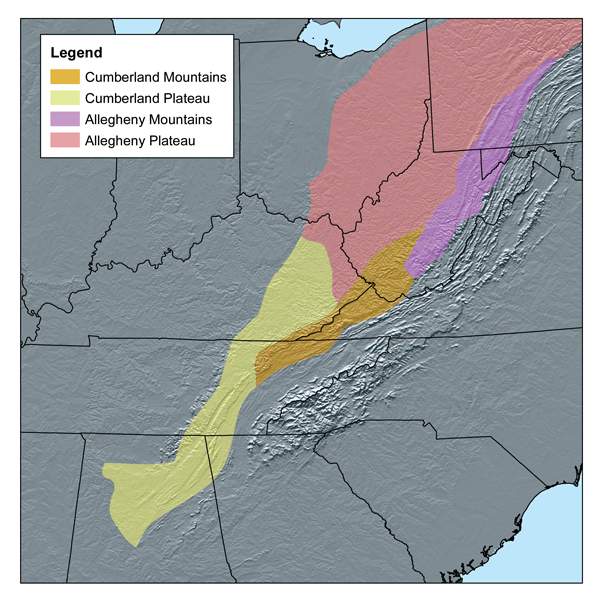
English: This map shows the subdivisions of the southern Appalachian Plateau. As defined by—Bailey's ecoregions. |
| Date | |
| Source | Self-published work by Kmusser |
| Author | Kmusser |
I, the copyright holder of this work, hereby publish it under the following license:
This file is licensed under the Creative Commons Attribution-Share Alike 2.5 Generic license.
- You are free:
- to share – to copy, distribute and transmit the work
- to remix – to adapt the work
- Under the following conditions:
- attribution – You must give appropriate credit, provide a link to the license, and indicate if changes were made. You may do so in any reasonable manner, but not in any way that suggests the licensor endorses you or your use.
- share alike – If you remix, transform, or build upon the material, you must distribute your contributions under the same or compatible license as the original.
File history
Click on a date/time to view the file as it appeared at that time.
| Date/Time | Thumbnail | Dimensions | User | Comment | |
|---|---|---|---|---|---|
| current | 14:56, 20 March 2007 | | 600 × 600 (539 KB) | Kmusser (talk | contribs) | This map shows the subdivisions of the southern Appalachian Plateau as defined by Bailey's ecoregions.[http://www.fs.fed.us/rm/analytics/publications/ecoregionsindex.html] I, Karl Musser, created it based o |
You cannot overwrite this file.
File usage on Commons
The following page uses this file:
File usage on other wikis
The following other wikis use this file:
- Usage on ar.wikipedia.org
- Usage on arz.wikipedia.org
- Usage on bg.wikipedia.org
- Usage on bn.wikipedia.org
- Usage on ca.wikipedia.org
- Usage on ceb.wikipedia.org
- Usage on cs.wikipedia.org
- Usage on da.wikipedia.org
- Usage on de.wikipedia.org
- Usage on en.wikipedia.org
- Usage on en.wikiquote.org
- Usage on eo.wikipedia.org
- Usage on es.wikipedia.org
- Usage on et.wikipedia.org
- Usage on fa.wikipedia.org
- Usage on fi.wikipedia.org
- Usage on fr.wikipedia.org
- Usage on id.wikipedia.org
- Usage on it.wikipedia.org
- Usage on ja.wikipedia.org
- Usage on ka.wikipedia.org
- Usage on ko.wikipedia.org
- Usage on lld.wikipedia.org
- Usage on lt.wikipedia.org
- Usage on nl.wikipedia.org
View more global usage of this file.
Categories:
- Maps of the Appalachian Mountains
- Maps of Bailey's ecoregions
- Maps of the Eastern United States
- Maps of Alabama
- Mountains of Alabama
- Mountains of Georgia
- Maps of Maryland
- Mountains of Maryland
- Maps of New York (state)
- Mountains of New York (state)
- Mountains of Pennsylvania
- Maps of Pennsylvania
- Mountains of Tennessee
- Maps of Tennessee
- Maps of Virginia
- Mountains of Virginia
- Maps of West Virginia
- Mountains of West Virginia
- Cumberland Plateau
- Allegheny Mountains
- Allegheny Plateau