File:Cumberland River at Mill Springs.jpg
Jump to navigation
Jump to search

Size of this preview: 800 × 532 pixels. Other resolutions: 320 × 213 pixels | 640 × 426 pixels | 1,024 × 681 pixels | 1,280 × 851 pixels | 2,560 × 1,702 pixels | 6,016 × 4,000 pixels.
Original file (6,016 × 4,000 pixels, file size: 4.64 MB, MIME type: image/jpeg)
Captions
Captions
Add a one-line explanation of what this file represents
|
This is an image of a place or building that is listed on the National Register of Historic Places in the United States of America. Its reference number is 80001665. |
| Camera location | | View this and other nearby images on: OpenStreetMap |
|---|
| Description |
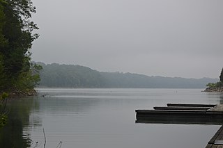
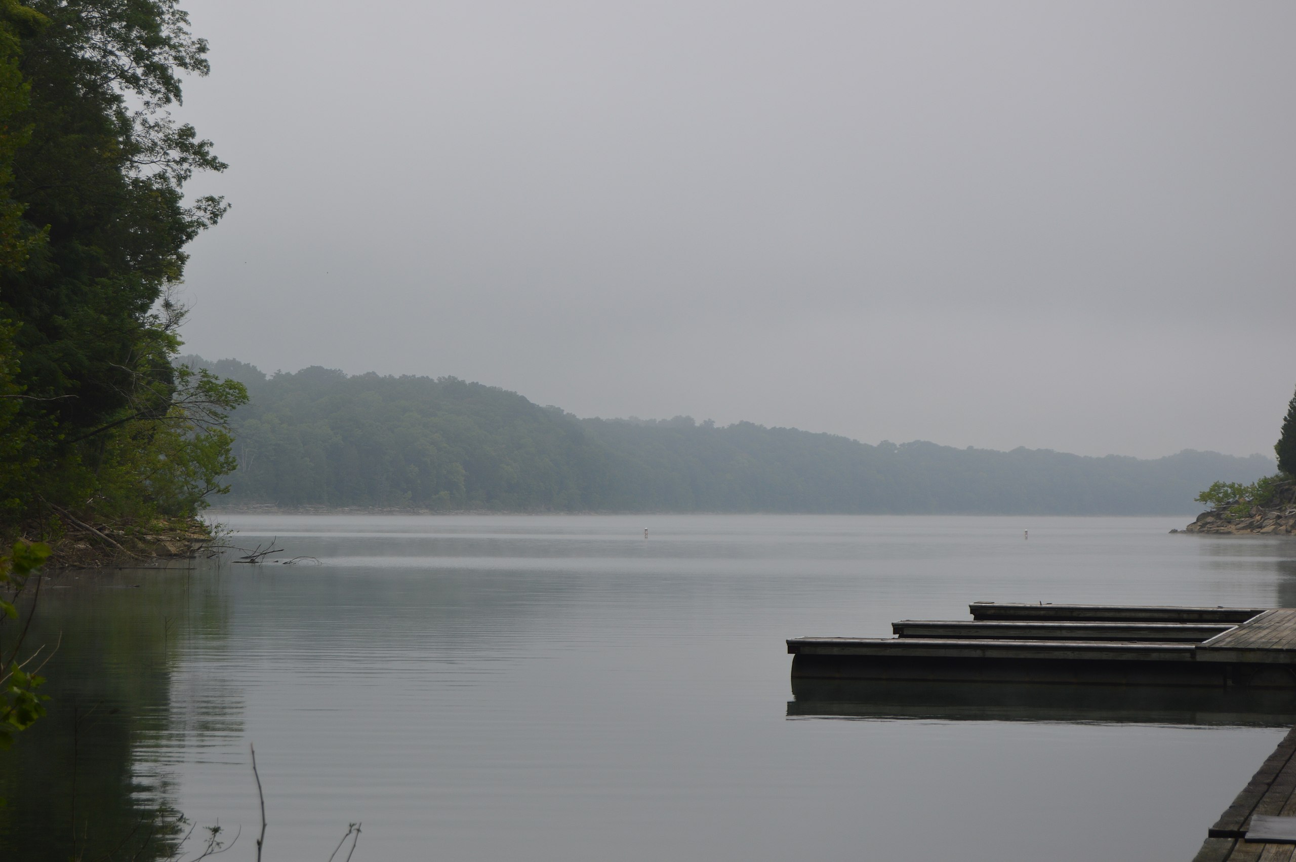
English: Overview of the Cumberland River, looking north from the Wayne County side toward the Pulaski County side. Both sides of the river at this point are part of the Mill Springs Battlefield, at which the pivotal Battle of Mill Springs was fought in January 1862. The battlefield has been designated a National Historic Landmark District. |
||
| Date | Taken on 25 July 2014 | ||
| Source | Own work | ||
| Author | Nyttend | ||
| Permission (Reusing this file) |
|
File history
Click on a date/time to view the file as it appeared at that time.
| Date/Time | Thumbnail | Dimensions | User | Comment | |
|---|---|---|---|---|---|
| current | 21:55, 24 August 2014 | | 6,016 × 4,000 (4.64 MB) | Nyttend (talk | contribs) | {{NRHP|80001665}} {{Location|36|56|5|N|84|46|44|W}} {{Information |Description={{en|Overview of the {{w|Cumberland River}}, looking north from the {{w|Wayne County, Kentucky|Wayne County}} side toward the {{w|Pulaski County, Kentucky|Pulaski County}} s... |
You cannot overwrite this file.
File usage on Commons
There are no pages that use this file.
File usage on other wikis
The following other wikis use this file:
- Usage on en.wikipedia.org