File:Cucharas River watershed.JPG
Jump to navigation
Jump to search
Size of this preview: 800 × 391 pixels. Other resolutions: 320 × 157 pixels | 640 × 313 pixels | 1,024 × 501 pixels | 1,280 × 626 pixels | 2,560 × 1,252 pixels | 5,783 × 2,829 pixels.
Original file (5,783 × 2,829 pixels, file size: 11.9 MB, MIME type: image/jpeg)
Captions
Captions
Add a one-line explanation of what this file represents
Summary
[edit]
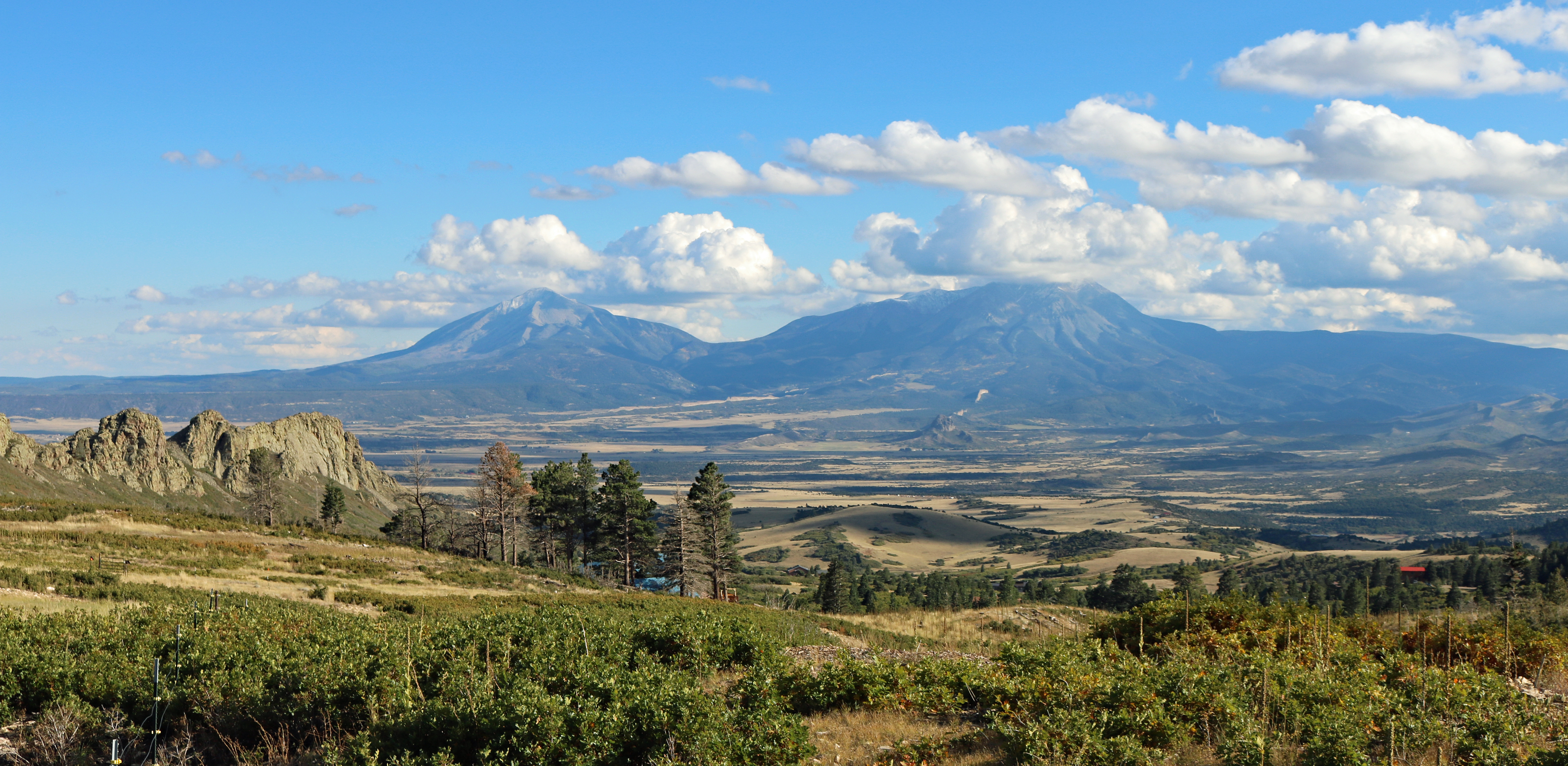
| Description | A broad view of the Cucharas River watershed, taken from the Tres Valles Subdivision in Huerfano County, Colorado, near Mount Mestas. The view includes the Tres Valles Dike (left foreground) and the Spanish Peaks and the associated magmatic dikes radiating out from West Spanish Peak (right). The Cucharas River flows from right to left near the center of the picture but is not visible in it. |
| Date | Taken on 6 October 2022 |
| Source | Own work |
| Author | Jeffrey Beall |
| Camera location | | View this and other nearby images on: OpenStreetMap |
|---|
Licensing
[edit]
I, the copyright holder of this work, hereby publish it under the following license:
This file is licensed under the Creative Commons Attribution 4.0 International license.
- You are free:
- to share – to copy, distribute and transmit the work
- to remix – to adapt the work
- Under the following conditions:
- attribution – You must give appropriate credit, provide a link to the license, and indicate if changes were made. You may do so in any reasonable manner, but not in any way that suggests the licensor endorses you or your use.
File history
Click on a date/time to view the file as it appeared at that time.
| Date/Time | Thumbnail | Dimensions | User | Comment | |
|---|---|---|---|---|---|
| current | 15:37, 8 October 2022 | | 5,783 × 2,829 (11.9 MB) | Jeffrey Beall (talk | contribs) | {{Information |Description=A broad view of the {{W|Cucharas River}} watershed, taken from the Tres Valles Subdivision in Huerfano County, Colorado, near Mount Mestas. The view includes the Tres Valles Dike (left foreground) and the {{W|Spanish Peaks}} and the associated magmatic dikes radiating out from West Spanish Peak (right). The Cucharas Rivers flows from right to left near the center of the picture but is not visible in the picture. |Source={{own}} |Date={{taken on|2022-10-06|location=U... |
You cannot overwrite this file.
File usage on Commons
There are no pages that use this file.