File:Crystal Cube, place for relaxing - panoramio.jpg
Jump to navigation
Jump to search

Size of this preview: 800 × 510 pixels. Other resolutions: 320 × 204 pixels | 640 × 408 pixels | 1,024 × 652 pixels | 1,280 × 815 pixels | 3,050 × 1,943 pixels.
Original file (3,050 × 1,943 pixels, file size: 2.32 MB, MIME type: image/jpeg)
Captions
Captions
Add a one-line explanation of what this file represents
Summary
[edit]
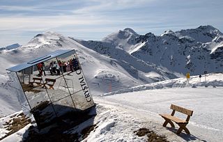
| Description | Crystal Cube, place for relaxing | ||
| Date | Taken on 22 March 2011 | ||
| Source | https://web.archive.org/web/20161021124319/http://www.panoramio.com/photo/50639486 | ||
| Author | nnike | ||
| Permission (Reusing this file) |
This file is licensed under the Creative Commons Attribution 3.0 Unported license. Attribution: nnike
|
||
| Tags (from Panoramio photo page) | Gemeinde Fiss, Austria |
| Camera location | | View this and other nearby images on: OpenStreetMap |
|---|
| Annotations | This image is annotated: View the annotations at Commons |
File history
Click on a date/time to view the file as it appeared at that time.
| Date/Time | Thumbnail | Dimensions | User | Comment | |
|---|---|---|---|---|---|
| current | 04:41, 18 November 2016 | | 3,050 × 1,943 (2.32 MB) | Panoramio upload bot (talk | contribs) | == {{int:filedesc}} == {{Information |description=Crystal Cube, place for relaxing |date={{Taken on|2011-03-22}} |source=http://www.panoramio.com/photo/50639486 |author=[http://www.panoramio.com/user/1985546?with_photo_id=50639486 nnike] |permission={{... |
You cannot overwrite this file.
File usage on Commons
The following page uses this file: