File:Crop of Lower Green Bay, March 28, 2022, true color Landsat-8.png
Jump to navigation
Jump to search

Size of this preview: 383 × 599 pixels. Other resolutions: 153 × 240 pixels | 306 × 480 pixels | 490 × 768 pixels | 654 × 1,024 pixels | 1,679 × 2,628 pixels.
Original file (1,679 × 2,628 pixels, file size: 6.25 MB, MIME type: image/png)
Captions
Captions
Add a one-line explanation of what this file represents
| Description | ||||
| Date | ||||
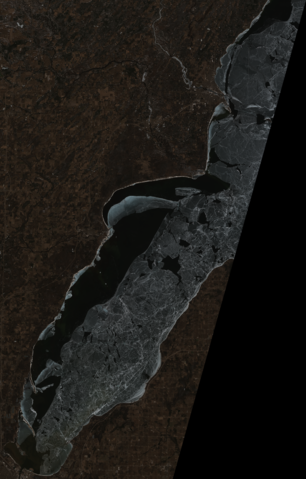
| Source | converted to .png by Epiphyllumlover from the original .tif files available as items LC08_L1TP_024029_20220328_20220328_02_RT_B2, LC08_L1TP_024029_20220328_20220328_02_RT_B3, and LC08_L1TP_024029_20220328_20220328_02_RT_B4, (bands 2, 3, and 4) on EarthExplorer; bands were combined with MultiSpec©. | |||
| Author | National Oceanic and Atmospheric Administration's Landsat program | |||
| Permission (Reusing this file) |
|
|||
| Other versions | For a similar photo taken a little more than a month prior to this one, see File:Lower Green Bay, February 25, 2022, true color Landsat-8.png. For a similar photo taken a little less than two months prior to this one, see File:Lower Green Bay, January 30, 2022, true color Landsat-8.png |

File history
Click on a date/time to view the file as it appeared at that time.
| Date/Time | Thumbnail | Dimensions | User | Comment | |
|---|---|---|---|---|---|
| current | 17:47, 7 April 2022 | | 1,679 × 2,628 (6.25 MB) | Epiphyllumlover (talk | contribs) | c:User:Rillke/bigChunkedUpload.js: fix croptool bug |
| 03:57, 29 March 2022 |  | 1,680 × 2,628 (4.88 MB) | Epiphyllumlover (talk | contribs) | File:Lower Green Bay, March 28, 2022, true color Landsat-8.png cropped 79 % horizontally, 67 % vertically using CropTool with lossless mode. |
You cannot overwrite this file.
File usage on Commons
The following page uses this file: