File:Croatia Wildfires, 2017 (cropped to Bay of Kaštela).jpg
Jump to navigation
Jump to search

Size of this preview: 800 × 400 pixels. Other resolutions: 320 × 160 pixels | 640 × 320 pixels | 1,024 × 512 pixels | 1,280 × 640 pixels | 2,560 × 1,280 pixels | 4,500 × 2,250 pixels.
Original file (4,500 × 2,250 pixels, file size: 7.54 MB, MIME type: image/jpeg)
Captions
Captions
Add a one-line explanation of what this file represents
Summary
[edit]| Warning | The original file is very high-resolution. It might not load properly or could cause your browser to freeze when opened at full size. |
|---|
| Description |
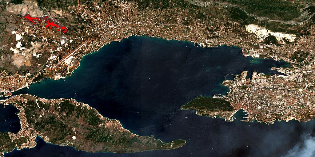
English: Croatia Wildfires, 2017
Date: 2017-07-17 Sentinel-2 L2A + Burned Area Detection Script Author: Monja Šebela Contains modified Copernicus Sentinel data [2019], processed by Sentinel Hub Inspect in EO Browser |
| Date | |
| Source | https://www.flickr.com/photos/158650882@N02/50309713071/ |
| Author | SentinelHub |
| Other versions |

.jpg&action=edit§ion=1)
.jpg&flash=no)
| Camera location | | View this and other nearby images on: OpenStreetMap |
|---|
.jpg¶ms=043.483377_N_0016.590729_E_globe:Earth_type:camera__&language=en)
Licensing
[edit].jpg&action=edit§ion=2)
This file is licensed under the Creative Commons Attribution 2.0 Generic license.
- You are free:
- to share – to copy, distribute and transmit the work
- to remix – to adapt the work
- Under the following conditions:
- attribution – You must give appropriate credit, provide a link to the license, and indicate if changes were made. You may do so in any reasonable manner, but not in any way that suggests the licensor endorses you or your use.
File history
Click on a date/time to view the file as it appeared at that time.
| Date/Time | Thumbnail | Dimensions | User | Comment | |
|---|---|---|---|---|---|
| current | 11:32, 14 December 2023 | | 4,500 × 2,250 (7.54 MB) | Argo Navis (talk | contribs) | File:Croatia Wildfires, 2017.jpg cropped 74 % horizontally, 79 % vertically using CropTool with precise mode. |
You cannot overwrite this file.
File usage on Commons
The following page uses this file:
.jpg&oldid=871148351)