File:Cowns Rocks - geograph.org.uk - 322166.jpg
Jump to navigation
Jump to search
No higher resolution available.
Cowns_Rocks_-_geograph.org.uk_-_322166.jpg (640 × 480 pixels, file size: 89 KB, MIME type: image/jpeg)
Captions
Captions
Add a one-line explanation of what this file represents
Summary
[edit]
| Description |
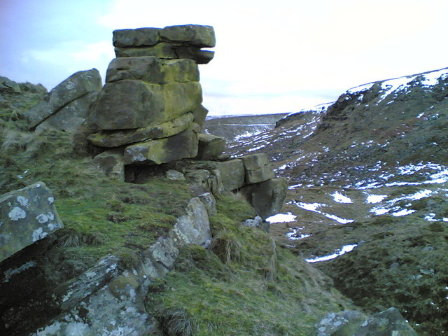
English: Cowns Rocks This minor gritstone edge (right) north of the Snake Pass is obscured from view from both the A57 road and the old Roman road followed by the public footpath by the curve of the intervening slope. Below the edge is a large area of landslipped debris, of which the tor in the foreground is part (the Google Earth image shows this very well). The path on the western side of Oyster Clough (SK1190) in the distance in the centre of the picture is made more obvious by lingering snow. |
| Date | |
| Source | From geograph.org.uk |
| Author | Dave Dunford |
| Attribution (required by the license) | Dave Dunford / Cowns Rocks / |
| Camera location | | View this and other nearby images on: OpenStreetMap |
|---|
_heading:315.00&language=en)
| Object location | | View this and other nearby images on: OpenStreetMap |
|---|
_heading:315.00&language=en)
Licensing
[edit]

|
This image was taken from the Geograph project collection. See this photograph's page on the Geograph website for the photographer's contact details. The copyright on this image is owned by Dave Dunford and is licensed for reuse under the Creative Commons Attribution-ShareAlike 2.0 license.
|
This file is licensed under the Creative Commons Attribution-Share Alike 2.0 Generic license.
Attribution: Dave Dunford
- You are free:
- to share – to copy, distribute and transmit the work
- to remix – to adapt the work
- Under the following conditions:
- attribution – You must give appropriate credit, provide a link to the license, and indicate if changes were made. You may do so in any reasonable manner, but not in any way that suggests the licensor endorses you or your use.
- share alike – If you remix, transform, or build upon the material, you must distribute your contributions under the same or compatible license as the original.
File history
Click on a date/time to view the file as it appeared at that time.
| Date/Time | Thumbnail | Dimensions | User | Comment | |
|---|---|---|---|---|---|
| current | 18:26, 30 December 2010 | | 640 × 480 (89 KB) | GeographBot (talk | contribs) | == {{int:filedesc}} == {{Information |description={{en|1=Cowns Rocks This minor gritstone edge (right) north of the Snake Pass is obscured from view from both the A57 road and the old Roman road followed by the public footpath by the curve of the interven |
You cannot overwrite this file.
File usage on Commons
There are no pages that use this file.