File:Cote Pasture West, Low Abbotside, Wensleydale - geograph.org.uk - 292108.jpg
Jump to navigation
Jump to search
No higher resolution available.
Cote_Pasture_West,_Low_Abbotside,_Wensleydale_-_geograph.org.uk_-_292108.jpg (640 × 480 pixels, file size: 61 KB, MIME type: image/jpeg)
Captions
Captions
Add a one-line explanation of what this file represents
Summary
[edit]
| Description |
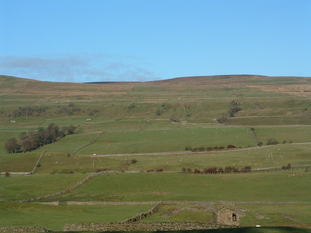
English: Cote Pasture West, Low Abbotside, Wensleydale This uninhabited area of gently rising high fell lies on the north side of Upper Wensleydale. It is seen here from the southern side of the dale and is the area above the Yorkshire Dales Cycleway which crosses the photo.
The land was statutorily 'enclosed' in the 18th century and the stone walls and field barns for the cattle in winter are characteristic of these high Yorkshire Dales. |
| Date | |
| Source | From geograph.org.uk |
| Author | Geoff Keeble |
| Attribution (required by the license) | Geoff Keeble / Cote Pasture West, Low Abbotside, Wensleydale / |
| Camera location | | View this and other nearby images on: OpenStreetMap |
|---|
_heading:337.00&language=en)
Licensing
[edit]

|
This image was taken from the Geograph project collection. See this photograph's page on the Geograph website for the photographer's contact details. The copyright on this image is owned by Geoff Keeble and is licensed for reuse under the Creative Commons Attribution-ShareAlike 2.0 license.
|
This file is licensed under the Creative Commons Attribution-Share Alike 2.0 Generic license.
Attribution: Geoff Keeble
- You are free:
- to share – to copy, distribute and transmit the work
- to remix – to adapt the work
- Under the following conditions:
- attribution – You must give appropriate credit, provide a link to the license, and indicate if changes were made. You may do so in any reasonable manner, but not in any way that suggests the licensor endorses you or your use.
- share alike – If you remix, transform, or build upon the material, you must distribute your contributions under the same or compatible license as the original.
File history
Click on a date/time to view the file as it appeared at that time.
| Date/Time | Thumbnail | Dimensions | User | Comment | |
|---|---|---|---|---|---|
| current | 21:01, 14 December 2010 | | 640 × 480 (61 KB) | GeographBot (talk | contribs) | == {{int:filedesc}} == {{Information |description={{en|1=Cote Pasture West, Low Abbotside, Wensleydale This uninhabited area of gently rising high fell lies on the north side of Upper Wensleydale. It is seen here from the southern side of the dale and is |
You cannot overwrite this file.
File usage on Commons
There are no pages that use this file.