File:Cornelis de Bruijn, Tabula Geographica continens Vestigia et Proceßum Itineris Tant Martimi quam Terrestris (FL6881263 2368399).jpg
Jump to navigation
Jump to search

Size of this preview: 800 × 469 pixels. Other resolutions: 320 × 188 pixels | 640 × 375 pixels | 1,024 × 601 pixels | 1,280 × 751 pixels | 3,274 × 1,920 pixels.
Original file (3,274 × 1,920 pixels, file size: 2.64 MB, MIME type: image/jpeg)
Captions
Captions
Add a one-line explanation of what this file represents
Summary
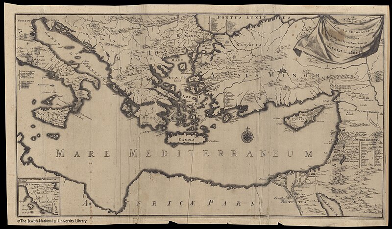
[edit]| Cornelis de Bruijn: Tabula Geographica continens Vestigia et Proceßum Itineris Tant Martimi quam Terrestris
( |
||||||||||||||||||||||||
|---|---|---|---|---|---|---|---|---|---|---|---|---|---|---|---|---|---|---|---|---|---|---|---|---|
| Artist |
| |||||||||||||||||||||||
| Contributors | Krooneveld, Henrik van | |||||||||||||||||||||||
| Title |
Tabula Geographica continens Vestigia et Proceßum Itineris Tant Martimi quam Terrestris |
|||||||||||||||||||||||
| Publisher |
Henrik van Krooneveld |
|||||||||||||||||||||||
| Description |
Tabula Geographica continens Vestigia et Proceßum Itineris Tant Martimi quam Terrestris. Cornelii de Bruin. |
|||||||||||||||||||||||
| Language | Latin | |||||||||||||||||||||||
| Publication date | 1700 | |||||||||||||||||||||||
| Dimensions | height: 312 mm (12.28 in); width: 576 mm (22.67 in) | |||||||||||||||||||||||
| Collection |
|
|||||||||||||||||||||||
| Current location |
|
|||||||||||||||||||||||
| Place of publication | Delft | |||||||||||||||||||||||
| search Merhav catalog | Delft | |||||||||||||||||||||||
| Notes | Copperplate; Inset: Principium itineris maritimi ex Italia; From: Bruyn, Cornelis de. Voyage au Levant... Delft, Henri van Kroonevelt, 1700. Before Fol. 1. | |||||||||||||||||||||||
| IE PID | IE6881261 | |||||||||||||||||||||||
| Rosetta filename | FL6881263 | |||||||||||||||||||||||
| NNL item ID (P3959) | 990023683990205171 | |||||||||||||||||||||||
| search Merhav catalog | Latin, Cornelis de Bruijn | |||||||||||||||||||||||
| search Merhav catalog | Henrik van Krooneveld | |||||||||||||||||||||||
| Source/Photographer |
|
|||||||||||||||||||||||
| Other versions | ||||||||||||||||||||||||
| Jpg / Tif version |
|
|||||||||||||||||||||||
.jpg)

.jpg)

.jpg&action=edit§ion=1)
Licensing
[edit].jpg&action=edit§ion=2)
The copyright situation of this work is theoretically uncertain, because in the country of origin copyright lasts 70 years after the death of the author, and the date of the author's death is unknown. However, the date of creation of the work was over 120 years ago, and it is thus a reasonable assumption that the copyright has expired (see here for the community discussion). Do not use this template if the date of death of the author is known.
| |
| This file has been identified as being free of known restrictions under copyright law, including all related and neighboring rights. | |
File history
Click on a date/time to view the file as it appeared at that time.
| Date/Time | Thumbnail | Dimensions | User | Comment | |
|---|---|---|---|---|---|
| current | 06:56, 28 July 2023 | | 3,274 × 1,920 (2.64 MB) | Geagea (talk | contribs) | pattypan 22.03 |
You cannot overwrite this file.
File usage on Commons
The following page uses this file:
.jpg&oldid=868408259)