File:Cordillera del Tigre y Cerro El Plata.jpg
Jump to navigation
Jump to search
Size of this preview: 800 × 533 pixels. Other resolutions: 320 × 213 pixels | 640 × 427 pixels | 1,024 × 683 pixels | 1,280 × 853 pixels | 2,560 × 1,707 pixels | 3,648 × 2,432 pixels.
Original file (3,648 × 2,432 pixels, file size: 1.35 MB, MIME type: image/jpeg)
Captions
Captions
Add a one-line explanation of what this file represents
Summary
[edit]
| Description |
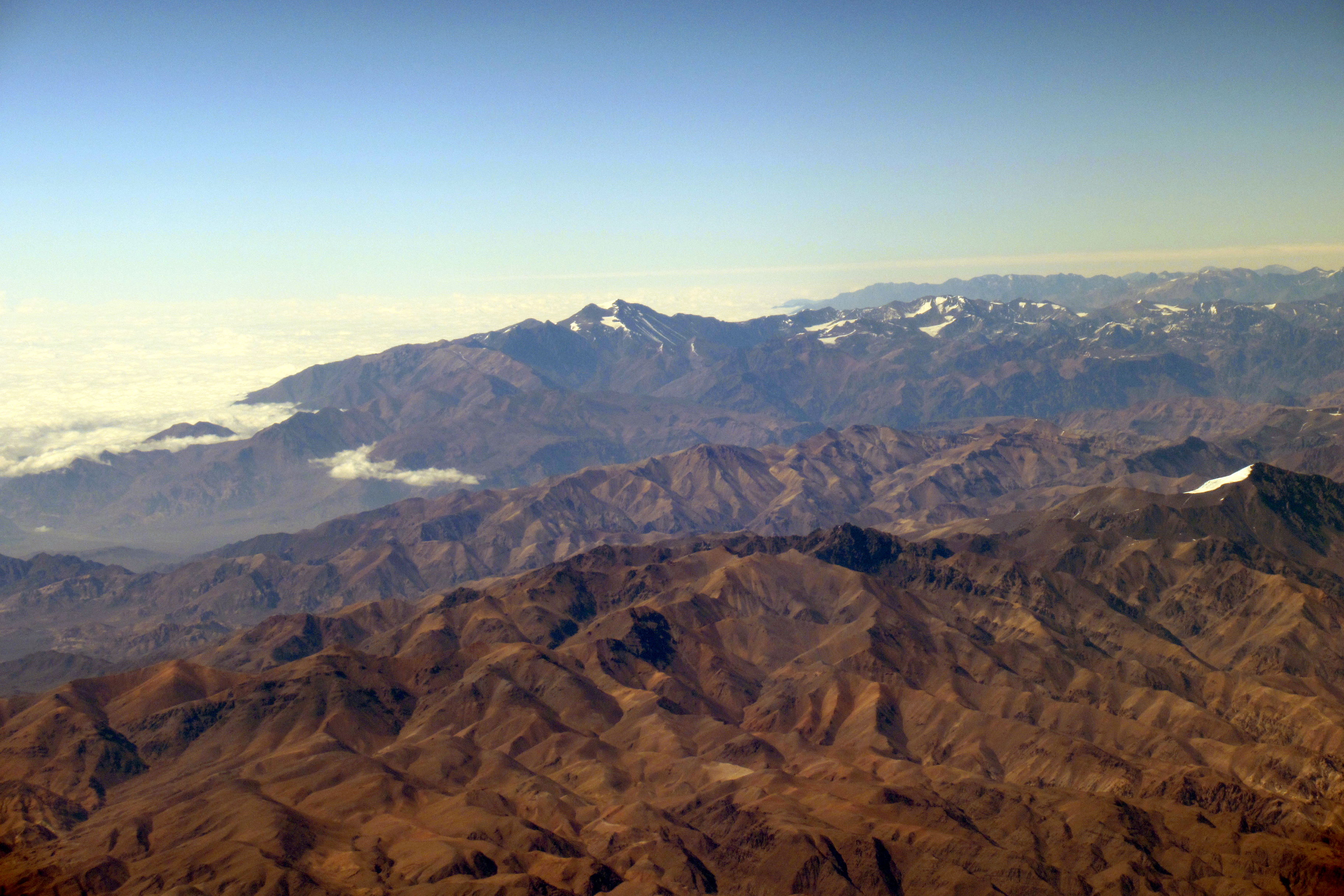
Español: La Cordillera Frontal de los Andes en Argentina: En primer plano la Cordillera del Tigre con el Cerro del Tambillo (5653 m s.n.m., distancia 93 km) glaciado. Al fondo el Cordón del Plata con el Cerro El Plata (5941 m s.n.m., distancia 174 km)
Deutsch: Das Anden-Frontgebirge in Argentinien: Im Vordergrund die Cordillera del Tigre mit dem vergletscherten Cerro del Tambillo (5653 m ü.M., Entfernung 93 km). Im Hintergrund der Cordón del Plata mit dem Cerro El Plata (5941 m ü.M., Entfernung 174 km)
English: The front range of the Andes in Argentina: In the foreground the Cordillera del Tigre with the glaciated Cerro del Tambillo (5653 m a.s.l., distance 93 km). In the background, the Cordón del Plata with the Cerro El Plata (5941 m a.s.l., distance 174 km) |
| Date | 3 December 2021, 09:46:48 (according to Exif data) |
| Source | Own work |
| Author | WeHaKa |
| Permission (Reusing this file) |
This file is licensed under the Creative Commons Attribution-Share Alike 4.0 International license. Attribution: WeHaKa
|
| Camera location | | View this and other nearby images on: OpenStreetMap |
|---|
| Object location | | View this and other nearby images on: OpenStreetMap |
|---|
| Object location | | View this and other nearby images on: OpenStreetMap |
|---|
| Object location | | View this and other nearby images on: OpenStreetMap |
|---|
| Object location | | View this and other nearby images on: OpenStreetMap |
|---|
| Annotations | This image is annotated: View the annotations at Commons |
File history
Click on a date/time to view the file as it appeared at that time.
| Date/Time | Thumbnail | Dimensions | User | Comment | |
|---|---|---|---|---|---|
| current | 14:15, 8 May 2022 | | 3,648 × 2,432 (1.35 MB) | WeHaKa (talk | contribs) | {{Information |description = {{es| La Cordillera Frontal de los Andes en Argentina: En primer plano la Cordillera del Tigre con el Cerro del Tambillo (5653 m s.n.m., distancia 93 km) glaciado. Al fondo el Cordón del Plata con el Cerro El Plata (5941 m s.n.m., distancia 174 km) }} {{de| Das Anden-Frontgebirge in Argentinien: Im Vordergrund die Cordillera del Tigre mit dem vergletscherten Cerro del Tambillo (5653 m ü.M., Entfernung 93 km). Im Hintergrund der Cordón del Plata mit dem Cerro... |
You cannot overwrite this file.
File usage on Commons
There are no pages that use this file.
File usage on other wikis
The following other wikis use this file:
- Usage on ceb.wikipedia.org
- Usage on www.wikidata.org